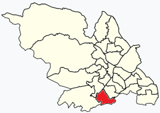
Dundee is Scotland's fourth-largest city and the 51st-most-populous built-up area in the United Kingdom. The mid-year population estimate for 2016 was 148,210, giving Dundee a population density of 2,478/km2 or 6,420/sq mi, the second-highest in Scotland. It lies within the eastern central Lowlands on the north bank of the Firth of Tay, which feeds into the North Sea. Under the name of Dundee City, it forms one of the 32 council areas used for local government in Scotland.

Pollok is a large housing estate on the south-western side of the city of Glasgow, Scotland. The estate was built either side of World War II to house families from the overcrowded inner city. Housing 30,000 at its peak, its population has since declined due to the replacement of substandard housing with lower-density accommodation. As of 2021, the population was recorded at 81,951 people.

Castlemilk is a district of Glasgow, Scotland. It lies to the far south of the city centre, adjacent to the Croftfoot and Simshill residential areas within the city to the north-west, the town of Rutherglen - neighbourhoods of Spittal to the north-east and Fernhill to the east, Linn Park and its golf course to the west, and the separate village of Carmunnock further south across countryside.

Seacroft is an outer-city suburb/township consisting mainly of council estate housing covering an extensive area of east Leeds, West Yorkshire, England. It lies in the LS14 Leeds postcode area, around 4 miles (6.4 km) east of Leeds city centre.
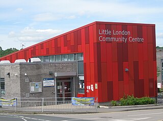
Little London is a residential area of Leeds in England, north of the city centre and Leeds Inner Ring Road. It is so called because in the 19th century it had fashionable housing and interesting architecture comparable to London. In the 1950s and '60s it became largely council housing and now consists of a mixture of high and low-rise flats and housing. The area falls within the Little London and Woodhouse ward of the City of Leeds Council. The area is divided into four estates; Lovell Park, Oatlands, Carlton and the Servias.

Pasir Ris is a planning area and residential town located in the East Region of Singapore. It is bordered by Tampines and Paya Lebar to the south, Sengkang to the southwest and Changi to the east. The planning area also shares riverine boundary with Punggol to the west, separated by the Serangoon River, as well as having a maritime boundary with the North-Eastern Islands planning area, across the Straits of Johor.

Newington is a neighbourhood of southern Edinburgh, Scotland. Developed from the early 19th century, it is an affluent, predominantly residential area.

City One Shatin is a residential precinct in Sha Tin, New Territories, Hong Kong. The estate occupies approximately 1,800,000 square feet of land. The estate was named City One as it is on Lot 1, Shatin Town. It has a census area population of 24,758 people. City One is the largest private residential estate in Sha Tin District. There are a total of 52 blocks of residential buildings with 10,642 units. Each tower is about 30 storeys with units ranging from 389 square feet (36.1 m2) to an area of 1,018 square feet (94.6 m2), offering different floor plans.
Cranhill is an inner city district and housing scheme in the north east of Glasgow, Scotland. Cranhill was developed from public funding in the early 1950s and was originally, chiefly composed of four-storey tenement blocks surrounding a patch of grassland, which became Cranhill Park. Later development saw the building of three tower blocks, surrounded by rows of terraced maisonettes. In more recent years, a number of semi-detached and detached homes have been built. The area also hosts some shops, two primary schools and nurseries, a community centre and the Cranhill water tower.

Milton is a district in the Scottish city of Glasgow, situated north of the River Clyde. The housing scheme is about 2+1⁄2 miles north of Glasgow City Centre and forms part of the northern edge of the city's urban area.
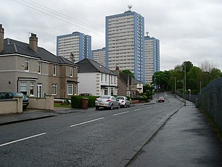
Sandyhills is an area of the Scottish city of Glasgow. It is situated north of the River Clyde and has fallen within the Shettleston ward of Glasgow City Council since 2007.
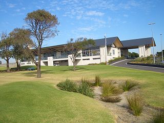
Eastlakes is an inner southern and eastern suburb of Sydney, in the state of New South Wales, Australia. Eastlakes is located 8 kilometres south of the Sydney central business district, in the local government area of the Bayside Council, Eastlakes is mostly residential with a shopping centre located at Evans Avenue. The residential portion of the suburb falls in the inner south being west of the Eastern Distributor while the non-residential side of the suburb consisting of The Lakes Golf Course and Botany Dams is east of the Eastern Distributor falling within the Eastern Suburbs, south-east of the CBD.

Howdon is a largely residential area in the eastern part of Wallsend, Tyne and Wear, England. It consists of High Howdon and the smaller settlement of East Howdon. Much of the High Howdon area was formerly called Willington prior to post-World War II urbanisation. The North Tyneside ward population at the 2011 Census was 11,129.
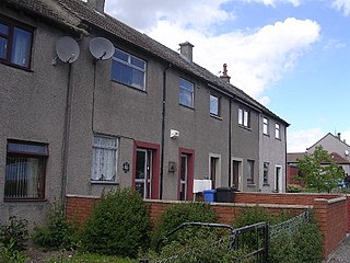
Fintry is a housing scheme in Dundee, Scotland. Fintry is located in the north of the city with Mill o' Mains to the west and Whitfield to the east. On the north, Fintry is bordered by farmland, including the Powrie Farm and Powrie Castle. Local parks include Powrie Park and Finlathen Park. Fintry had a population of 6592 in 2011.
Ardler is an area in the north-west of Dundee, Scotland, built on land previously owned by Downfield Golf Club. The housing scheme was completed in the late 1960s and originally included six 17-storey multi-storey blocks that formed the northern part of the scheme. These were demolished between 1993 and 2007 as part of a major programme of regeneration due to finish in 2011.
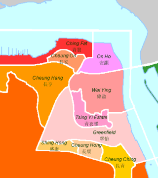
The following is an overview of public housing estates on Tsing Yi, Hong Kong including Home Ownership Scheme (HOS), Private Sector Participation Scheme (PSPS), Flat-for-Sale Scheme (FFSS), Tenant Purchase Scheme (TPS) and Subsidised Sale Flats Project (SSFP) estates.
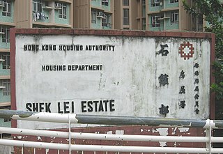
Shek Lei Estate, also known by Shek Lei is a public housing estate in Hong Kong, situated in the Shek Lei Pui (石梨貝/石梨背/石犁背) area in northeast Kwai Chung, New Territories, near Shek Yam Estate, On Yam Estate and Shek Yam East Estate.

Orchard Park Estate is an area or housing estate situated on the north-western side of Kingston upon Hull, England.

Cadder is a neighbourhood in the north of Glasgow, Scotland. Within the Canal ward under Glasgow City Council, historically more closely associated with the Lambhill and Maryhill districts, it is located 5 kilometres (3 mi) north of Glasgow city centre, sited on the route of the Forth and Clyde Canal. Occupying a footprint which is around 800 metres (870 yd) east to west but only 200 metres (220 yd) north to south on a fairly steep incline, the neighbourhood was built in the early 1950s and borders Glasgow Western Necropolis & Crematorium, Lambhill Cemetery and St. Kentigern's RC Cemetery, as well as Possil Marsh at its eastern side.


