
The Town of Mancos is a Statutory Town located in Montezuma County, Colorado, United States. The town population was 1,336 at the 2010 United States Census.

The Town of Holly is a statutory town in Prowers County in southeastern Colorado, United States, near the Kansas border. Located four miles (6 km) from the Kansas border at an elevation of 3,392 feet (1,034 m), Holly is the lowest elevation town in Colorado. The town population was 837 at the 2020 United States Census.

Bailey is an unincorporated community and U.S. Post Office in northeastern Park County, Colorado, United States. Bailey's Post Office ZIP Code is 80421.
The Rio Grande Ranch Headquarters Historic District is a historic one-story residence located 3 miles (4.8 km) east of Okay in Wagoner County, Oklahoma. The site was listed on the National Register of Historic Places September 9, 1992. The site's Period of Significance is 1910 to 1935, and it qualified for listing under NRHP criteria A and C.
The Fort Laramie Three-Mile Hog Ranch was built to serve as a social center away from the soldiers' post at historic Fort Laramie. Fort Laramie was a 19th-century military post in eastern Wyoming. It became notorious as a place for gambling and drinking, and for prostitution, with at least ten prostitutes always in residence. The location is notable as an example of one of only a few military bordellos still standing in the United States by 1974, the time of its nomination to the National Register of Historic Places The Fort Laramie site was one of a number of so-called "hog ranches" that appeared along trails in Wyoming.

The Francis M. Stafford House is a historic house located at 102 Broadway Street in Paintsville, Kentucky, United States.
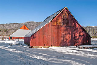
The McCauley and Meyer Barns in Yosemite National Park are the last barns in the park that retain their original characteristics as structures built by homesteaders. The McCauley barn and the two Meyer barns represent different construction techniques and styles of design.
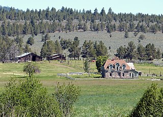
The Roba Ranch is a pioneer ranch located near the small unincorporated community of Paulina in Crook County, Oregon. The ranch is named for George and Mary Roba, sheep ranchers who acquired the property in 1892. Most of the important ranch buildings were constructed by the Roba family between about 1892 and 1910. Today, the ranch covers 1,480 acres (6.0 km2) and is privately owned. The ranch was listed on the National Register of Historic Places in 2007.

Mountain View Farm, also known as Pioneer Farms, is a historic home and farm complex located near Lexington, Rockbridge County, Virginia. The main house was built in 1854, and is a two-story, three-bay, brick dwelling, with a 1+1⁄2-story gabled kitchen and servant's wing, and one-story front and back porches. It features a Greek Revival style interior and has a standing seam metal hipped roof. The property includes an additional 13 contributing buildings and 3 contributing structures loosely grouped into a domestic complex and two agricultural complexes. They include a two-story, frame spring house / wash house, a frame meathouse, a one-room brick building that probably served as a secondary dwelling, a double-crib log barn, a large multi-use frame barn, a slatted corn crib with side and central wagon bays and a large granary.

The Helvig–Olson Farm Historic District is an agricultural historic district located in rural Clinton County, Iowa, United States, 3 miles (4.8 km) southwest of the town of Grand Mound. It was listed on the National Register of Historic Places in 2000.
John McGreer Barn and Crib are a historic building (barn) and structure located in rural Harrison Township, Lee County, Iowa, United States. They are located on a farm northwest of the town of Donnellson. The agricultural buildings were listed on the National Register of Historic Places in 2001.

The West View Farm is a historic farm property on Hastings Road in Waterford, Vermont. The farm is unique for its distinctive round barn, built in 1903 to a design by St. Johnsbury architect Lambert Packard, and surviving 19th-century corn crib and smokehouse. The property was listed on the National Register of Historic Places in 1995. It includes a round barn.

The Colter Ranch Historic District consists of twelve buildings in a rural setting near Eagar, Arizona. The site is located in the Amity Valley, which itself is part of Round Valley ; the Little Colorado River runs along the one side of the district. Most of the buildings date from between 1904 and 1930, the period during which Fred Colter resided on the residence.

Eagar Townsite Historic District is a section of the town of Eagar, Arizona which has been designated a National Historic Place. Sitting on roughly 54 acres, the site contains 37 structures, 21 of which have historical significance. The period of significance is from 1886, the year the townsite was founded, through 1942, which represents the significant period of development of the town. The site was added to the Register on July 23, 1993.

The Downtown Holly Commercial District is a commercial historic district located primarily South Saginaw Street and Battle Alley in Holly, Michigan. The district is roughly bounded by Maple Street, South Broad Street, First Street, and the Grand Trunk Railroad tracks. It was listed on the National Register of Historic Places in 1986.
The James Henry and Rachel Kilby House was built around 1898 and was listed on the National Register of Historic Places in 2005. It is located at 28 Tumbling Waters Lane in rural Rabun County, Georgia in the Persimmon community, about 15 miles (24 km) northwest of Clayton.

