Ainderby Quernhow is a village and civil parish in North Yorkshire, England. The village is situated on the B6267 Thirsk to Masham road just east of the A1(M) and is about five miles west of Thirsk. The population of the civil parish was estimated at 70 in 2014.
Birdforth is a village and civil parish in the Hambleton district of North Yorkshire, England. According to the 2001 census it had a population of 13. The population remained less than 100 at the 2011 Census. Details are included in the civil parish of Long Marston, North Yorkshire. The village is on the A19 road, about six miles south of Thirsk.
Burneston is a village and civil parish in North Yorkshire, England. According to the 2001 Census it had a population of 244, increasing to 311 at the 2011 Census. The village is close to the A1(M) road and is about 4 miles (6 km) south-east of Bedale.
Thirlby is a village and civil parish in former Hambleton District of North Yorkshire, England. With a population of about 120 in 2003, measured at 134 at the 2011 Census, Thirlby is situated approximately 4 miles (6.4 km) east of Thirsk.

Sinderby is a village and civil parish in North Yorkshire, England. Sinderby is located 223 miles (359 km) north of London and 48 miles (77 km) south of Durham, just east of the A1(M) motorway offering road links to larger cities such as Leeds, London and the Channel Ports. It has a population of 142 people according to the 2001 census, reducing to 137 at the 2011 census.

Thrintoft is a village and civil parish in the Hambleton district of North Yorkshire, England. It is situated close to the River Swale, 3 miles (5 km) west of Northallerton.

Litton is a village and civil parish in Littondale in the Yorkshire Dales in England. It lies in the Craven District of North Yorkshire, 1.5 miles (2.4 km) up Littondale from Arncliffe. From Litton a footpath leads 3 miles (4.8 km) over the fells to the north east to Buckden in Wharfedale. The population of the civil parish was estimated at 70 in 2015.
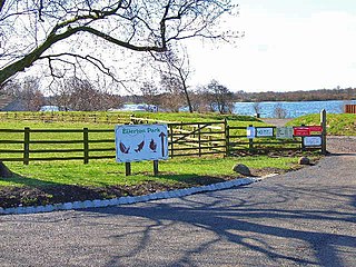
Ellerton-on-Swale or Ellerton is a small village and civil parish about a mile east of Catterick in the Richmondshire district of North Yorkshire, England. In 2015, North Yorkshire County Council estimated the population of the parish at 110.

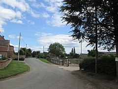
Pickhill is a village in North Yorkshire, England, 6 miles (10 km) west of Thirsk. It is a part of the civil parish of Pickhill with Roxby.

Melmerby is a village and civil parish in North Yorkshire, England. It lies in Coverdale in the Yorkshire Dales about 3 miles (4.8 km) south-west of Leyburn. Its neighbours are the villages of Carlton and Agglethorpe. The population of the civil parish was estimated at 40 in 2015.
Hawkswick is a hamlet and civil parish in the Craven district of North Yorkshire, England. Situated in the Yorkshire Dales, it lies in Littondale on the River Skirfare.

Warlaby is a small village and civil parish in the Hambleton District of North Yorkshire, England. The population of the civil parish taken at the 2011 Census was less than 100. Details are included in the civil parish of Ainderby Steeple. In 2015, North Yorkshire County Council estimated the population to be around 50 people. It is near the A684 and Morton-on-Swale. It is 1.6 miles (2.5 km) west of Northallerton.
Howe is a small village and civil parish in the Hambleton District of North Yorkshire, England. It is situated near Ainderby Quernhow and the A61 and 5 miles (8 km) west of Thirsk. The population of the civil parish was estimated at 20 in 2015.

Middleton Quernhow is a settlement and civil parish in North Yorkshire, England. The parish is included in the Wathvale Ward with a population of 3,479. North Yorkshire County Council estimated that the population of the parish was 60 in 2015. It is very near the A1(M) road and is 4 miles (7 km) north of Ripon.

Kirklington is a village in the English county of North Yorkshire close to the A1(M) motorway. Kirklington forms the major part of the civil parish of Kirklington-cum-Upsland.

Kirklington-cum-Upsland is a civil parish in the Hambleton district of North Yorkshire, England. The main settlement is Kirklington. Upsland is a single farm in the south-west of the parish.

Sutton Howgrave is a village in North Yorkshire, England. It is the only village in the civil parish of Sutton with Howgrave. The population of the parish was estimated at 70 in 2014.

Howgrave is a civil parish in the Hambleton District of North Yorkshire, England. It is a very small parish, with an area of only 323 acres (131 ha) and an estimated population in 2014 of only 10. There is no modern village in the parish. The site of the deserted medieval village of Howgrave lies in the west of the parish, 0.3 miles (0.5 km) west of the village of Sutton Howgrave.

New Forest is a civil parish in North Yorkshire, England. It lies 6 miles (10 km) west of Richmond.