
Lillooet, formerly Cayoosh Flat, is a community on the Fraser River in British Columbia, Canada, about 240 kilometres (150 mi) up the British Columbia Railway line from Vancouver. Situated at an intersection of deep gorges in the lee of the Coast Mountains, it has a dry climate with an average of 329.5 millimetres (13 in) of precipitation being recorded annually. Lillooet has a long growing season, and once had prolific market gardens and orchard produce. It often vies with Lytton and Osoyoos for the title of "Canada's Hot Spot" on a daily basis in summer.

Mission is a district municipality in the Lower Mainland of the province of British Columbia, Canada. It was incorporated as a district municipality in 1892, growing to include additional villages and rural areas over the years, adding the original Town of Mission City, long an independent core of the region, in 1969.

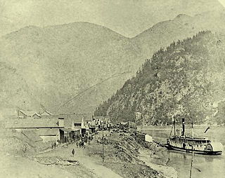
Quesnel is a city located in the Cariboo Regional District of British Columbia, Canada. Located nearly evenly between the cities of Prince George and Williams Lake, it is on the main route to northern British Columbia and the Yukon. Quesnel is located at the confluence of the Fraser and Quesnel Rivers. Quesnel's metropolitan area has a population of 23,146 making it the largest urban center between Prince George and Kamloops.
Yale is an unincorporated town in the Canadian province of British Columbia.

The Camelsfoot Range is a sub-range of the Chilcotin Ranges subdivision of the Pacific Ranges of the Coast Mountains in British Columbia. The Fraser River forms its eastern boundary. The range is approximately 90 km at its maximum length and less than 30 km wide at its widest.

The Quesnel River is a major tributary of the Fraser River in the Cariboo District of central British Columbia. It begins at the outflow of Quesnel Lake, at the town of Likely and flows for about 100 kilometres (60 mi) northwest to its confluence with the Fraser at the city of Quesnel.
The British Columbia Interior, BC Interior or Interior of British Columbia, usually referred to only as the Interior, is one of the three main regions of the Canadian province of British Columbia, the other two being the Lower Mainland, which comprises the overlapping areas of Greater Vancouver and the Fraser Valley, and the Coast, which includes Vancouver Island and also including the Lower Mainland.
The Willow River is a tributary of the Fraser River in the north-central Interior of British Columbia, Canada. It enters the Fraser at the community of Willow River, just upstream from the city of Prince George, near the confluence of the McGregor River. Its source is in the Cariboo goldfields at Jack of Clubs Lake in the mining and arts community of Wells, British Columbia, near Barkerville.
The Holmes River is a tributary of the upper Fraser River in the Robson Valley region of British Columbia, Canada, entering that river southeast of the village of McBride. The river was named after Albert W. Holmes, provincial forest ranger at McBride. "Beaver River" is or was the local name, probably referring to a distinctive rock formation.

The Doré River is a tributary of the Fraser River in the Canadian province of British Columbia.

Cayoosh Creek is a northeast-flowing tributary of the Seton River in the Canadian province of British Columbia. The name Cayoosh Creek remains on the bridge-sign crossing the stream on BC Highway 99 and continues in use locally to refer to the final reaches of the Seton River, formerly Seton Creek, which prior to the renaming ending at the confluence with Cayoosh Creek. The creek is the namesake of Cayoosh Creek Indian Reserve No. 1, one of the main Indian reserves of the Cayoose Creek Indian Band, which lies adjacent to what was renamed the Seton River without local consultation.
Lamming Mills is a railway point and former unincorporated community located on the Canadian National Railway line just northwest of McBride, British Columbia in the Cariboo Land District. It stands near a bend of the upper Fraser River and is connected by road to the Highway 16 section of the Yellowhead Highway. It was one of the oldest settlements in the Robson Valley.
Hixon is an unincorporated community at the northern edge of the Cariboo region of the Central Interior region of British Columbia, Canada. It is part of Electoral Area E in the Regional District of Fraser-Fort George. It is located on the east (left) bank of the Fraser River, and is about midway along BC Highway 97 between the cities of Prince George (N) and Quesnel (S). It was named for Hixon Creek, which in turn is named for a 19th-century prospector in the area, by the name of Joseph Foster Hixon, who found gold here on the banks of the Fraser River back around 1866.
Cottonwood River is a tributary of the Fraser River in the Central Interior of British Columbia, Canada. Rising at the confluence of the Swift River and Lightning Creek at Coldspring House in the Cariboo goldfields of the northern Cariboo Plateau, it flows northwest and then turns southwest to join the Fraser just north of the city of Quesnel, which is at the confluence of the Quesnel River with the Fraser.

Cottonwood, including the Cottonwood Ranch and Cottonwood House, is an unincorporated settlement in the North Cariboo region of the Central Interior of British Columbia, Canada. Originally a ranch, it is located in the northern Cariboo Plateau, just 8 km northwest of Coldspring House, which is at the confluence of the Swift River and Lightning Creek, which is the beginning of the Cottonwood River. Lightning Creek was one of the more famous of the gold-bearing creeks of the Cariboo Gold Rush.
Coldspring House is an unincorporated locality and former roadhouse on the Cariboo Wagon Road in the Cariboo Country of the Central Interior of British Columbia, Canada. Located just east of the confluence of Lightning Creek and the Swift River between Quesnel and Barkerville along that route. Only 8 km east along that road from Cottonwood House, another roadhouse still operating as a store and campground today, as well as a provincial heritage property with a small museum. Just farther along the route, which is today's BC Highway 26, is Beaver Pass House. All date from the era of the Cariboo Gold Rush and were busy stopping places for travellers going to and from the goldfields.

Wells Gray Provincial Park is a large wilderness park located in east-central British Columbia, Canada. The park protects most of the southern, and highest, regions of the Cariboo Mountains and covers 5,250 square kilometres. It is British Columbia's fourth largest park, after Tatshenshini, Spatsizi and Tweedsmuir.
Dog Creek is a tributary of the Fraser River in the Cariboo region of the Canadian province of British Columbia, entering that river south of the confluence of the Chilcotin River.] The eponymous community of Dog Creek is located on the northeast side of the creek's confluence with the Fraser.

Castle Creek, also known locally as Cottonwood Creek, is a tributary of the Fraser River in the Robson Valley region of British Columbia. Castle Creek flows from its source at Castle Creek glacier in the Cariboo Mountains to its confluence with the Fraser near McBride. The Castle Creek glacier has seen major retreats in the late 2010s, receding by an average of 15 metres a year. The creek provides hydroelectricity through a "run-of-the-river" instream generating station run by BC Hydro, which provides 34 gigawatt hours of power.
