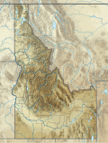
Moscow is a city in northern Idaho along the state border with Washington, with a population of 23,800 at the 2010 census. The county seat and largest city of Latah County, Moscow is the home of the University of Idaho, the state's land-grant institution and primary research university.

Nez Perce County is a county located in the U.S. state of Idaho. As of the 2010 census, the population was 39,265. The county seat is Lewiston. The county is named after the Nez Percé tribe. Nez Perce County is part of the Lewiston, Idaho–WA Metropolitan Statistical Area.

Latah County is a county located in the north central region of the U.S. state of Idaho. As of the 2010 census, the population was 37,244. The county seat and largest city is Moscow, the home of the University of Idaho, the state's flagship until 2012 and land-grant university.

Benewah County is a county located in the northwest part of the U.S. state of Idaho. As of the 2010 United States Census the county had a population of 9,285. The county seat and largest city is St. Maries, which has some area inside the Coeur d'Alene Reservation.

Genesee is a city in Latah County, Idaho, United States. The population was 955 at the 2010 census, up from 946 in 2000. The city was named for the Genesee region of western New York, although it may also be a modification of the biblical Genesis.

The Inland Northwest, historically and alternatively known as the Inland Empire, is a region of the American Northwest centered on the Greater Spokane, Washington Area, encompassing all of Eastern Washington and Northern Idaho. Under broader definitions, Northeastern Oregon and Western Montana may be included in the Inland Northwest. Alternatively, stricter definitions may exclude Central Washington and Idaho County, Idaho.

North Central Idaho is an area which spans the central part of the state of Idaho and borders Oregon, Montana, and Washington. It is the southern half of the Idaho Panhandle region and is rich in agriculture and natural resources. Lewis and Clark travelled through this area on their journey to the Pacific Ocean in 1805-06. The primary cities in this region are Lewiston and Moscow, home of the University of Idaho.

The Idaho Panhandle—locally known as North Idaho—is a salient region of the U.S. state of Idaho encompassing the state's 10 northernmost counties: Benewah, Bonner, Boundary, Clearwater, Idaho, Kootenai, Latah, Lewis, Nez Perce, and Shoshone. The Panhandle is bordered by the state of Washington to the west, Montana to the east, and the Canadian province of British Columbia to the north. The Idaho panhandle, along with Eastern Washington, comprises the region known as the Inland Northwest, headed by its largest city, Spokane, Washington.

The Palouse River is a tributary of the Snake River in Washington and Idaho, in the northwest United States. It flows for 167 miles (269 km) southwestwards, primarily through the Palouse region of southeastern Washington. It is part of the Columbia River Basin, as the Snake River is a tributary of the Columbia River.

McCroskey State Park—officially Mary Minerva McCroskey State Park—is a public recreation area in the Pacific Northwest of the United States, located in the Palouse region of northern Idaho. The park's 5,300 acres stretch along a ridge in Latah and Benewah Counties, along the border with Washington.
Mica Peak is the name of two separate mountain summits in the United States located approximately 5.49 miles (9 km) apart; one in Spokane County, Washington and the other in Kootenai County, Idaho. The two peaks are located along the same ridge, which separates the Spokane Valley and Rathdrum Prairie from the Palouse. The mountains have an elevation difference of only 31 ft (9.4 m) and are the southernmost peaks of the Selkirk Mountains.

State Highway 6 (SH-6) is a state highway in northern Idaho running from the Washington state line near Potlatch to Santa. It is 40.645 miles (65.41 km) in length and generally runs southwest to northeast

Latah Creek, also known as Hangman Creek, is a large stream in eastern Washington and north central Idaho in the United States. The creek flows northwest from the Rocky Mountains to Spokane, where it empties into the Spokane River. It drains 673 square miles (1,740 km2) in parts of Benewah and Kootenai counties in Idaho, Spokane County and a small portion of Whitman County in Washington, where over 64 percent of its watershed resides. Some major tributaries of the approximately 60-mile (97 km) creek include Little Latah Creek and Rock Creek. The average flow of the creek can range from 20 cubic feet per second (0.57 m3/s) to 20,000 cubic feet per second (570 m3/s). Latah Creek receives its name from a Nez Perce word likely meaning "fish". In 1854, the creek received another name, Hangman Creek, from a war between the Palouse Indians and white soldiers, which resulted in several Palouse being hanged alongside the creek.

Harvard is an unincorporated community in the northwest United States, on the Palouse of north central Idaho in Latah County.

The Bill Chipman Palouse Trail is a paved rail trail in the northwestern United States, from Pullman, Washington, eastward to Moscow, Idaho. Completed 24 years ago in 1998, it follows the former Union Pacific Railroad right-of-way and connects the rural university towns on the Palouse across the state border.

Emida is a small unincorporated community in Benewah County, Idaho, United States, located on the east side of State Highway 6.

North–South Ski Bowl was a modest ski area in the western United States, located in northern Idaho in the Hoodoo Mountains of southern Benewah County.

Tamarack Ski Area is a former ski area in the western United States, located in north central Idaho, seven miles (11 km) northwest of Troy in Latah County.
White Pine Creek is a stream in Latah and Benewah counties, in the U.S. state of Idaho.


