Hooppole, Illinois

Last updated

Hooppole, Illinois
Village
Henry County Illinois Incorporated and Unincorporated areas Hooppole Highlighted.svg
Location of Hooppole in Henry County, Illinois.
Illinois in United States (US48).svg
Location of Illinois in the United States
Coordinates: 41°31′20″N89°54′50″W / 41.52222°N 89.91389°W / 41.52222; -89.91389
CountryUnited States
StateIllinois
County Henry
Area
[1]
  Total0.37 sq mi (0.96 km2)
  Land0.37 sq mi (0.96 km2)
  Water0.00 sq mi (0.00 km2)
Population
 (2020)
  Total180
  Density483.87/sq mi (186.88/km2)
Time zone UTC-6 (CST)
  Summer (DST) UTC-5 (CDT)
ZIP Code(s)
61258
Area code 815
FIPS code 17-36074
Wikimedia CommonsHooppole, Illinois

Hooppole is a village in Henry County, Illinois, United States. The population was 204 at the 2010 census, up from 162 in 2000. As of 2018, the population has grown to an estimated 236. [2]

Contents

Geography

Hooppole is located at 41°31′20″N89°54′50″W / 41.52222°N 89.91389°W / 41.52222; -89.91389 (41.522127, -89.913862). [3]

According to the 2010 census, Hooppole has a total area of 0.88 square kilometers (0.34 mi2), all land. [4]

Demographics

Historical population
CensusPop.Note
1920 381
1930 266−30.2%
1940 200−24.8%
1950 195−2.5%
1960 22716.4%
1970 2270.0%
1980 2353.5%
1990 196−16.6%
2000 162−17.3%
2010 20425.9%
2020 180−11.8%
U.S. Decennial Census [5]

At the 2000 census there were 162 people, 61 households, and 45 families living in the village. The population density was 466.7 inhabitants per square mile (180.2/km2). There were 69 housing units at an average density of 198.8 per square mile (76.8/km2). The racial makeup of the village was 96.91% White, 0.62% African American, 2.47% from other races. Hispanic or Latino of any race were 7.41%. [6]

Of the 61 households, 29.5% had children under the age of 18 living with them, 67.2% were married couples living together, 6.6% had a female householder with no husband present, and 26.2% were non-families. 21.3% of households were one person and 11.5% were one person aged 65 or older. The average household size was 2.66 and the average family size was 3.02.

The age distribution was 27.2% under the age of 18, 4.3% from 18 to 24, 26.5% from 25 to 44, 30.2% from 45 to 64, and 11.7% 65 or older. The median age was 38 years. For every 100 females, there were 118.9 males. For every 100 females age 18 and over, there were 103.4 males.

The median household income was $32,188 and the median family income was $37,083. Males had a median income of $27,321 versus $21,667 for females. The per capita income for the village was $16,638. About 4.3% of families and 4.3% of the population were below the poverty line, including 7.1% of those under the age of 18 and none of those 65 or over.

Religion

There are two churches located in the village. The Calvary Evangelical Church and the Zion United Methodist Church are both located on Main St. The Shrine of St. Mary of the Fields is located in a rural area two miles northwest of Hooppole. It is one of several of the Shrines to the Rosary and to the Blessed Virgin Mary for the Roman Catholic Diocese of Peoria.

Related Research Articles

<span class="mw-page-title-main">Malden, Illinois</span> Village in Illinois, United States

Malden is a village in Bureau County, Illinois, United States. The population was 318 at the 2010 census. It is part of the Ottawa, IL Micropolitan Statistical Area.

<span class="mw-page-title-main">Ashton, Illinois</span> Village in Illinois, United States

Ashton is a village in Lee County, Illinois, United States. The population was 972 at the 2010 census, down from 1,142 in 2000.
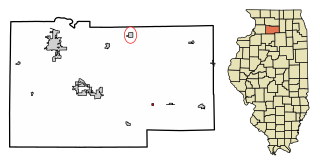
<span class="mw-page-title-main">West Brooklyn, Illinois</span> Village in Illinois, United States

West Brooklyn is a village in Lee County, Illinois, United States. The population was 142 at the 2010 census, down from 174 in 2000. There is one Church located in West Brooklyn...St. Mary of the Assumption Catholic Parish.

<span class="mw-page-title-main">Hillcrest, Illinois</span> Village in Illinois, United States

Hillcrest is a village located in Ogle County, Illinois, United States. The 2010 census lists its population at 1,326, up from 1,158 in 2000.

<span class="mw-page-title-main">Mapleton, Illinois</span> Village in Illinois, United States

Mapleton is a small village in Peoria County, Illinois, United States. The population was 227 at the 2000 census. Mapleton is part of the Peoria, Illinois Metropolitan Statistical Area. There are four different plants in Mapleton, all located along U.S. Route 24: an Evonik chemical plant, a Lonza Group plant, a Caterpillar Inc. foundry, and an Ingredion facility; together, the large industrial complex forms one of Mapleton's most significant employers and a good source of skilled employees and good jobs.
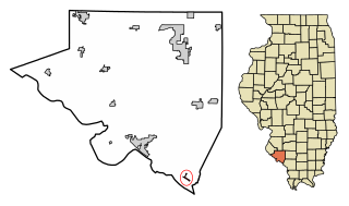
<span class="mw-page-title-main">Rockwood, Illinois</span> Village in Illinois, United States

Rockwood is a village in Randolph County, Illinois, United States. The population was 32 at the 2020 census. It is the headquarters of the Middle Mississippi River National Wildlife Refuge.
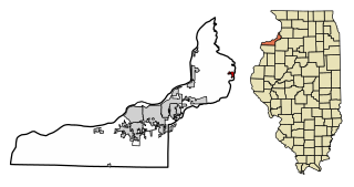
<span class="mw-page-title-main">Hillsdale, Illinois</span> Village in Illinois, United States

Hillsdale is a village in Rock Island County, Illinois, United States. The population was 531 at the time of the 2020 census, up from 523 at the 2010 census.

<span class="mw-page-title-main">Spaulding, Illinois</span> Village in Illinois, United States

Spaulding is a village in Sangamon County, Illinois, United States. The population was 873 at the 2010 census. It is part of the Springfield, Illinois Metropolitan Statistical Area. Spaulding is in the Riverton School District #14.

<span class="mw-page-title-main">German Valley, Illinois</span> Village in Illinois, United States

German Valley is a village in Stephenson County, Illinois, United States. German Valley is located four miles south of U.S. Route 20 between Freeport and Rockford. German Valley had a population of 433 at the 2020 census, with a 2023 estimate of 424.

<span class="mw-page-title-main">Coleta, Illinois</span> Village in Illinois, United States

Coleta is a village in Whiteside County, Illinois, United States. The population was 164 at the 2010 census, up from 155 in 2000.

<span class="mw-page-title-main">Deer Grove, Illinois</span> Village in Illinois, United States

Deer Grove is a village in Whiteside County, Illinois, United States. The population was given as 45 in the 2010 census, down from 48 in 2000.

<span class="mw-page-title-main">Durant, Iowa</span> City in Iowa, United States

Durant is a city in Cedar, Muscatine, and Scott counties in the U.S. state of Iowa. The population was 1,871 at the time of the 2020 census.

<span class="mw-page-title-main">Walthall, Mississippi</span> Village in Mississippi, United States

Walthall is a village in Webster County, Mississippi. The population was 144 at the 2010 census. It is the county seat of Webster County, designated in 1876.

<span class="mw-page-title-main">Sangerfield, New York</span> Town in New York, United States

Sangerfield is a town in Oneida County, New York, United States. The population was 2,561 at the 2010 census. The town is named after Jedediah Sanger, an early settler.

<span class="mw-page-title-main">Browntown, Wisconsin</span> Village in Wisconsin, United States

Browntown is a village in Green County, Wisconsin, United States. The population was 280 at the 2010 census.

<span class="mw-page-title-main">South Wayne, Wisconsin</span> Village in Wisconsin, United States

South Wayne is a village in Lafayette County, Wisconsin, United States. The population was 489 at the 2010 census.

<span class="mw-page-title-main">Brokaw, Wisconsin</span> Village in Wisconsin, United States

Brokaw is a former village in Marathon County, Wisconsin, United States. It is part of the Wausau, Wisconsin Metropolitan Statistical Area. The population was 251 at the 2010 census. Brokaw merged with the village of Maine, Wisconsin on October 1, 2018.

<span class="mw-page-title-main">Birnamwood, Wisconsin</span> Village in Wisconsin, United States

Birnamwood is a village in Marathon and Shawano counties in the U.S. state of Wisconsin. It is part of the Wausau, Wisconsin Metropolitan Statistical Area. The population was 818 at the 2010 census. Of this, 802 were in Shawano County, and 16 were in Marathon County. The village is located mostly within the town of Birnamwood in Shawano County; only a small portion extends into the town of Norrie in adjacent Marathon County.

Yorkshire is a census-designated place (CDP) in the northeastern corner of the town of Yorkshire in Cattaraugus County, New York, United States. The population of the CDP was 1,180 at the 2010 census, out of 3,913 in the town of Yorkshire as a whole.

<span class="mw-page-title-main">Aniwa, Wisconsin</span> Village in Wisconsin, United States

Aniwa is a village in Shawano County, Wisconsin, United States. The population was 260 at the 2010 census. The village is located within the Town of Aniwa. U.S. Route 45 runs north–south through the village.

References

  1. "2020 U.S. Gazetteer Files". United States Census Bureau. Retrieved March 15, 2022.
  2. "ACS DEMOGRAPHIC AND HOUSING ESTIMATES". data.census.gov. Retrieved April 3, 2020.
  3. "US Gazetteer files: 2010, 2000, and 1990". United States Census Bureau. February 12, 2011. Retrieved April 23, 2011.
  4. "G001 - Geographic Identifiers - 2010 Census Summary File 1". United States Census Bureau. Archived from the original on February 13, 2020. Retrieved August 3, 2015.
  5. "Census of Population and Housing". Census.gov. Retrieved June 4, 2015.
  6. "U.S. Census website". United States Census Bureau . Retrieved January 31, 2008.