Cherokee County, Alabama is a county located in the northeastern part of the U.S. state of Alabama. As of the 2020 census, the population was 24,971. Its county seat is Centre. The county is named for the Cherokee tribe.
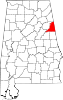
Cleburne County is a county located in the east central portion of the U.S. state of Alabama. As of the 2020 census, the population was 15,056. Its county seat is Heflin. Its name is in honor of Patrick R. Cleburne of Arkansas who rose to the rank of major general in the Confederate States Army. The eastern side of the county borders the state of Georgia.
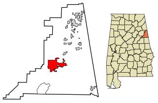
Heflin is a city and the county seat of Cleburne County, Alabama, United States. At the 2020 census, the population was 3,431. It is located approximately halfway between Birmingham and Atlanta along Interstate 20.

The Talladega National Forest is located in the U.S. state of Alabama and covers 392,567 acres at the southern edge of the Appalachian Mountains.

The Battle of Ringgold Gap was fought November 27, 1863, outside the town of Ringgold, Georgia, by the Confederate and Union armies during the American Civil War. Part of the Chattanooga Campaign, it followed a heavy Confederate loss at the Battle of Missionary Ridge from which General Braxton Bragg's artillery and wagon trains were forced to retreat south. The five hour Battle of Ringgold Gap resulted in the Confederate victory of Major General Patrick R. Cleburne and gave the Army of Tennessee safe passage to retreat through the Ringgold Gap mountain pass.

State Route 46 (SR 46) is a 21.074-mile-long (33.915 km) state highway in Cleburne County in the eastern part of the U.S. state of Alabama. The western terminus of the highway is at an intersection with U.S. Route 78 (US 78) in Heflin. The eastern terminus of the route is at the Georgia state line, east of Ranburne, where the roadway continues as Georgia State Route 166.
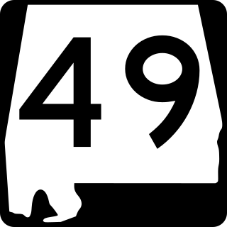
State Route 49 (SR 49) is an 82.684-mile-long (133.067 km) state highway in the central and eastern parts of the U.S. state of Alabama. The southern terminus of the highway is at an interchange with Interstate 85 (I-85) at Franklin in Macon County. The northern terminus of the highway is at an intersection with SR 281 east of Cheaha State Park in southern Cleburne County.
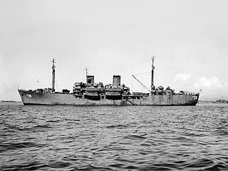
USS Cleburne (APA-73) was a Gilliam-class attack transport that served with the United States Navy from 1944 to 1946. She was scrapped in 1965.
Hopewell is an unincorporated community in Cleburne County, Arkansas, United States. It lies at an elevation of 896 feet.
Hopewell is an unincorporated community in Hillsborough County, Florida, United States. It lies at an elevation of 102 feet (31 m) above sea level. Hopewell is located along Florida State Road 60 at the intersection of Hillsborough County Road 39 and southern terminus of Florida State Road 39.
New Hopewell may refer to:
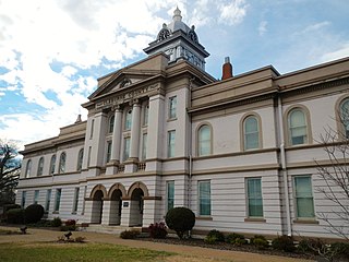
Cleburne County Courthouse may refer to:
Liberty Hill is an unincorporated community in Cleburne County, Alabama, United States. Liberty Hill is located on County Route 55, 5.7 miles (9.2 km) south-southeast of Piedmont.
Cleburne County School District is a school district in Cleburne County, Alabama, United States. The mission of the Cleburne County School System is to provide education of the highest quality, that motivates all students to excel, meets their individual needs, and prepares them for the future.

The 1976 United States presidential election in Alabama took place on November 2, 1976, as part of the 1976 presidential election. Voters chose nine representatives, or electors, to the Electoral College, who voted for president and vice president.
Arbacoochee is an unincorporated community in Cleburne County, Alabama, United States.
Trickem is an unincorporated community in Cleburne County, Alabama, United States.
Abernathy is an unincorporated community in Cleburne County, Alabama, United States
Cleburne County High School is a public school in Heflin, Alabama serving students in grades 8 to 12 in Cleburne County, Alabama. It has about 280 students. Old Cleburne County High School is a historic school building listed on the National Register of Historic Places. Tigers are the school mascot and the school colors red and white.