
Thornbury is a market town and civil parish in the South Gloucestershire unitary authority area of England, about 12 miles north of Bristol. It had a population of 12,063 at the 2011 Census. This was put at 12,459 in 2019. Thornbury is a Britain in Bloom award-winning town, with its own competition: Thornbury in Bloom. The earliest documentary evidence of a village at "Thornbyrig" dates from the end of the 9th century. Domesday Book noted a manor of "Turneberie" belonging to William the Conqueror's consort, Matilda of Flanders, with 104 residents.

Painswick is a town and civil parish in the Stroud District in Gloucestershire, England. Originally the town grew from the wool trade, but it is now best known for its parish church's yew trees and the local Rococo Garden. The village is mainly constructed of locally quarried Cotswold stone. Many of the buildings feature south-facing attic rooms once used as weavers' workshops.

Nailsworth is a town and civil parish in Gloucestershire, England, lying in one of the Stroud Valleys in the Cotswolds, on the A46 road, 3.5 miles (5.6 km) south of Stroud and about 25 miles (40 km) north-east of Bristol and Bath. The parish had a population of 5,794 at the 2011 census.

Almondsbury is a large village near junction 16 of the M5 motorway, in South Gloucestershire, England, and a civil parish which also includes the villages of Hortham, Gaunt's Earthcott, Over, Easter Compton, Compton Greenfield, Hallen and Berwick.
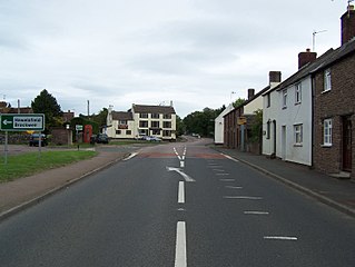
Falfield is a village, located near the northern border of the South Gloucestershire district of Gloucestershire, England on the southern edge of the Berkeley Vale, to the east of the River Severn and just falling into the boundary of the Cotswolds. It is the last parish on the northern boundary of South Gloucestershire. The area has a Wotton-under-Edge (GL12) post code and so is often incorrectly listed as being in the Stroud district of Gloucestershire. Falfield is one of the longest villages in England, alongside local village Cromhall.

Churchdown is a large village in Gloucestershire, England, situated between Gloucester and Cheltenham in the south of the Tewkesbury Borough.

Bibury is a village and civil parish in Gloucestershire, England. It is on the River Coln, a Thames tributary that rises in the same (Cotswold) District. The village centre is 6+1⁄2 miles northeast of Cirencester. Arlington Row is a nationally notable architectural conservation area depicted on the inside cover of all British passports. It is a major destination for tourists visiting the traditional rural villages, tea houses and many historic buildings of the Cotswold District; it is one of six places in the country featured in Mini-Europe, Brussels.
Brimscombe and Thrupp is a civil parish made up of the villages of Thrupp and Brimscombe, in the narrow Frome Valley slightly south-east of Stroud, Gloucestershire, England. The parish also includes the hamlets of Quarhouse and The Heavens. The population taken at the 2011 census was 1,830.

Chalford is a large village in the Frome Valley of the Cotswolds in Gloucestershire, England. It is to the southeast of Stroud about four miles upstream. It gives its name to Chalford parish, which covers the villages of Chalford, Chalford Hill, France Lynch, Bussage and Brownshill, spread over two square miles of the Cotswold countryside. At this point the valley is also called the Golden Valley.

Minsterworth is a village in Gloucestershire, England. It lies on the border of the City of Gloucester, on the north bank of the River Severn and on the A48 road between Gloucester and Chepstow.

Quedgeley is a suburban town of Gloucester, located 3.5 miles (5.6 km) southwest of the city centre, in the county of Gloucestershire, England. If counted independent from Gloucester itself, it has a population of 17,519. A thin strip of land between the Severn and the Gloucester Ship Canal occupies the west, and the south-eastern part of the town is Kingsway Village, directly to the north of which is Tuffley.
Alvington is a village and civil parish in the Forest of Dean in Gloucestershire, England, situated on the A48 road, six miles north-east of Chepstow in Wales. The parish had a total population of 506 at the 2011 census.

Leckhampton is a Gloucestershire village and a district in south Cheltenham, Gloucestershire, England. The area is in the civil parish of Leckhampton with Warden Hill and is part of the district of Cheltenham. The population of the civil parish taken at the 2011 census was 4,409.

Parson Drove is a fen village in the Isle of Ely, Cambridgeshire, England. A linear settlement, it is 6 miles (10 km) west of Wisbech, the nearest town. The village is named after the central thoroughfare along which the village developed, a green drove, much wider than the current metalled road (B1166). The population at the 2001 Census was 1,030. The population is included in the civil parish of Wisbech St Mary.

Eastington is a village and civil parish in the English county of Gloucestershire. It lies 4 miles west of Stroud and 9 miles south of Gloucester at the entrance to the Stroud Valley. It is situated west of the town of Stonehouse and is convenient for Junction 13 of the M5 motorway and the A38 and A419 roads. Since the M5 and its access roads were opened, the main road no longer runs through the village.
Siddington is a village and civil parish in Gloucestershire, England. It is located immediately south of Cirencester. At the 2011 United Kingdom Census, the parish had a population of 1,249.
Hatherop is a village and civil parish in the Cotswolds Area of Outstanding Natural Beauty, about 2.5 miles (4.0 km) north of Fairford in Gloucestershire, England. The River Coln forms part of the western boundary of the parish.

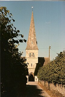
Leonard Stanley, or Stanley St.Leonard, is a village and parish in Gloucestershire, England, 95 miles (150 km) west of London and 3.5 miles (5.5 km) southwest of the town of Stroud. Situated beneath the Cotswold escarpment overlooking the Severn Vale, the surrounding land is mainly given over to agricultural use. The village is made up of some 600 houses and has an estimated population of 1,545 as of 2019. The hamlet of Stanley Downton lies less than a mile to the north and lies within the parish. In 1970, the village was twinned with the commune of Dozulé in the Calvados region of Normandy, northern France.
Sherborne is a village and civil parish almost 3.5 miles (5.6 km) east of Northleach in Gloucestershire. Sherborne is a linear village, extending more than a mile along the valley of Sherborne Brook, a tributary of the River Windrush.

Longford is a village and civil parish in Gloucestershire, England. Although situated within two miles of Gloucester city centre, Longford parish falls within the jurisdiction of the Borough of Tewkesbury.

