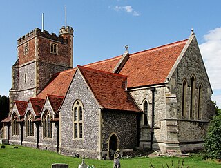
Horton is a village and civil parish in Berkshire, England. It is between Windsor and Staines-upon-Thames.
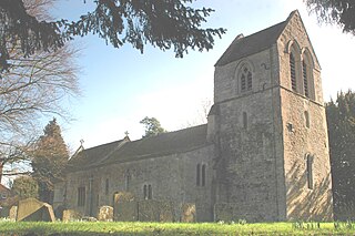
Ickford is a village and civil parish in the unitary authority area of Buckinghamshire, England. It is on the boundary with Oxfordshire, about 4 miles (6.4 km) west of the market town of Thame.

Little Missenden is a village and civil parish on the River Misbourne in Buckinghamshire, England. It is in the Chiltern Hills, about 3 miles (5 km) southeast of Great Missenden and 3 miles (5 km) west of Amersham. The village lies on the River Misbourne in the Misbourne valley.
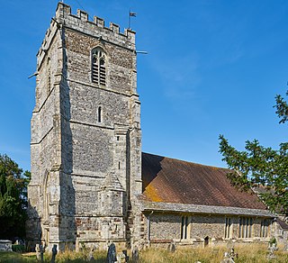
Cranborne is a village in East Dorset, England. As at the 2011 Census the parish had 779 ordinarily resident people, unaltered from 2001.

Ickleton is a village and civil parish about 9 miles (14 km) south of Cambridge in Cambridgeshire, England. The village is beside the River Cam, close to where a southern branch of the Icknield Way crossed the river. The eastern and southern boundaries of the parish form part of the county boundary with Essex, and the Essex town of Saffron Walden is only about 4.5 miles (7 km) southeast of the village.

Bishops Cannings is a village and civil parish in the Vale of Pewsey in Wiltshire, England, 3 miles (5 km) north-east of Devizes. The parish includes the village of Coate and the hamlets of Bourton, Horton and Little Horton.

Puddletown is a village and civil parish in Dorset, England. It is situated by the River Piddle, from which it derives its name, about 4.5 miles (7 km) northeast of the county town Dorchester. Its earlier name Piddletown fell out of favour, probably because of connotations of the word "piddle". The name Puddletown was officially sanctioned in the late 1950s. Puddletown's civil parish covers 2,908 hectares and extends to the River Frome to the south. In 2013 the estimated population of the civil parish was 1,450.

Fordham is a village in rural Cambridgeshire, England. Fordham is part of the East Cambridgeshire district. It is four miles north of Newmarket, as well as being close to the settlements of Soham, Burwell, Isleham, Mildenhall and Chippenham.

Abbotskerswell is a village and civil parish in the English county of Devon. The village is in the north part of the parish and is located two miles (3 km) south of the town of Newton Abbot, 7 miles (11 km) from the seaside resort of Torquay and 32 miles (51 km) from the city of Plymouth. The A381 road between Newton Abbot and Totnes runs down the western side of the parish and the main railway line between these two towns forms part of its eastern boundary.

Horton is a village in Northamptonshire, England. The village manor, Horton Hall, now demolished, was home to the first governor of the Bank of England and William Parr, 1st Baron Parr of Horton. An outline of its former nucleus can be seen in neighbouring fields, by its grade II park and garden which features an ornamental bridge. It is in the civil parish of Hackleton.
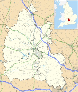
Cogges is an area beside the River Windrush in Witney, Oxfordshire, 0.5 miles (800 m) east of the town centre. It had been a separate village and until 1932 it was a separate civil parish.

Ogbourne St George is a village and civil parish on the River Og about 3 miles (4.8 km) north of Marlborough, Wiltshire, England.

Stourton with Gasper is a civil parish in the southwest of the English county of Wiltshire. Its main settlement is the village of Stourton, along with the hamlets of Bonham and Gasper. The village is about 2 1⁄2 miles (4 km) northwest of the small town of Mere, and is part of the Stourhead estate, which includes much of the west of the parish. The estate is in the ownership of the National Trust, and the entrance to the estate's famous house and garden is through the village.

Horningsham is a small village and civil parish in Wiltshire, England, on the county border with Somerset. The village lies about 4 miles (6 km) southwest of the town of Warminster and 4 1⁄2 miles (7 km) southeast of Frome, Somerset.
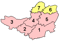
The Grade I listed buildings in Somerset, England, demonstrate the history and diversity of its architecture. The ceremonial county of Somerset consists of a non-metropolitan county, administered by Somerset County Council, which is divided into five districts, and two unitary authorities. The districts of Somerset are West Somerset, South Somerset, Taunton Deane, Mendip and Sedgemoor. The two administratively independent unitary authorities, which were established on 1 April 1996 following the breakup of the county of Avon, are North Somerset and Bath and North East Somerset. These unitary authorities include areas that were once part of Somerset before the creation of Avon in 1974.
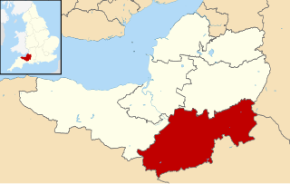
South Somerset is a local government district in the English county of Somerset. The South Somerset district occupies an area of 370 square miles (958 km2), stretching from its borders with Devon and Dorset to the edge of the Somerset Levels. The district has a population of about 158,000, and has Yeovil as its administrative centre.

Chesterton is a village and civil parish on Gagle Brook, a tributary of the Langford Brook in north Oxfordshire. The village is about 1 1⁄2 miles (2.4 km) southwest of the market town of Bicester. The village has sometimes been called Great Chesterton to distinguish it from the hamlet of Little Chesterton, about 3⁄4 mile (1.2 km) to the south in the same parish. The 2011 Census recorded the parish population as 850.

Horton-cum-Studley is a village and civil parish in Oxfordshire about 6 1⁄2 miles (10.5 km) northeast of the centre of Oxford and bordering Otmoor, and is one of the "Seven Towns" of Otmoor. The 2011 Census recorded the parish's population as 455.

Cranborne Priory was a priory in Cranborne in Dorset, England. The priory church survives as Cranborne's parish church, the Church of St Mary and St Bartholomew, and is a Grade I listed building, with parts of the building dating back to the 12th century.


