Fleet Pond is a 48.3-hectare (119-acre) biological Site of Special Scientific Interest in Fleet in Hampshire. It is also a Local Nature Reserve.

The Borough of Eastleigh is a local government district with borough status in Hampshire, England, bordering the unitary authority of Southampton, Test Valley, the City of Winchester and the Borough of Fareham. Eastleigh is separated from the New Forest by Southampton Water. Water bounds much of the borough, with Southampton Water and the River Hamble bordering the east and southwest of the district. The built-up nature of neighbouring Southampton and the urban area around the town of Eastleigh contrast with the rural nature of much of the borough, which lies within the Hampshire Basin.

The Borough of Fareham is a local government district with borough status in Hampshire, England. Its council is based in Fareham. Other places within the borough include Portchester, Hill Head, Sarisbury, Stubbington, Titchfield and Warsash. The borough covers much of the semi-urban area between the cities of Southampton and Portsmouth, and is part of the South Hampshire conurbation. The neighbouring districts are Eastleigh, Winchester, Portsmouth and Gosport. The district's southern boundary is the coast of the Solent.
Hedge End is a town and civil parish in Hampshire, England. Situated to the east of the City of Southampton, it adjoins the districts of West End and Botley. Hedge End lies within the Borough of Eastleigh and is part of the Southampton Urban Area. The original hamlet developed on Botley Common after 1250 when it was granted to the men of Botley as common pasture. In 1267, royal charters allowed Botley to hold an annual fair and a weekly market on the common which eventually became a market town.

South Hampshire is a term used mainly to refer to the conurbation formed by the city of Portsmouth, city of Southampton and the non-metropolitan boroughs of Gosport, Fareham, Havant and Eastleigh in southern Hampshire, South East England. The area was estimated to have a population of over 1.5 million in 2013. It is the most populated part of South East England excluding London. The area is sometimes referred to as Solent City particularly in relation to local devolution, but the term is controversial.
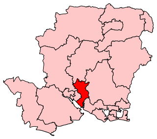
Eastleigh is a constituency represented in the House of Commons of the UK Parliament since 2019 by Paul Holmes, a Conservative.

Ashmore Green is a small hamlet in Berkshire, England. It is situated just to the west of the village of Cold Ash and to the north of Thatcham in the West Berkshire district.

Colden Common is a civil parish in the Winchester District of Hampshire, England, approximately 5 miles south of the city of Winchester, covering an area of 690.74 hectares (2.6670 sq mi) with a resident population of approximately 4,000 people. It includes the village of Colden Common and the hamlets of Hensting, Fisher's Pond, Nob's Crook, Highbridge and Brambridge. Part of the parish lies within the South Downs National Park.
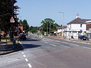
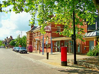
Fair Oak is a large village to the east of the town of Eastleigh in Hampshire, England. Together with the village of Horton Heath, which lies to the south, it is part of the civil parish of Fair Oak and Horton Heath.
Bishopstoke, a village recorded in the Domesday Book, is a civil parish in the borough of Eastleigh in Hampshire, England. Bishopstoke was also mentioned when King Alfred the Great's grandson King Eadred, granted land at "Stohes" to Thegn Aelfric in 948 AD. The village is about a mile east of Eastleigh town centre, and is on the eastern bank of the River Itchen. It adjoins Fair Oak on the east, in the Fair Oak and Horton Heath parish. The village was annexed to Eastleigh in 1932, and was split out again as an independent civil parish later. It forms part of the Southampton Urban Area.

North Baddesley is a large village and civil parish in Hampshire, England. It is situated 3 mi (5 km) east of the town of Romsey and 6 mi (10 km) north of Southampton. It occupies an area of approximately 9.15 km2 (3.53 sq mi), and is home to a population of just over 10,000 people, reducing to 7,000 at the 2011 Census. It is located in the Test Valley; a river famous for trout fishing. North Baddesley is one of the largest villages in the South of England, larger than many market towns.

Chadwell St Mary is an area of the unitary authority of Thurrock in Essex, England. It is one of the traditional parishes in Thurrock and a former civil parish. Grays is 2 miles (3.2 km) to the west and 1 mile (1.6 km) to the south is Tilbury. The area is sometimes referred to simply as Chadwell, particularly before the 19th century.

Wyvern College is a coeducational secondary school with academy status for students in the villages of Fair Oak, Bishopstoke, Horton Heath, Upham and Durley in southern Hampshire. The college is for students aged 11–16 and post-16 students go on to local sixth form colleges such as Barton Peveril and Eastleigh College, which are located in the neighbouring town of Eastleigh. It currently has over 1300 students, 95 teaching staff and 80 support staff.
Allbrook is a settlement and civil parish in the Borough of Eastleigh in Hampshire, England.
The Point is a theatre and dance studio for contemporary performance and contemporary dance at Eastleigh in Hampshire, England, operating under the auspices of Eastleigh Borough Council. It was previously the local council offices and then the local town hall for Eastleigh before being converted into a theatre in 1997.

The 2017 Hampshire County Council election took place on 4 May 2017 as part of the 2017 local elections in the United Kingdom. All councillors were elected from electoral divisions by first-past-the-post voting for a four-year term of office. The electoral divisions were somewhat changed from the previous election, with some being split, merged or with boundary changes. No elections were held in Portsmouth and Southampton, which are unitary authorities and hold their elections in other years. Similarly the districts within Hampshire did also not hold elections this year.

Fair Oak Park was a country house located to the east of the original village of Fair Oak in Hampshire, England. It was home to two sheriffs of Hampshire: Sir Samuel Raymond Jarvis, who sold it to James Edward Bradshaw. Subsequently, it was owned by Justice of the Peace George Herbert Pember.

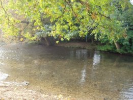
Fair Oak Lodge is a former country house in the village of Fair Oak, Hampshire. Much of the original estate has been built upon with modern housing, but the house itself survives and is owned by the Hampshire Christian Education Trust, who operate the King's School from the building. The two entrance lodges to the property also still survive as do some of the woodland, ponds and specimen trees that formed part of the estate.
Fair Oak and Horton Heath is a civil parish within the Borough of Eastleigh in Hampshire, England. The parish contains the villages of Fair Oak and Horton Heath. In 2011 it had a population of 10,212.

