Related Research Articles
The East Coast Greenway is a 3,000-mile (4,800 km) pedestrian and bicycle route between Maine and Florida along the East Coast of the United States. In 2020, the Greenway received over 50 million visits.

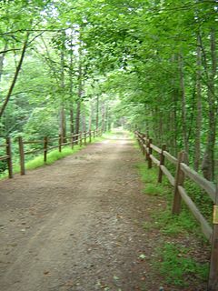
A greenway is usually a shared-use path along a strip of undeveloped land, in an urban or rural area, set aside for recreational use or environmental protection. Greenways are frequently created out of disused railways, canal towpaths, utility or similar rights of way, or derelict industrial land. Greenways also can also be linear parks, and can serve as wildlife corridors. The path's surface may be paved and often serves multiple users: walkers, runners, bicyclists, skaters and hikers. A characteristic of greenways, as defined by the European Greenways Association, is "ease of passage": that is that they have "either low or zero gradient", so that they can be used by all "types of users, including mobility impaired people".

Iron Horse State Park, part of the Washington State Park System, is a 1,612-acre (7 km2) state park located in the Cascade Mountains and Yakima River Valley, between Cedar Falls on the west and the Columbia River on the east.

The Genesee Valley Greenway is a rail trail in western New York's Genesee River valley.

Crabtree Creek is a tributary of the Neuse River in central Wake County, North Carolina, United States. The creek begins in the town of Cary and flows through Morrisville, William B. Umstead State Park, and the northern sections of Raleigh before emptying into the Neuse at Anderson Point Park, a large city park located in East Raleigh.
Hackensack RiverWalk a is partially constructed greenway along the Newark Bay and Hackensack River on the west side of the Bergen Neck peninsula in Hudson County, New Jersey. The eight-mile walkway, following the contour of the water's edge, will run between the southern tip at Bergen Point, where it may connect to the Hudson River Waterfront Walkway, and Eastern Brackish Marsh in the north. Existing parks and promenades have been incorporated and some new sections have been built, but there remain large gaps. There is a RiverWalk in the city of Hackensack, sometimes called the Hackensack RiverWalk, but they are not part of the same project nor are they connected. A parallel walkway on the west banks of the river is known as the Meadow Path.
A linear park is a type of park that is significantly longer than it is wide. These linear parks are strips of public land running along canals, rivers, streams, defensive walls, electrical lines, or highways and shorelines. Examples of linear parks include everything from wildlife corridors to riverways to trails, capturing the broadest sense of the word. Other examples include rail trails, which are disused railroad beds converted for recreational use by removing existing structures. Commonly, these linear parks result from the public and private sectors acting on the dense urban need for open green space. Linear parks stretch through urban areas, coming through as a solution for the lack of space and need for urban greenery. They also effectively connect different neighborhoods in dense urban areas as a result, and create places that are ideal for activities such as jogging or walking. Linear parks may also be categorized as greenways. In Australia, a linear park along the coast is known as a foreshoreway. When being designed, linear parks appear unique as they are planned around the public's opinion of how the space will affect them.
The Youghiogheny Scenic & Wild River is a river given special protected status by the state of Maryland. This wild and scenic portion of the Youghiogheny River is located in Western Garrett County, in Western Maryland. The Yough drains an area comprising approximately 397 square miles (1,030 km2) in Maryland, flowing through forests and farms. It rises from the west side of Backbone Mountain in Preston County, West Virginia, near the state's border with Garrett County.
Dunderberg Mountain is a 1,086-foot (331 m) mountain on the west bank of the Hudson River at the southern end of the Hudson Highlands. It lies just above Jones Point, New York, within Bear Mountain State Park and the town of Stony Point in Rockland County, New York.

Northwest Branch Anacostia River is a 21.5-mile-long (34.6 km) free-flowing stream in Montgomery County and Prince George's County, Maryland. It is a tributary of the Anacostia River, which flows to the Potomac River and the Chesapeake Bay.

The Anacostia Tributary Trail System (ATTS) is a unified and signed system of stream valley trails joining trails along the Anacostia tributaries of Northwest Branch, Northeast Branch, Indian Creek and Paint Branch with a trail along the Anacostia River, set aside and maintained by the Maryland-National Capital Park and Planning Commission (M-NCPPC) in the Maryland suburbs of Washington, D.C.

The Hudson Valley Rail Trail is a paved 4-mile (6.4 km) east–west rail trail in the town of Lloyd in Ulster County, New York, stretching from the Hudson River through the hamlet of Highland. The trail was originally part of the Poughkeepsie Bridge Route, a rail corridor that crossed the Hudson via the Poughkeepsie Bridge. Controlled by a variety of railroads throughout the 19th and 20th centuries, the bridge was damaged and became unusable after a May 8, 1974 fire. By the 1980s, the corridor's then-owner, Conrail, had routed all rail traffic in the region north through Selkirk Yard and was eager to relieve itself of the bridge and adjoining rights-of-way. In 1984, it sold the entire property for one dollar to a felon who did not maintain it or pay taxes on it. The section of the corridor west of the Hudson was seized by Ulster County in 1991 and transferred to the town of Lloyd.
Breakneck Brook, sometimes Breakneck Valley Brook, is a 1.7-mile-long (2.8 km) tributary of the Hudson River located entirely in the Putnam County town of Philipstown, New York, United States. It rises at Surprise Lake and flows southwest towards the Hudson from there, mostly through Hudson Highlands State Park. The name comes from Breakneck Ridge to its north.

The Empire State Trail is a multi-use trail in New York State that was proposed by Governor Andrew Cuomo in January 2017 and completed in December 2020. The trail runs from Manhattan north to the Canadian border in Rouses Point near the northern tip of Lake Champlain, and also from Buffalo to Albany. At 750 miles (1,210 km), it is the longest multi-use trail in the United States. The trail includes pre-existing trail segments, which retain their existing identity but are now co-signed as a segment of the Empire State Trail. The trail also links to other regional bicycling and hiking trails such as the Appalachian Trail, the Adirondack and Catskill Parks, the Great Lakes Seaway Trail, the Genesee Valley Greenway, and others. A segment near its southernmost part, on the Hudson River Greenway in Manhattan, is concurrent with the East Coast Greenway. The trail is used for hiking, biking, snowshoeing, cross-country skiing and in some areas snowmobiling.

The Seneca Creek Greenway Trail is a 24.2-mile (38.9 km) long trail that runs along Seneca Creek from the Potomac River to Watkins Mill Road, with some parts maintained by the state of Maryland and some parts maintained by Montgomery County, MD
References
- ↑ "Greenway Area & Map". www.hudsongreenway.ny.gov. Archived from the original on 2016-03-04. Retrieved 2015-12-21.