James Durand was a businessman and political figure in Upper Canada.

Hughson Street is a Lower City collector road in Hamilton, Ontario, Canada. It starts at Charlton Avenue East at St. Joseph's hospital and runs north to Haymarket Street in the downtown where it's cut off by the Hamilton GO Transit station. Up to this point it is a two-way street. It then starts up again north of the station on Hunter Street East, where it then becomes a one-way street going north just past Barton Street East to Murray Street where it's cut off again by a parking lot for LIUNA Station. It then starts up again one block north past the CN railway tracks on Strachan Street and from this point onwards becomes a two-way street again that extends to the city's North End to the waterfront on Guise Street West, the site of the Canada Marine Discovery Centre and Pier 9.

MacNab Street is a Lower City collector road in Hamilton, Ontario, Canada. It starts in the Durand neighbourhood on Markland Street, as a one-way street going north to Bold Street, where it becomes two-way for one block until Hurst Place where it's cut off by a wall for the Hunter Street railway bridge. Pedestrians may cross Hunter Street at an underpass. MacNab Street starts again north of the Railway line on Hunter Street as a two-way street but is cut off again at King Street where the Lloyd D. Jackson Square mall and Stelco Tower are situated. MacNab Street continues north of this Mall on York Boulevard, in front of the Hamilton Public Library & the entrance to the Hamilton Farmer's Market, again as a two-way street right through the city's North End to Burlington Street. It continues as a one-way street to the waterfront where it ends at Guise Street West, the site of the Royal Hamilton Yacht Club and Pier 5.

John Street is a Lower City arterial road in Hamilton, Ontario, Canada. Originally it was known as Mountain Road or Ancaster Road. It starts off at the base of Arkledun Avenue, a Mountain-access road in the city, just east of St. Joseph's Hospital, where it is a one-way street going north and tunnels underneath the Hunter Street Railway bridge and continues onward to the city's North End at the waterfront, where it ends at Guise Street East, the site of Pier 9.

James Street is a Lower City arterial road in Hamilton, Ontario, Canada. It starts off at the base of the Niagara Escarpment from James Mountain Road, a mountain-access road in the city. It was one of many arterials in the central business district converted to one-way operation in 1956 when the city retained Wilbur Smith and Associates to develop a Traffic and Transportation Plan. Parts of it were restored to two-way operation in 2002. It extends north to the city's waterfront at the North End where it ends at Guise Street West right in front of the Harbour West Marina Complex and the Royal Hamilton Yacht Club.

Hess Village is a pedestrianized area in the downtown of Hamilton, Ontario, Canada. Its streets, in contrast to other areas in Hamilton, are quite thin and restrict vehicle access. It is located between Main and King Street, and a block north west of city hall. It is home to various amenities and shops, notably nightclubs, bars, and historic buildings. It is named after Hess Street, a north-south Lower City collector street that travels through the centre of the area.
Queen Street is a Lower City arterial road in Hamilton, Ontario, Canada. It starts off at Beckett Drive, a mountain-access road in the city and is a two-way street up to Herkimer Street and a one-way street (southbound) the rest of the way north up to the Canadian National Railway Yard, where the road turns right, merging with Stuart Street which travels in a west–east direction.

Locke Street is a Lower City collector road in Hamilton, Ontario, Canada. It starts off at Aberdeen Avenue as a two-way street going through the Locke Street shopping district up to Main Street where it then becomes a one-way street until it crosses King Street and becomes two-way again going north past Victoria Park and ends just past Barton Street West on Tecumseh Street, a road that winds West and leads to the back-end of Dundurn Park.
Dundurn Street is a Lower City arterial road in Hamilton, Ontario, Canada. It is a two-way street that starts off at Mountain Face Park, Niagara Escarpment in front of the Bruce Trail as a collector road, right behind Hillcrest Avenue and then turns into a four lane thoroughfare from Aberdeen Avenue northward to York Boulevard where it ends in front of Dundurn Park.

Victoria Avenue is a Lower City arterial road in Hamilton, Ontario, Canada. It starts off as a ramp and part of a Mountain-access road, the Claremont Access, on Hunter Street East in the Stinson neighbourhood. It's also a one-way thoroughfare that flows north through the Landsdale and the city's North End industrial neighbourhood past Burlington Street East where it ends at Pier 11.

Wentworth Street is a Lower City arterial road in Hamilton, Ontario, Canada. It starts off at the base of the Niagara Escarpment (mountain) on Charlton Avenue East just south of the CP lines and runs right through the city's North End industrial neighbourhood and ends north of Burlington Street East at Pier 14, which one time was used by International Harvester (1902–1992).

Barton Street is an arterial road in the Lower City of Hamilton, Ontario, Canada. It's also the longest street (21.0 km) in the city. It starts at the north end of downtown at Locke Street North and is a two-way street that stretches eastward through a number of different and varied communities in the city and ends in Winona at Fifty Road just west of the Hamilton/Niagara regional boundary. The street is divided in East and West portions, divided by James Street. However, the East designation does not continue through the Stoney Creek district, which was a separate municipality prior to amalgamation in 2001, and the designation as well as the address numbering system were not restructured upon amalgamation, and numbers reset at the former city limits at Centennial Parkway.

Cannon Street, is a Lower City collector road in Hamilton, Ontario, Canada. It starts off at Queen Street North as a one-way street (Westbound) up to Sherman Avenue North where it then switches over to a two-way street the rest of the way Eastward and ends just past Kenilworth Avenue North on Barons Avenue and merges with Britannia Avenue, a street that runs parallel with Cannon Street from Ottawa Street North to Barons Avenue.

King Street is a Lower City arterial road in Hamilton, Ontario, Canada, also known as Highway 8. The western-end starts off beside McMaster University Medical Centre as a two-way street and passes through Westdale. At Paradise Road, King Street switches over to a one-way street (westbound) right through the city's core up to "the Delta", a spot in town where King and Main streets intersect. From the Delta onwards, King Street then switches over to become a two-way street again and ends at Highway 8 in Stoney Creek.
Main Street is a street in Hamilton, Ontario, Canada.

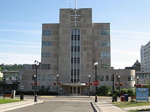
Jackson Street, is a Lower City collector road in Hamilton, Ontario, Canada. It starts off West of Locke Street South at Jackson Playground as a one-way street (Westbound) up to Queen Street South where it then switches over to a two-way street and is interrupted at Bay Street South the site of the Hamilton City Hall and the Canadian Football Hall of Fame (museum), resumes again East of the property on MacNab Street South and then ends at Wellington Street South.

Aberdeen Avenue is a Lower City minor arterial road in Hamilton, Ontario, Canada. It starts off just west of Longwood Road South and east of Highway 403 as a two-way thoroughfare up to Queen Street South, where it then switches over to a one-way collector road (eastbound) to Bay Street South and then to another two-way section from Bay Street to James Mountain Road, a mountain-access road in the city near the base of the Niagara Escarpment (mountain).