Huntsville, Ohio

Last updated

Huntsville, Ohio
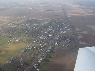
Huntsville Aerial.jpg
Aerial view of Huntsville
OHMap-doton-Huntsville.png
Location of Huntsville, Ohio
Detailed map of Huntsville, Ohio.png
Detailed map of Huntsville
Coordinates: 40°26′32″N83°48′16″W / 40.44222°N 83.80444°W / 40.44222; -83.80444
Country United States
State Ohio
County Logan
Township McArthur
Area
[1]
  Total0.30 sq mi (0.78 km2)
  Land0.30 sq mi (0.78 km2)
  Water0.00 sq mi (0.00 km2)
Elevation
[2]
1,076 ft (328 m)
Population
 (2020)
  Total408
  Density1,346.53/sq mi (520.59/km2)
Time zone UTC-5 (Eastern (EST))
  Summer (DST) UTC-4 (EDT)
ZIP code
43324
Area code(s) 937, 326
FIPS code 39-36988 [3]
GNIS feature ID2398564 [2]
Website https://huntsvilleohio.net/

Huntsville is a village in Logan County, Ohio, United States. The population was 408 at the 2020 census.

Contents

History

Huntsville was platted in 1846, and named after Aaron L. Hunt, a government surveyor. [4] The village was incorporated in December 1865. [5]

Geography

According to the United States Census Bureau, the village has a total area of 0.30 square miles (0.78 km2), all of it land. [6]

Demographics

Historical population
CensusPop.Note
1850 214
1860 28131.3%
1870 32214.6%
1880 42030.4%
1890 50019.0%
1900 408−18.4%
1910 328−19.6%
1920 3393.4%
1930 39817.4%
1940 353−11.3%
1950 40815.6%
1960 51125.2%
1970 475−7.0%
1980 4892.9%
1990 343−29.9%
2000 45432.4%
2010 431−5.1%
2020 408−5.3%
U.S. Decennial Census [7]

2010 census

As of the census [8] of 2010, there were 431 people, 159 households, and 123 families living in the village. The population density was 1,436.7 inhabitants per square mile (554.7/km2). There were 189 housing units at an average density of 630.0 per square mile (243.2/km2). The racial makeup of the village was 98.4% White, 0.5% African American, 0.5% from other races, and 0.7% from two or more races. Hispanic or Latino of any race were 0.9% of the population.

There were 159 households, of which 42.1% had children under the age of 18 living with them, 60.4% were married couples living together, 11.3% had a female householder with no husband present, 5.7% had a male householder with no wife present, and 22.6% were non-families. 20.8% of all households were made up of individuals, and 7.6% had someone living alone who was 65 years of age or older. The average household size was 2.71 and the average family size was 3.02.

The median age in the village was 35.6 years. 30.9% of residents were under the age of 18; 8.2% were between the ages of 18 and 24; 26.2% were from 25 to 44; 20.9% were from 45 to 64; and 13.9% were 65 years of age or older. The gender makeup of the village was 48.3% male and 51.7% female.

2000 census

As of the census [3] of 2000, there were 454 people, 175 households, and 134 families living in the village. The population density was 1,346.8 inhabitants per square mile (520.0/km2). There were 185 housing units at an average density of 548.8 per square mile (211.9/km2). The racial makeup of the village was 97.14% White, 0.22% African American, 0.44% Native American, 0.22% Asian, 0.44% from other races, and 1.54% from two or more races. Hispanic or Latino of any race were 0.66% of the population.

There were 175 households, out of which 37.1% had children under the age of 18 living with them, 60.6% were married couples living together, 12.6% had a female householder with no husband present, and 22.9% were non-families. 17.7% of all households were made up of individuals, and 6.9% had someone living alone who was 65 years of age or older. The average household size was 2.59 and the average family size was 2.93.

In the village, the population was spread out, with 26.9% under the age of 18, 7.0% from 18 to 24, 32.6% from 25 to 44, 20.3% from 45 to 64, and 13.2% who were 65 years of age or older. The median age was 34 years. For every 100 females, there were 92.4 males. For every 100 females age 18 and over, there were 88.6 males.

The median income for a household in the village was $40,156, and the median income for a family was $44,306. Males had a median income of $33,333 versus $23,750 for females. The per capita income for the village was $15,928. About 3.6% of families and 8.4% of the population were below the poverty line, including 7.4% of those under age 18 and 14.6% of those age 65 or over.

Government

Huntsville is governed by a mayor-council system. The Mayor is Joseph Hurley, and the council is composed of President Matt Groeschel and members Robin Jenkins, Mike Hyder, Margret Fraizer, Deb Anderson, Huntsville, 2021. In the November 2019 elections, Hurley was elected without opposition, Susan Yelton is hired as Fiscal officer.

Transportation

Huntsville's beginnings include being that of a railroad town. The former Toledo and Ohio Central Railway ran through Huntsville and operated repair shops for its locomotive fleet. The railroad ran a branch line between Saint Marys, through Russells Point and towards East Liberty and Columbus. By the 1960s the section that ran between Bellefontaine and East Liberty was abandoned when it was part of the New York Central and then the remaining trackage between St. Marys and Bellefontaine abandoned in the 1970s when Penn Central fell into bankruptcy.

Despite its small size, Huntsville lies at the intersection of several highways. State Route 274 passes through the village, and State Route 117's southern end is at Huntsville. Moreover, U.S. Route 33 passes on the southwest edge of the village, and the eastern ends of State Routes 366 and 368 are located just north of the village.

Notable people

Related Research Articles

<span class="mw-page-title-main">Gordon, Ohio</span> Village in Ohio, United States

Gordon is a village in Darke County, Ohio, United States. The population was 245 at the 2020 census.

<span class="mw-page-title-main">Lithopolis, Ohio</span> Village in Ohio, United States

Lithopolis is a village in Fairfield and Franklin counties in the U.S. state of Ohio. The population was 2,134 at the 2020 census.

<span class="mw-page-title-main">Lyons, Ohio</span> Village in Ohio, United States

Lyons is a village in Fulton County, Ohio, United States. The population was 602 at the 2020 census.

<span class="mw-page-title-main">Elmwood Place, Ohio</span> Village in Hamilton County, Ohio, United States

Elmwood Place is a village in Hamilton County, Ohio, United States. The population was 2,087 at the 2020 census. Except for a small portion which touches neighboring St. Bernard, Elmwood Place is nearly surrounded by the city of Cincinnati.

<span class="mw-page-title-main">Evendale, Ohio</span> Village in Ohio, United States

Evendale is a village in Hamilton County, Ohio, United States, within the Cincinnati metropolitan area. The population was 2,669 at the 2020 census.
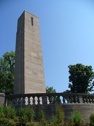
<span class="mw-page-title-main">North Bend, Ohio</span> Village in Ohio, United States

North Bend is a village in Miami Township, Hamilton County, Ohio, United States, along the Ohio River. It is a part of the Greater Cincinnati area. The population was 835 at the 2020 census.

<span class="mw-page-title-main">Arcadia, Ohio</span> Village in Ohio, United States

Arcadia is a village in Hancock County, Ohio, United States. The population was 564 at the 2020 census.

<span class="mw-page-title-main">Hanover, Ohio</span> Village in Ohio, United States

Hanover is a village in Licking County, Ohio, United States. The population was 1,270 at the 2020 census. The village lies along Ohio State Route 16.

<span class="mw-page-title-main">Hartford, Ohio</span> Village in Ohio, United States

Hartford is a village in the township of the same name in Licking County, Ohio, United States. The population was 404 at the 2020 census.
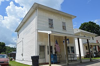
<span class="mw-page-title-main">St. Louisville, Ohio</span> Village in Ohio, United States

St. Louisville or Saint Louisville is a village in Licking County, Ohio, United States, along the North Fork of the Licking River. The population was 352 at the 2020 census.

<span class="mw-page-title-main">West Mansfield, Ohio</span> Village in Ohio, United States

West Mansfield is a village located in Logan County, Ohio, United States. The population was 749 at the 2020 census.
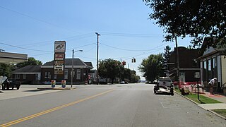
<span class="mw-page-title-main">Clarksburg, Ohio</span> Village in Ohio, United States

Clarksburg is a village in Ross County, Ohio, United States. The population was 409 at the 2020 census.

<span class="mw-page-title-main">Hartville, Ohio</span> Village in Ohio, United States

Hartville is a village in northern Stark County, Ohio, United States. The population was 3,329 at the 2020 census. It is part of the Canton–Massillon metropolitan area. Hartville lies halfway between Akron and Canton at the intersection of State Routes 43 and 619.

<span class="mw-page-title-main">Limaville, Ohio</span> Census-designated place in Ohio, United States

Limaville is a census-designated place (CDP) and former village in Stark County, Ohio, United States. The population was 151 at the 2020 census. It is part of the Canton–Massillon Metropolitan Statistical Area.

<span class="mw-page-title-main">Navarre, Ohio</span> Village in Ohio, United States

Navarre is a village in southwestern Stark County, Ohio, United States. The population was 1,846 at the 2020 census. It is part of the Canton–Massillon metropolitan area.

<span class="mw-page-title-main">Clinton, Ohio</span> Village in Ohio, United States

Clinton is a village in southwestern Summit County, Ohio, United States. The population was 1,197 at the 2020 Census. It is part of the Akron metropolitan area.

<span class="mw-page-title-main">Apple Creek, Ohio</span> Village in Ohio, United States

Apple Creek is a village in East Union Township, Wayne County, Ohio, United States. The population was 1,188 at the 2020 census.

<span class="mw-page-title-main">Bairdstown, Ohio</span> Village in Ohio, United States

Bairdstown is a village in Wood County, Ohio, United States. The population was 115 at the 2020 census.
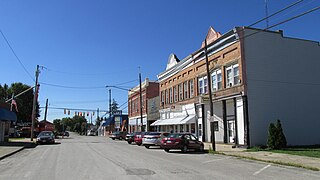
<span class="mw-page-title-main">New Holland, Ohio</span> Village in Ohio, United States

New Holland is a village in Fayette and Pickaway counties in Ohio, United States. The population was 804 at the 2020 census.
<span class="mw-page-title-main">Ridgeway, Ohio</span> Village in Ohio, United States

Ridgeway is a village in Hardin and Logan counties in the U.S. state of Ohio. The population was 314 at the 2020 census.
References

  1. "ArcGIS REST Services Directory". United States Census Bureau. Retrieved September 20, 2022.
  2. 1 2 U.S. Geological Survey Geographic Names Information System: Huntsville, Ohio
  3. 1 2 "U.S. Census website". United States Census Bureau . Retrieved January 31, 2008.
  4. Overman, William Daniel (1958). Ohio Town Names. Akron, OH: Atlantic Press. p. 63.
  5. Perrin, W.H. and J.H. Battle. History of Logan County and Ohio. Chicago: O.L. Baskin, 1880, 383.
  6. "US Gazetteer files 2010". United States Census Bureau. Archived from the original on January 12, 2012. Retrieved January 6, 2013.
  7. "Census of Population and Housing". Census.gov. Retrieved June 4, 2015.
  8. "U.S. Census website". United States Census Bureau . Retrieved January 6, 2013.