
The Chattahoochee River forms the southern half of the Alabama and Georgia border, as well as a portion of the Florida and Georgia border. It is a tributary of the Apalachicola River, a relatively short river formed by the confluence of the Chattahoochee and Flint rivers and emptying from Florida into Apalachicola Bay in the Gulf of Mexico. The Chattahoochee River is about 430 miles (690 km) long. The Chattahoochee, Flint, and Apalachicola rivers together make up the Apalachicola–Chattahoochee–Flint River Basin. The Chattahoochee makes up the largest part of the ACF's drainage basin.

The Tioga River is a tributary of the Chemung River, approximately 58 miles (93 km) long, in northern Pennsylvania and western New York in the United States. It drains a region of ridges in the northern Allegheny Plateau in the watershed of the Susquehanna River. It is a Northern flowing river

The Coosa River is a tributary of the Alabama River in the U.S. states of Alabama and Georgia. The river is about 280 miles (450 km) long.

The Chattooga River is the main tributary of the Tugaloo River.

The Tallapoosa River runs 265 miles (426 km) from the southern end of the Appalachian Mountains in Georgia, United States, southward and westward into the Appalachian foothills in Alabama. It is formed by the confluence of McClendon Creek and Mud Creek in Paulding County, Georgia. Lake Martin at Dadeville, Alabama is a large and popular water recreation area formed by a dam on the river. The Tallapoosa joins the Coosa River about 10 miles (16 km) northeast of Montgomery near Wetumpka to form the Alabama River.

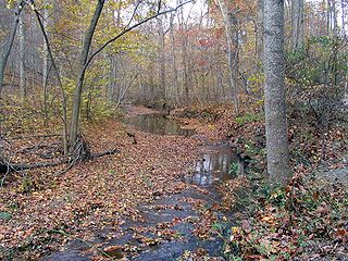
Peachtree Creek is a major stream in Atlanta. It flows for 7.5 miles (12.1 km) almost due west into the Chattahoochee River just south of Vinings.

Larrys Creek is a 22.9-mile-long (36.9 km) tributary of the West Branch Susquehanna River in Lycoming County in the U.S. state of Pennsylvania. A part of the Chesapeake Bay drainage basin, its watershed drains 89.1 square miles (231 km2) in six townships and a borough. The creek flows south from the dissected Allegheny Plateau to the Ridge-and-valley Appalachians through sandstone, limestone, and shale from the Devonian, Mississippian, and Pennsylvanian periods.
Cabin John Creek is a tributary stream of the Potomac River in Montgomery County, Maryland. The watershed covers an area of 26 square miles (67 km2). The headwaters of the creek originate in the city of Rockville, and the creek flows southward for 10.9 miles (17.5 km) to the Potomac River.

Moodna Creek is a small tributary of the Hudson River that drains eastern Orange County, New York. At 15.5 miles (25 km) in length from its source at the confluence of Cromline Creek and Otter Kill west of Washingtonville, it is the longest stream located entirely within the county.
Yellow Creek is a tributary of the Pecatonica River in Stephenson County, in the US state of Illinois. The 50-mile (80 km) stream also flows through a small part of Jo Daviess County. The waters of Yellow Creek were assessed for water quality in 1996, with 28 miles (45 km) being listed as "fair" and 22 miles (35 km) being listed as "good". During the 1832 Black Hawk War, the Battle of Waddams Grove was fought along Yellow Creek.

Medicine Creek is a 96-mile-long (154 km) tributary of the Republican River in Nebraska. Medicine Creek rises in an outlying portion of the Nebraska Sand Hills near the unincorporated community of Somerset in Lincoln County and flows southeast through Frontier County to its confluence with the Republican River .5 mi (0.80 km) east of Cambridge, in Furnas County, Nebraska. About 7 mi (11 km) north of Cambridge, the Medicine Creek Dam impounds the Harry Strunk reservoir, 1,850 acres (750 ha) in area and primarily created for flood-control. A state park and recreational area is located around the dam and lower portion of the reservoir. Medicine Creek is spring fed. Water quality is good and quantity is reliable.

Little Seneca Creek is an 14.0-mile-long (22.5 km) stream in Montgomery County, Maryland, roughly 18 miles (29 km) northwest of Washington, D.C.

Quail Creek State Park is a state park of Utah, United States, featuring a 600-acre (240 ha) reservoir. The park is located within Hurricane, Utah, 9 miles (14 km) west of the city center and 1.5 miles (2.4 km) south of the historic ghost town of Harrisburg. Quail Creek State Park offers camping, boating, swimming, and fishing.
Hurricane Creek may refer to:

Tenmile Creek is a tributary stream of Little Seneca Creek in Montgomery County, Maryland.

Spring Brook is a tributary of the Lackawanna River in Lackawanna County and Luzerne County, in Pennsylvania, in the United States. It is approximately 17 miles (27 km) long and flows through Covington Township, Spring Brook Township, and Moosic in Lackawanna County and Pittston Township in Luzerne County. The watershed of the stream has an area of 57.2 square miles (148 km2). It is designated as a High-Quality Coldwater Fishery and a Migratory Fishery above Interstate 476 and as a Coldwater Fishery and a Migratory Fishery below it. A section is also designated as Class A Wild Trout Waters. The stream's tributaries include Panther Creek, Plank Bridge Creek, Rattlesnake Creek, Green Run, Monument Creek, and Covey Swamp Creek. It has a relatively high level of water quality and is very slightly acidic, with a pH of 6.4 to 6.9.
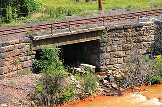
Trout Run is a tributary of Shamokin Creek in Northumberland County, Pennsylvania, in the United States. It is approximately 1.4 miles (2.3 km) long and flows through Coal Township. The watershed of the stream has an area of 3.01 square miles (7.8 km2). The stream is not designated as impaired and has a high level of water quality. It flows through a valley between Big Mountain and Little Mountain. A reservoir is located in the stream's watershed and it has been used as a water supply. The stream is designated as a Coldwater Fishery and a Migratory Fishery and supports aquatic life.
Polk Valley Run is a tributary of Saucon Creek in Northampton County, Pennsylvania. It is approximately 1.9 miles (3.1 km) long and flows through Lower Saucon Township and Hellertown. The watershed of the stream has an area of 2.13 square miles (5.5 km2). A reach of the stream is designated as an impaired waterbody due to siltation from agriculture. However, wild trout and other wildlife are present in and around it. Most of the watershed is forested.
East Kill, a 16-mile-long (26 km) tributary of Schoharie Creek, flows across the town of Jewett, New York, United States, from its source on Stoppel Point. Ultimately its waters reach the Hudson River via the Mohawk. Since it drains into the Schoharie upstream of Schoharie Reservoir, it is part of the New York City water supply system. East Kill drains the southern slopes of the Blackhead Mountains, which include Thomas Cole Mountain, Black Dome, and Blackhead Mountain, the fourth-, third-, and fifth-highest peaks in the Catskills, respectively.

Batavia Kill is a 21-mile-long (34 km) tributary of Schoharie Creek, that flows across the towns of Windham, Ashland and Prattsville in the U.S. state of New York. Its waters reach the Hudson River via Schoharie Creek and the Mohawk River. Since it drains into the Schoharie upstream of Schoharie Reservoir, it is part of the New York City water supply system. From the source to Maplecrest, Batavia Kill drains the northern slopes of the Blackhead Mountains, which include Thomas Cole Mountain, Black Dome, and Blackhead Mountain, the fourth-, third-, and fifth-highest peaks in the Catskills, respectively.
