Hutsonville, Illinois | |
---|---|
Coordinates: 39°06′30″N87°39′39″W / 39.10833°N 87.66083°W [1] | |
Country | United States |
State | Illinois |
County | Crawford |
Area | |
• Total | 0.62 sq mi (1.61 km2) |
• Land | 0.62 sq mi (1.61 km2) |
• Water | 0.00 sq mi (0.00 km2) |
Elevation | 449 ft (137 m) |
Population (2020) | |
• Total | 478 |
• Density | 768.49/sq mi (296.84/km2) |
Time zone | UTC-6 (CST) |
• Summer (DST) | UTC-5 (CDT) |
ZIP Code(s) | 62433 |
Area code | 618 |
FIPS code | 17-36841 |
GNIS feature ID | 2398565 [1] |
Wikimedia Commons | Hutsonville, Illinois |
Hutsonville is a village in Crawford County, Illinois, United States. The population was 478 at the 2020 census. [3]
Hutsonville is located in northeastern Crawford County along the Wabash River. [4] Its eastern border is formed by the river, which is also the Indiana state line. The main east-west street through the village is Clover Street, which crosses the river to become Indiana State Road 154, which leads east 15 miles (24 km) to Sullivan, Indiana. Clover Street leads west 1.5 miles (2.4 km) to Illinois Route 1, which runs north 20 miles (32 km) to Marshall and south 26 miles (42 km) to Lawrenceville. Hutsonville's Main Street leads south as County Route 5, 8 miles (13 km) to Palestine.
According to the 2010 census, Hutsonville has a total area of 0.62 square miles (1.61 km2), all land. [5]
Census | Pop. | Note | %± |
---|---|---|---|
1880 | 418 | — | |
1890 | 582 | 39.2% | |
1900 | 743 | 27.7% | |
1910 | 722 | −2.8% | |
1920 | 665 | −7.9% | |
1930 | 604 | −9.2% | |
1940 | 714 | 18.2% | |
1950 | 647 | −9.4% | |
1960 | 583 | −9.9% | |
1970 | 544 | −6.7% | |
1980 | 705 | 29.6% | |
1990 | 622 | −11.8% | |
2000 | 568 | −8.7% | |
2010 | 554 | −2.5% | |
2020 | 478 | −13.7% | |
U.S. Decennial Census [6] |
As of the 2020 census [3] there were 478 people, 255 households, and 136 families residing in the village. The population density was 768.49 inhabitants per square mile (296.72/km2). There were 221 housing units at an average density of 355.31 per square mile (137.19/km2). The racial makeup of the village was 94.14% White, 1.26% African American, 0.42% Native American, 0.63% Asian, 0.84% from other races, and 2.72% from two or more races. Hispanic or Latino of any race were 3.35% of the population.
There were 255 households, out of which 20.8% had children under the age of 18 living with them, 47.06% were married couples living together, 2.35% had a female householder with no husband present, and 46.67% were non-families. 27.45% of all households were made up of individuals, and 9.41% had someone living alone who was 65 years of age or older. The average household size was 2.77 and the average family size was 2.09.
The village's age distribution consisted of 16.0% under the age of 18, 14.3% from 18 to 24, 23.6% from 25 to 44, 26.8% from 45 to 64, and 19.4% who were 65 years of age or older. The median age was 40.7 years. For every 100 females, there were 99.3 males. For every 100 females age 18 and over, there were 121.9 males.
The median income for a household in the village was $46,875, and the median income for a family was $75,833. Males had a median income of $22,000 versus $28,750 for females. The per capita income for the village was $23,468. About 15.4% of families and 24.2% of the population were below the poverty line, including 15.6% of those under age 18 and 12.7% of those age 65 or over.
Hutsonville Power Station was a coal-fired power plant located north of Hutsonville. Electricity was generated at the power plant until its closure in 2011. [7]
Harvel is a village in Christian and Montgomery counties in the U.S. state of Illinois. The population was 178 at the 2020 census, down from 223 in 2010.
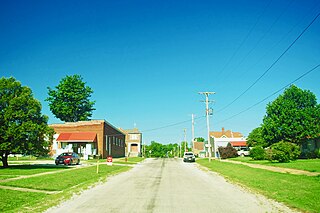
Flat Rock is a village in Crawford County, Illinois, United States. The population was 323 at the 2020 census.
Bowen is a village in southeast Hancock County, Illinois, United States. The population was 494 at the 2010 census.
Pontoosuc is a village in Hancock County, Illinois, United States. The population was 146 at the 2010 census, down from 171 at the 2000 census.
Rose Hill is a village in Jasper County, Illinois, United States. The population was 80 at the 2010 census.
Gages Lake is a census-designated place (CDP) in Warren Township, Lake County, Illinois, United States. The population was 10,637 at the 2020 census.
Medora is a village in Macoupin County, Illinois, United States. The population was 379 at the 2020 census, down from 419 in 2010.
Maryville is a village in Madison County, Illinois, United States. The population was 8,221 at the 2020 census, up from 7,487 in 2010.
South Roxana, incorporated in March 1967, is a village in Madison County, Illinois, United States. The population was 1,891 at the 2020 census.
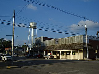
Sparland is a village in Marshall County, Illinois, United States. The population was 366 at the 2020 census, down from 406 in 2010. It is part of the Peoria Metropolitan Statistical Area.
Washburn is a village mostly in Woodford County, with a small northerly portion in Marshall County, Illinois, United States. The population was 1,032 at the 2020 census. It is part of the Peoria Metropolitan Statistical Area.
Tallula is a village in Menard County, Illinois, United States. It was founded in 1857 by William G. Greene. The population was 434 at the 2020 census, down from 488 in 2010. It is part of the Springfield, Illinois Metropolitan Statistical Area.
Reynolds is a village mainly in Rock Island County in the U.S. state of Illinois. The population was 498 at the 2020 census. A small portion on the south side is in Mercer County. The village was founded in 1876.
Viola is a village in Mercer County, Illinois, United States. The population was 869 at the 2020 census, a decline of 9 percent from 955 in 2010.
Nokomis is a city in Montgomery County, Illinois, United States. The population was 2,142 at the 2020 census.
Chapin is a village in Morgan County, Illinois, United States. The population was 475 at the 2020 census. It is part of the Jacksonville Micropolitan Statistical Area.
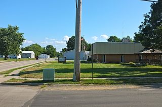
Gays is a village in Moultrie County, Illinois, United States. The population was 218 at the 2020 census, down from 281 in 2010.
Lovington is a village in Moultrie County, Illinois, United States. The population was 1,069 at the 2020 census. Lovington was named after Andrew Love, the first postmaster in the area.
Hutsonville Township is one of ten townships in Crawford County, Illinois, USA. As of the 2020 census, its population was 994 and it contained 486 housing units.
Licking Township is one of ten townships in Crawford County, Illinois, USA. As of the 2020 census, its population was 407 and it contained 170 housing units.
Media related to Hutsonville, Illinois at Wikimedia Commons