
Tiruvallur is a Grade I municipality and a fast developing city in the Indian state of Tamil Nadu. It is located on the banks of Cooum river about 46 km (29 mi) from downtown Chennai (Madras) and just 5 km from megacity border, in the western part of the Chennai Metropolitan Area (CMA). It is the administrative headquarters of Tiruvallur district. The city has less dense population spread all over with large area.

Ambattur is located in north west part of Chennai City, in Ambattur taluk of the Chennai District, surrounded by Anna Nagar, Padi, Mogappair, Korattur, Ayappakkam and Avadi. It covers an area of 45 km2 (17 sq mi). The neighbourhood is served by Ambattur railway station of the Chennai Suburban Railway. Ambattur has its origins in a village of the same name which can be located at present as areas opposite to Ambattur telephone exchange. Ambattur was a village with large extents of agricultural farm lands irrigated by the once-sprawling Ambattur Lake. In 2011, the neighbourhood had a population 466,205.

Anna Nagar, is a neighbourhood in the metropolitan city of Chennai, India. Named after the Tamil leader C. N. Annadurai, it is located in the north-western part of Chennai and forms a part of the Aminjikarai taluk and the Anna Nagar Zone. It is one of the prime residential areas in Chennai and is home to several prominent doctors, lawyers and politicians. Real estate prices are among the highest in the city. A recent addition to the area is VR Chennai Mall, located near Shanthi Colony and Thirumangalam junction.
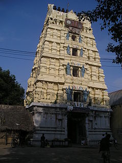
Thiruttani is a town in the state of Tamil Nadu, India. This town is famous for Thiruthani Murugan Temple which is one of the Arupadaiveedu and is dedicated to Kartikeya.
Madhavaram or Madhapuram, which is pronounced as 'Maadhavaram', is a part of north of Chennai, Tamil Nadu, India. It is also a taluk in Chennai District and a zone in Greater Chennai Corporation. It is located in between Perambur and Kodungaiyur. As of 2011, the neighbourhood had a population of 119,105. The Chennai district is expanded on 16 August 2018 by transferring Madhavaram taluk from Tiruvallur district to Chennai district.
Madurantakam is a town and a municipality in Chengalpattu district in the Indian state of Tamil Nadu. The town is known for the artificial and second largest lake in Tamil Nadu, the Maduranthakam lake. It is said to have been built by the Chola King Uttama Chola, also called as Maduranthaka, during his reign. It is also home to the Eri-Katha Ramar Temple. As of 2011, the town had a population of 30,796.
Marandahalli is a panchayat town Dharmapuri district in the Indian state of Tamil Nadu. Located in the northern part of the district.
Pallipattu is a town in Tiruvallur district in the state of Tamil Nadu, India.It is known for its rich and fertile agricultural lands and is blessed with the flowing of river, from west to east, named 'Kusasthalai'. It has produced personalities who have made a mark in film industry, medical profession, Information Technology, Entrepreneurship, Trading and politics. It is located 113 kilometres from Chennai, 40 kilometres from Chittoor, 51 kilometres from Tirupathi, 36 kilometres from Tiruttani, 50 kilometres from Arakkonam and border place of the state of Andhra Pradesh
Sambavar vadakarai is a Panchayat town (Peerooratchi) in Tenkasi district in the Indian state of Tamil Nadu.
Verkilambi is an interior rural area the district of Kanyakumari at the state of Tamil Nadu. This is a grade – I Town panchayat spread in a total area of 15.7 Sq. km and consists of 18 wards, represented by 18 councilors. The Executive officer is the administrative head and the elected Chairman is the political head of this Town Panchayat. This was constituted as Kumarankudy Village, Pathmanapapuram MLA Constituency, Nagercoil MP Constituency. The town is located at a distance of 5 km from Ponmanai Town Panchayat on the East, 5 km from Thiruvattar Town Panchayat on the west. 3 km from Kothanalloor Town Panchayat on the South. This town is located along the Kanyakumari, Thiruvanthapuram, National High way and Colachel – Kulasekaram state high way Road through this TP. This TP Constitutes its village component to talking an area of 3.25 Sq. km up graded as town Panchayat
Villivakkam is a neighbourhood of Chennai, Tamil Nadu, India. It is served by the Villivakkam railway station on the Chennai Central–Arakkonam suburban section.
Santhanagopalaurma is a small village in Tiruttani Taluk of Thiruvallur district in the Indian state of Tamil Nadu. It is 10 kilometers north-east of Tiruttani and 2 kilometers from Andhra Pradhesh border. Total population is more than 1035 people.

Parassala is a small border town located half within in Kerala and Tamil Nadu.It comes under Thiruvananthapuram district at southern tip of Kerala. It is situated 34 km south of state capital Thiruvananthapuram in Kerala, bordering Tamil Nadu. It is famous for its Mahadeva Temple. The Place has a pond called the "Thavala Illa Kulam" which means "A pond with no frog".
Guruvarajapet is a census town located in the Indian state of Tamil Nadu. It is located 85 km from the state capital of Chennai.
Ellispet is a small village near Erode, Tamil Nadu, India. The village is named after a Christian missionary Ellis. This village was created by settling a small number of families during British India period as a settlement of early Christians.

Chingleput district was a district in the Madras Presidency of British India. It covered the area of the present-day districts of Kanchipuram, Chengalpattu and Tiruvallur and parts of Chennai city. It was sub-divided into six taluks with a total area of 7,970 square kilometres (3,079 sq mi). The first capital was the town of Karunguzhi, with an interruption between 1825 and 1835, administrative headquarters were transferred to Kanchipuram. In 1859 the capital Saidapet, now a neighbourhood in the city of Chennai, was made the administrative headquarters of the district.
Tirur village is a panchayat located in the Thiruvallur district of Tamil-Nadu state,India. The latitude 13.1017962 and longitude 79.9668308 are the geocoordinate of the Tirur. Chennai is the state capital for Tirur village,it is located around 35.3 kilometer away from Tirur. The village well connected by rail route from the Chennai centrail suburbs nearest railway stations are Sevvapettai 1.5 km.

Poondi Lake or Sathyamoorthy reservoir is the reservoir across Kotralai River in Tiruvallur district of Tamil Nadu State. It acts as the important water source for Chennai city which is 60 km away.
Arani, also known as Araniar or Araniyar, is a 108 km long river) in India. It flows through the states of Tamil Nadu and Andhra Pradesh.
Kilacheri is a village in Tamil Nadu, India. It is located in the Kadambatur taluka of the Tiruvallur district. Kilacheri Village is an administrative village in the Tiruvallur district of the Indian state of Tamil Nadu.