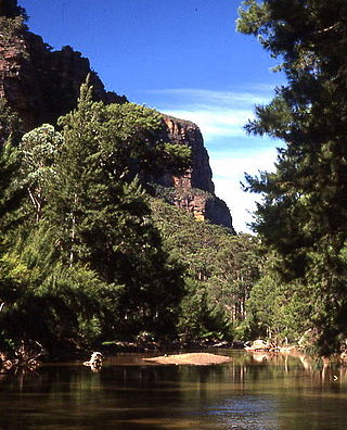
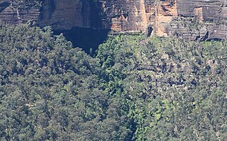
The Wollemi National Park is a protected national park and wilderness area that is located in the Central West and Hunter region of New South Wales, in eastern Australia. The 501,703-hectare (1,239,740-acre) park, the second largest national park in New South Wales, contains the 361,113-hectare (892,330-acre) Wollemi Wilderness – the largest such wilderness area in Australia – and is situated approximately 130 kilometres (81 mi) northwest of Sydney.
The Sydney Basin is an interim Australian bioregion and is both a structural entity and a depositional area, now preserved on the east coast of New South Wales, Australia and with some of its eastern side now subsided beneath the Tasman Sea. The basin is named for the city of Sydney, on which it is centred.

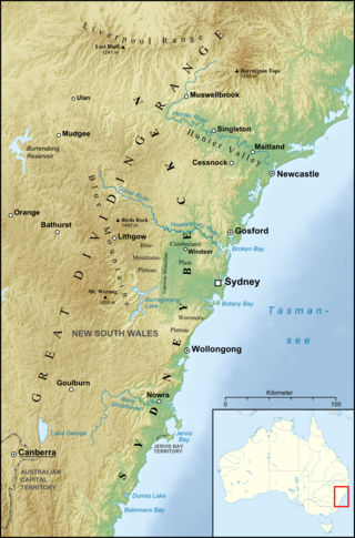
The geography of Sydney is characterised by its coastal location on a basin bordered by the Pacific Ocean to the east, the Blue Mountains to the west, the Hawkesbury River to the north and the Woronora Plateau to the south. Sydney lies on a submergent coastline on the east coast of New South Wales, where the ocean level has risen to flood deep river valleys (rias) carved in the Sydney sandstone. Port Jackson, better known as Sydney Harbour, is one such ria.

Sydney sandstone, also known as the Hawkesbury sandstone, yellowblock, and yellow gold, is a sedimentary rock named after Sydney, and the Hawkesbury River north of Sydney, where this sandstone is particularly common.

The Cumberland Plain, also known as Cumberland Basin, is a relatively flat region lying to the west of Sydney CBD in New South Wales, Australia. An IBRA biogeographic region, Cumberland Basin is the preferred physiographic and geological term for the low-lying plain of the Permian-Triassic Sydney Basin found between Sydney and the Blue Mountains, and it is a structural sub-basin of the Sydney Basin.

The Wianamatta Group is a geological feature of the Sydney Basin, New South Wales, Australia that directly overlies the older Hawkesbury sandstone and generally comprise fine grained sedimentary rocks such as shales and laminites as well as less common sandstone units.

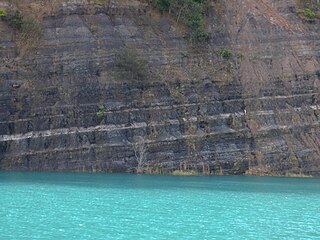
The Narrabeen group of sedimentary rocks occurs in the Sydney Basin in eastern Australia. This series of rocks was formed in the Triassic Period.
Geologically the Australian state of New South Wales consists of seven main regions: Lachlan Fold Belt, the Hunter-Bowen Orogeny or New England Orogen (NEO), the Delamerian Orogeny, the Clarence Moreton Basin, the Great Artesian Basin, the Sydney Basin, and the Murray Basin.
The Clarence Moreton Basin is a Mesozoic sedimentary basin on the easternmost part of the Australian continent. It is located in the far north east of the state of New South Wales around Lismore and Grafton and in the south east corner of Queensland. It is the part of the Great Artesian Basin that extends to the east coast in Australia's central eastern lowlands.

In lithostratigraphy, coal measures are coal-bearing strata, with the term typically applied to European units of the Upper Carboniferous System.

Ashfield Shale is part of the Wianamatta group of sedimentary rocks in the Sydney Basin. It lies directly on contemporaneously eroded Hawkesbury sandstone or the Mittagong formation. These rock types were formed in the Triassic Period. It is named after the Sydney suburb of Ashfield. Some of the early research was performed at the old Ashfield Brickworks Quarry. This rock type is often associated with the Inner West and North Shore of the city. However, it has also been recorded at Penrith, Revesby, Bilpin and Mount Irvine.

Bringelly Shale is a component of the Wianamatta group of sedimentary rocks in the Sydney Basin of eastern Australia. Formed in the Triassic Period, it has an extensive outcrop in the western parts of Sydney. The shale has its greatest geographical extent at Bringelly, near the suburb of Liverpool.

Minchinbury Sandstone is a component of the Wianammatta Group of sedimentary rocks in the Sydney Basin of eastern Australia.

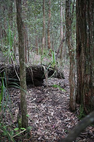
The Dharawal National Park is a protected national park that is located in the Illawarra region of New South Wales, in eastern Australia. The 6,508-hectare (16,080-acre) national park is situated between the Illawarra Range and the Georges River and is approximately 45 kilometres (28 mi) south west of Sydney. There are three entry points to the park: from the east through Darkes Forest; from the north through Wedderburn; and from the south through Appin.

Bald Hill Claystone is a sedimentary rock found in the Sydney Basin in eastern Australia. It is part of the Clifton sub-group of the Narrabeen Group of sedimentary rocks. It was formed by weathering of the Gerringong Volcanics in the early Triassic. Named after Bald Hill, in the northern Illawarra, where it is 15 metres thick. The claystone is easily noticed at Long Reef, where it is 18 metres thick.
The Cambewarra Range Nature Reserve, as part of the Kangaroo Valley Group of Nature Reserves, is a protected area located on the cliffs and plateaus of the Kangaroo Valley in the Southern Highlands and South Coast regions of New South Wales in eastern Australia. The Reserve is situated approximately 150 kilometres (93 mi) south of Sydney, 50 kilometres (31 mi) southwest of Wollongong and 16 kilometres (9.9 mi) northwest of Nowra. The Reserve has a total area of 1684 hectares, and includes 11 privately owned properties. It is critical for it to be pristine for a variety of reasons, not the least the catchment of water, as the Reserve floor flows into the Kangaroo Valley River and the Shoalhaven River, from which the Sydney Water Authority draws water to supply large populations in Sydney and Wollongong.

Bulgo Sandstone is a sedimentary rock occurring in the Sydney Basin in eastern Australia. This stratum is up to 100 metres thick, formed in the early Triassic (Olenekian). A component of the Narrabeen Group of sedimentary rocks. It consists of layers of fine to medium-grained quartz-lithic sandstone, with lenticular shale interbeds.

Stanwell Park Claystone is a geologic formation in the Sydney Basin in eastern Australia. Commonly seen in the Illawarra region, this stratum is up to 79 metres thick. Formed in the early Triassic, it is part of the Narrabeen Group of sedimentary rocks.This formation includes red, green and grey shale with quartz-lithic sandstone.
The Caley Formation is a band of sedimentary rocks occurring in the Sydney Basin in eastern Australia. This stratum is up to 46 metres thick. The formation consists of claystone, shale and quartz-lithic sandstone. Often seen situated below the Burra-Moko Head Sandstone in the cliffs of the Blue Mountains.
Wombarra Claystone is a geologic formation in the Sydney Basin in eastern Australia. Commonly seen in the Illawarra region, this stratum is up to 30 metres thick. Formed in the late Permian to the early Triassic, it is part of the Narrabeen Group of sedimentary rocks. This formation includes grey shale, and minor quartz-lithic sandstone.
