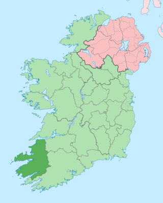
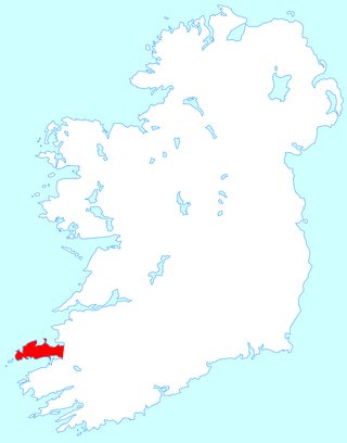
County Kerry is a county in Ireland. It is in the Southern Region and the province of Munster. It is named after the Ciarraige who lived in part of the present county. The population of the county was 156,458 at the 2022 census.
The Dingle Peninsula is the northernmost of the major peninsulas in County Kerry. It ends beyond the town of Dingle at Dunmore Head, the westernmost point of Ireland and arguably Europe.

Baile an Fheirtéaraigh unofficially anglicised as Ballyferriter, or also known as An Buailtín, is a Gaeltacht village in County Kerry, Ireland. It is in the west of the Corca Dhuibhne (Dingle) peninsula and according to the 2002 census, about 75% of the town's population speak the Irish language on a daily basis. The village is named after the Norman-Irish Feiritéar family who settled in Ard na Caithne in the late medieval period. The last Chief of the Name was the seventeenth-century Bard and leader Piaras Feiritéar who was executed. The older Irish name for the village An B[h]uailtín is still used locally.
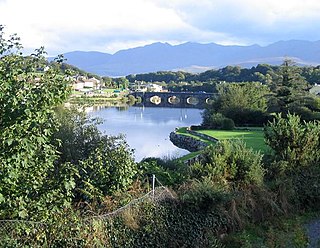
The River Laune is a river in County Kerry, Ireland, which flows from Lough Leane, one of the Lakes of Killarney, through Beaufort, past Ballymalis Castle, through the town of Killorglin, and empties into the sea, first at Castlemaine harbour beside the river Maine and then out through Dingle Bay. The Laune is well known for salmon and trout fishing.
Maharees or Magharees is a 5 km long tombolo located on the northern side of the Dingle Peninsula in County Kerry, Ireland.

Fahamore is a townland and small hamlet/village on the Maharees peninsula in County Kerry. It consists of about 50 houses and one pub, Spillane's. Fahamore was historically much more populated than it is now as evidenced by two old schoolhouses in the village, one dating from 1849 and the other from 1911.

Dingle Bay is a bay located in County Kerry, western Ireland. The outer parts of the Dingle Peninsula and Dingle Bay mark one of the westernmost points of mainland Ireland. The harbour town of Dingle lies on the north side of the bay.

Feothanach or an Fheothanach is a small village and townland in the Corca Dhuibhne Gaeltacht, located 13 km (8.1 mi) north-west of Dingle on the Dingle Peninsula in County Kerry, Ireland. It is at the foot of Mount Brandon.

Ard na Caithne, sometimes known in English as Smerwick, is a bay and townland in County Kerry in Ireland. One of the principal bays of Corca Dhuibhne, it is located at the foot of an Triúr Deirfiúr and Mount Brandon. Bounded by the villages of Baile an Fheirtéaraigh, Baile na nGall and Ard na Caithne itself, the area is what has been known as the Fíor-Ghaeltacht, or "true Gaeltacht".
Caherboshina is a townland situated approximately 4 kilometres from Dingle in County Kerry, Ireland. Its position lies at the almost latitudinal centre of Ireland's most westerly land-mass, Corcha Dhuibhne.
Slea Head is a promontory in the westernmost part of the Dingle Peninsula, located in the barony of Corca Dhuibhne in southwest County Kerry, Ireland. It belongs to the province of Munster and the county of Kerry and is served by the R559 road; the nearest villages are Ballyickeen and Coumeenoole. The headland itself, together with the larger part of Mount Eagle's southern slopes is formed from steeply dipping beds of the pebbly sandstones and conglomerates of the Slea Head Formation, dating from the Devonian period and traditionally referred to as the Old Red Sandstone.

The Dingle Way is a long-distance trail around the Dingle Peninsula in County Kerry, Ireland. It is a 162-kilometre (101-mile) long circular route that begins and ends in Tralee and is typically completed in eight days. It is designated as a National Waymarked Trail by the National Trails Office of the Irish Sports Council and is managed by the Dingle Way Committee and Kerry County Council.

Doonshean or Doonsheane is a townland in western County Kerry in Ireland. It is located about 3.8 km east from the neighbouring town of Dingle.

Rossbeigh, or Rossbehy, is a sandspit with beaches on either side, located approximately 1.6 km from the village of Glenbeigh, in County Kerry, Ireland. It is on the Ring of Kerry, on the Dingle Bay side of the Iveragh Peninsula.

The R561 road is a regional road in Ireland. It is on the Dingle Peninsula in County Kerry. Part of the road is on the Wild Atlantic Way.

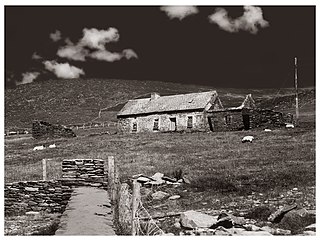
Glanfahan is a townland on the Dingle Peninsula, Ireland, notable for its large collection of clocháns, which form a National Monument.
Rinn an Chaisleáin or Castle Point is a National Monument on Great Blasket Island, Ireland.

Castlemaine Harbour is a Ramsar site, Special Area of Conservation, Special Protection Area and national nature reserve of approximately 2,281 acres (9.23 km2) located in County Kerry, Ireland.

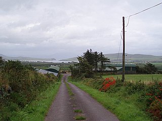
Stradbally is a small village and civil parish on the Dingle Peninsula in County Kerry, Ireland. The larger village of Castlegregory is nearby.
