
U.S. Route 24 or U.S. Highway 24 (US 24) is one of the original United States Numbered Highways of 1926 which runs east and west for most of its routing. It originally ran from Pontiac, Michigan, in the east to Kansas City, Missouri, in the west. Today, the highway's eastern terminus is in Independence Township, Michigan, at an intersection with Interstate 75 (I-75), and its western terminus is near Minturn, Colorado, at an intersection with I-70. The highway transitions from north–south to east–west signage at the Ohio–Michigan state line.

U.S. Route 31 or U.S. Highway 31 (US 31) is a major north–south U.S. highway connecting southern Alabama to northern Michigan. Its southern terminus is at an intersection with US 90/US 98 in Spanish Fort, Alabama. Its northern terminus is at an interchange with Interstate 75 (I-75) south of Mackinaw City, Michigan.

U.S. Route 35 (US 35) is a United States Highway that runs southeast-northwest for approximately 412 miles (663 km) from the western suburbs of Charleston, West Virginia to northern Indiana. Although the highway is physically southeast-northwest, it is nominally north–south. The highway's southern terminus is in Teays Valley, West Virginia, near Scott Depot, at Interstate 64 (I-64). Its northern terminus is near Michigan City, Indiana, at US 20. The West Virginia portion of the highway is mostly expressway, becoming a freeway shortly before it crosses the Ohio River into Ohio. The Ohio portion has been upgraded to a four-lane highway/freeway between the West Virginia state line and Trotwood, west of Dayton.
Interstate 265 (I-265) is a 41.71-mile (67.13 km) Interstate Highway partially encircling the Louisville metropolitan area. Starting from I-65 in the southern part of Louisville, it runs through Jefferson County, Kentucky, crosses the Ohio River on the Lewis and Clark Bridge into Indiana, meets I-65 for a second time, and then proceeds westbound to terminate at the I-64 interchange.
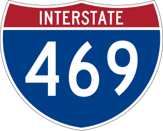
Interstate 469 (I-469) is an Interstate Highway in northeastern Indiana. It is an auxiliary route of parent I-69 that also carries portions of US Highway 24 (US 24), US 30, and US 33 around the urban parts of Fort Wayne. It is 30.83 miles (49.62 km) in length. The Interstate was originally conceived as a bypass for US 24 around the south and east ends of Fort Wayne. Due to heavy traffic on US 30 through the city, support was gained to connect the bypass to I-69 on the city's north end. I-469 was given the name Ronald Reagan Expressway in 2005.

State Road 26 is an east–west discontinuous state road in the central part of the US state of Indiana. The western end of the western segment is at the Illinois border, where it continues as Illinois Route 9. The highway passes through rural areas of Warren and Tippecanoe counties, before ending near West Lafayette. The eastern segment begins at an interchange with Interstate 65 (I-65) and heads east passing through the cities of Kokomo, Hartford City, and Portland, before ending at the Ohio border, where it continues east as Ohio State Route 119. The road covers a distance of about 150.1 miles (241.6 km), passing through mostly rural areas.
State Road 46 in the U.S. state of Indiana is an east–west state highway in the southern half of Indiana.

State Road 18 (SR 18) in the U.S. State of Indiana is an east–west route in North Central Indiana running from the Illinois border in Benton County almost to the Ohio border, terminating at U.S. Route 27 (US 27)/State Road 67 (SR 67) in Jay County. State Route 18 is mainly a 2-lane road with exception of 4-lane divided highway from Marion to Interstate 69 (I-69). Marion is the only considerably large city that Route 18 passes through. State Route 18 runs just south of the lakes region, with Lake Shafer, Lake Freeman, Mississinewa Reservoir, and Salamonie Reservoir not too far to the north. With the exception of Marion, Route 18 passes through mostly small towns. The terrain is mostly level and is utilized mostly for agriculture.

State Road 32 (SR 32) in the U.S. state of Indiana is an east–west state highway in central Indiana that crosses the entire state, covering a distance of about 157 miles (253 km). The western terminus of SR 32 is at the Illinois state line, southeast of Danville, Illinois, where the state highway becomes a county road. The eastern terminus is at Union City, Indiana, and Union City, Ohio, at the Ohio state border where the highway becomes Ohio State Route 47.
State Road 38 (SR 38) in the U.S. state of Indiana serves as a connection between Lafayette in the west and Richmond in the east.

State Road 43 in the U.S. State of Indiana is split into two segments.

State Road 56 in the U.S. state of Indiana is a route that travels the south central part of the state from west to east.

State Road 67 in the U.S. state of Indiana cuts a diagonal route from southwest to northeast across the state from the north side of Vincennes to Indianapolis to the Ohio state line, where it becomes State Route 29 east of Bryant.

State Road 69 (SR 69) is a part of the Indiana State Road system that runs between Hovey Lake Fish and Wildlife Area and Griffin in US state of Indiana. The 35.07 miles (56.44 km) of SR 69 that lie within Indiana serve as a major conduit. Some of the highway is listed on the National Highway System. Various sections are urban two-lane highway, three-lane highway and rural two-lane highway. The highway passes through residential, industrial and commercial properties.

U.S. Route 30 (US 30) is a part of the United States Numbered Highway System that runs from Astoria, Oregon, to Atlantic City, New Jersey. In Indiana, the route runs from the Illinois state line at Dyer to the Ohio state line east of Fort Wayne and New Haven. The 156.217 miles (251.407 km) of US 30 that lie within Indiana serve as a major conduit. The entire length of US 30 in Indiana is included in the National Highway System (NHS). The highway includes four-lane rural sections, an urbanized four-lane divided expressway, and several high-traffic six-lane freeway areas. First designated as a U.S. Highway in 1926, US 30 replaced the original State Road 2 (SR 2) and SR 44 designation of the highway which dated back to the formation of the Indiana State Road system. A section of the highway originally served as part of the Lincoln Highway. Realignment and construction projects have expanded the highway to four lanes across the state, and the road is now part of a long stretch of US 30 from New Lenox, Illinois, to Canton, Ohio, where the road has at least four lanes. There are over 40 traffic signals between Interstate 65 (I-65) at Merrillville and I-69 at Fort Wayne.

Interstate 65 (I-65) in the US state of Indiana traverses from the south-southeastern Falls City area bordering Louisville, Kentucky, through the centrally located capital city of Indianapolis, to the northwestern Calumet Region of the Hoosier State which is part of the Chicago metropolitan area. The Indiana portion of I-65 begins in Jeffersonville after crossing the Ohio River and travels mainly north, passing just west of Columbus prior to reaching the Indianapolis metro area. Upon reaching Indianapolis, the route alignment of I-65 begins to run more to the northwest and subsequently passes Lafayette on that city's east and north sides. Northwest of there, in west-central Jasper County, the route again curves more northward as it approaches the Calumet Region. Shortly after passing a major junction with I-80 and I-94, I-65 reaches its northern national terminus in Gary at US Highway 12/US Highway 20 after an interchange on I-90. I-65 covers 261.27 miles (420.47 km) in the state of Indiana. This is one of the principal Interstate Highways that cross the state, and, more specifically, intersect at the city of Indianapolis, that has given the state the nickname of "Crossroads of America".

State Road 243 is a north–south highway located in the west central part of Indiana near Cloverdale.

U.S. Route 41 (US 41) in the state of Indiana is a north–south US Highway that is parallel to the Illinois state line. It enters the state south of Evansville as a four-lane divided highway passing around Vincennes and traveling north to Terre Haute. In Terre Haute, it is known as 3rd Street. North of Terre Haute, it hooks east and becomes a two-lane surface road. Those wanting to stay on a four-lane divided highway can use State Road 63 to the west. It passes through Rockville, Veedersburg, and Attica before returning to a four-lane divided highway when SR 63 terminates in Warren County. It remains a four-lane divided highway until Lake County, where it becomes a main road known as Indianapolis Boulevard. It overlaps US 12 and US 20 in Hammond and exits Indiana into the South Side of Chicago.
U.S. Route 31 (US 31) is a part of the United States Numbered Highway System that runs from Spanish Fort, Alabama, to Mackinaw City, Michigan. It enters the U.S. state of Indiana via the George Rogers Clark Memorial Bridge between Louisville, Kentucky, and Clarksville, Indiana. The 257.6 miles (414.57 km) of US 31 that lie within Indiana serve as a major conduit. Some of the highway is listed on the National Highway System. Various sections are rural two-lane highway and urbanized four- or six-lane divided expressway. The northernmost community along the highway is South Bend near the Michigan state line.

U.S. Route 231 is the longest numbered highway in Indiana, covering over 284 miles (457 km). It is a main north–south highway in the western part of the state. The southern terminus of US 231 in Indiana is at the Kentucky state line and the northern terminus is at US 41 just south of St. John. The highway is a mixture of expressway and two-lane roadway. The expressway portions exist mainly in southern Indiana and around the Lafayette-West Lafayette area, with the rest mainly being two lanes.

