Greater Kailash is a residential area in South Delhi consisting of several neighborhoods and multiple markets. It is divided into three zones, namely part 1, 2, and 3, located around a section of the Outer Ring Road. The neighborhood registered a 4.4% growth in residential sales.

Mayur Vihar is an upmarket residential area in East Delhi close to the Noida-Delhi border, situated just across the Yamuna River, and is divided into three distinct phases. As the name suggests, it has been the dwelling (vihar) of peacocks (mayur). Even today, the area has a closed sanctuary dedicated to the conservation of peacocks.

Saket is a residential colony and the administrative headquarters of the South Delhi district of Delhi in India. The neighborhood is named after the city of Ayodhya, also known as Saket, an ancient, religiously significant city in Uttar Pradesh. Saket has four major malls on the Press Enclave Marg. The neighbourhood is home to the first Apple Store, called the Apple Saket, in New Delhi and the second in India, after Apple BKC located in Bandra Kurla Complex of the financial centre of the country, Mumbai.

Bangarmau is a tehsil and a municipal board in Unnao district in the state of Uttar Pradesh, India. It is located on high ground overlooking the left bank of the Kalyani river, about 50 km northwest of Unnao and 22 km northwest of Safipur. Roads fan out in all directions from Bangarmau, including the main Unnao-Hardoi road SH38 that passes through town. Major commodities produced here include wheat flour, rice, and pulses. As of 2011, the population of Bangarmau is 44,204, in 7,600 households.
Behta Hajipur is a census town in the Loni block of Ghaziabad district in the Indian state of Uttar Pradesh. It is a part of the National Capital Region (NCR). At one end (southwest), the town's boundary terminates at National Highway 709B, which connects Delhi to Saharanpur, and at the other end (northeast), the boundary ends at Loni-Ghaziabad Road. It also share its territories with the neighboring census town, Mandoli.
Nacharam is a neighbourhood of Hyderabad in the Indian state of Telangana. It falls under Uppal Mandal. It forms Ward No. 6 of Greater Hyderabad Municipal Corporation.
The Civil Lines is a residential area and one of the 3 subdivisions of the Central Delhi district of Delhi in India. It is one of the 12 zones under the Municipal Corporation of Delhi. It was the hub of European-style hotels in the city until New Delhi came into being in 1911. The official residence of the Lieutenant Governor of Delhi is also located at Raj Niwas Marg, Civil Lines.

Gomti Nagar is an area in the Indian city of Lucknow consisting of both residential and business settlements. It is one of the largest and fastest-growing areas of Lucknow. It is also considered Asia's largest colony. It is home to high-end residential projects, malls, commercial property, plots, business centers, multiplexes, cafés, hotels, hospitals, clubs, banks, food courts and entertainment centers. The colonies in Gomti Nagar are based on a 'maximum open space' concept hence most of the plots/houses and apartments are park-facing.
Ashok Nagar is a neighborhood in the city of Delhi. It constitutes a part of the Tilak Nagar assembly constituency as well as the West Delhi parliamentary constituency. The area was known as Tihar Village 2 before being renamed as such. It is an authorized neighborhood today, and the government of Delhi plays a role in its development.
Bali Nagar is a medium-high dem residential colony located in West of New Delhi, India. It was developed by Bali & Co (Pvt) Ltd. Once a farming land, it was sold for development in the 1970s and was primarily bought up by businessmen. It is a relatively green ex-suburb with a spacious high street boasting most amenities. Please click on link provided to check the latest Rating & Review on Bali Nagar:

Lucknow Metro is a mass rapid transit (MRT) system in Lucknow, Uttar Pradesh, India. The metro is owned and operated by the Uttar Pradesh Metro Rail Corporation (UPMRC). Frequency.of the Metro is 5 - 7 minutes.
Defence Colony is a neighbourhood in Delhi. It was built in the 1960s for veterans of the Indian Armed Forces. It serves as the administrative headquarters of the South East Delhi district of Delhi.

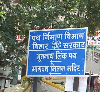
Bhootnath Road area is a neighborhood and residential area in Patna. The area is served by Agamkuan Police Station under Patna Police and Bahadurpur Housing Colony Post Office. This road is a State Highway and also act as a linking road between Patna Main Road and Bypass Road. So this make this road one of the busiest road of Patna. TV Tower of Patna is located near this Road.

Munshi Pulia is the northern terminal metro station on the North-South Corridor of the Red Line of Lucknow Metro station in Lucknow, Uttar Pradesh, India. It is situated in the Sector-13, 14 and 16 of Indira Nagar colony. There are two entrances to the station, from the Sector-16 side and from the Sector-13 and 14 side.

Krishna Nagar is an important elevated metro station on the North-South Corridor of the Red Line of Lucknow Metro in the city of Lucknow, Uttar Pradesh, India, which is used for commuting hub for the residential areas of Krishna Nagar, LDA and Aashiyana.
Krishna Nagar is a residential area in the city of Lucknow. It is located to the south of Sharda Canal and west of Kanpur Road. It has a police station which is under the control of the Lucknow Police.
Uttam Nagar is a suburb situated in West Delhi. Uttam Nagar has the Pincode 110059. Uttam Nagar mainly consists of several sub towns that are completely urbanized. Since the advent of the Delhi Metro in the area, the population has increased much faster here. The proximity with Metro, Airport and Gurgaon makes this area special.
Okhla Vihar is a new settlement in Okhla, in the district of South East Delhi, India. It consists of many lanes (roads) and many sub-lanes (sub-roads). Over 80% of the area of Okhla Vihar is covered with 5-story apartments. The area consists of three mosques and a church. Amanatullah Khan is the local M.L.A from AAP.
Vijay Nagar is a major residential, industrial and commercial area in Ghaziabad, Uttar Pradesh, India. It was developed with assistance of the Ghaziabad Development Authority. The suburb is located at the junction of Noida, Greater Noida, Crossings Republik, Pratap Vihar and Indirapuram. Vijay Nagar is known for its educational institutes, industrial areas, the Ghaziabad Junction Railway Station, the Meerut Expressway, NH-24 and the Vishwakarma Road. The area has witnessed rampant growth in infrastructure and civic development. Vijay Nagar is closely linked with the adjoining Pratap Vihar area having a residential area, upcoming real estate projects and the Santosh Medical & Dental College, a part of Santosh University.The adjoining Bhur Bharat Nagar is close to Ghaziabad Railway Station, the nearest railway station that serves this area.


