Iro Lake

Last updated
Lake Iro
Iro Lake 2021-07-16 Sentinel-2 L2A True color.jpg
Sentinel-2 image (2021)
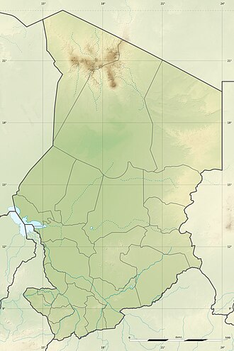
Chad relief location map.jpg
Red pog.svg
Lake Iro
Location in Chad
Location Moyen-Chari Region; Chad
Coordinates Coordinates: 10°06′N19°25′E / 10.100°N 19.417°E / 10.100; 19.417
Primary inflows Bahr Salamat
Primary outflows evaporation
Basin  countriesChad
Max. length13 km (8.1 mi)
Max. width11 km (6.8 mi)
Surface area110 km2 (42 sq mi)
Surface elevation386 m (1,266 ft)
Islands no
SettlementsBoum Kabir

Iro Lake (French : Lac Iro) is a cyclically occurring lake in the Moyen-Chari Region in southeastern Chad. It is fed in the summer and autumn months from the eastern arm of the Bahr Salamat, which forks seven kilometers southwest of the lake. The lake is about 100 kilometers north of the border with the Central African Republic. It is nearly circular, 13 kilometers long and 11 kilometers wide. During the dry season it can completely run dry.

Contents

It has been suspected that the depression is the remains of an impact crater. [1] [2]
See also

Related Research Articles

Geography of Chad African country

Chad is one of the 47 landlocked countries in the world and is located in North Central Africa, measuring 1,284,000 square kilometers (495,755 sq mi), nearly twice the size of France and slightly more than three times the size of California. Most of its ethnically and linguistically diverse population lives in the south, with densities ranging from 54 persons per square kilometer in the Logone River basin to 0.1 persons in the northern B.E.T. (Borkou-Ennedi-Tibesti) desert region, which itself is larger than France. The capital city of N'Djaména, situated at the confluence of the Chari and Logone Rivers, is cosmopolitan in nature, with a current population in excess of 700,000 people.

Impact crater Circular depression on a solid astronomical body formed by a smaller objects impact

An impact crater is a depression in the surface of a planet, moon, or other solid body in the Solar System or elsewhere, formed by the hypervelocity impact of a smaller body. In contrast to volcanic craters, which result from explosion or internal collapse, impact craters typically have raised rims and floors that are lower in elevation than the surrounding terrain. Lunar impact craters range from microscopic craters on lunar rocks returned by the Apollo Program and small, simple, bowl-shaped depressions in the lunar regolith to large, complex, multi-ringed impact basins. Meteor Crater is a well-known example of a small impact crater on Earth.

Chicxulub crater Prehistoric impact crater under the Yucatán Peninsula, Mexico

The Chicxulub crater is an impact crater buried underneath the Yucatán Peninsula in Mexico. Its center is offshore near the communities of Chicxulub Puerto and Chicxulub Pueblo, after which the crater is named. It was formed slightly over 66 million years ago when a large asteroid, about 10 kilometers in diameter, struck Earth. The crater is estimated to be 180 kilometers in diameter and 20 kilometers in depth. It is the second largest confirmed impact structure on Earth, and the only one whose peak ring is intact and directly accessible for scientific research.

Manicouagan Reservoir Lake in Quebec, Canada

Manicouagan Reservoir is an annular lake in central Quebec, Canada, covering an area of 1,942 km2 (750 sq mi). The lake island in its centre is known as René-Levasseur Island, and its highest point is Mount Babel. The structure was created 214 (±1) million years ago, in the Late Triassic, by the impact of a meteorite 5 km (3 mi) in diameter. The lake and island are clearly seen from space and are sometimes called the "eye of Quebec". The lake has a volume of 137.9 km3 (33.1 cu mi).

Couture crater Lake in Northern Quebec, Canada

Lac Couture is a lake in Northern Quebec, Canada. It is located near Hudson Bay in the Kativik territory. The lake is approximately 150 meters deep.

Keurusselkä Lake in Finland

Keurusselkä is a lake in Central Finland between the towns of Keuruu to the north and Mänttä to the south. It covers an area of 117.3 km2 (45.3 sq mi). Its average depth is 6.4 m (21 ft) with a maximum depth of 40 m (130 ft). The surface lies at 105.4 m (346 ft) above sea level. The lake is 27 km (17 mi) long and is a part of the Kokemäenjoki water system. Keurusselkä gained international publicity in 2004 when a pair of amateur geologists discovered an ancient impact crater on the western shore of the lake.

Lake Lappajärvi Impact crater lake in Finland

Lappajärvi is a lake in Finland, in the municipalities of Lappajärvi, Alajärvi and Vimpeli. It is formed in a 23 km (14 mi) wide, partly eroded meteorite impact crater. The lake is part of Ähtävänjoki basin together with Lake Evijärvi that is located downstream (north) of it.

Sääksjärvi Lake of Kokemäki, Finland

Sääksjärvi is a lake in Kokemäki, Satakunta, western Finland, east from the town of Pori. The lake is notable because it overlies an impact crater.

Lake Bosumtwi Crater lake in Ghana

Lake Bosumtwi is the only natural lake in Ghana. It is situated within an ancient impact crater that is about 10.5 kilometres (6.5 mi) in diameter. It is about 30 km (19 mi) south-east of Kumasi, the capital of Ashanti, and is a popular recreational area. There are about 30 villages near the crater lake of Lake Bosumtwi, with a combined population of about 70,000. The most popular amongst the villages where tourists usually settle is Abono.

Apianus (crater) Feature on the moon

Apianus is a lunar impact crater that is located on the rugged south-central highlands of the Moon. It is named after 16th century German mathematician and astronomer Petrus Apianus. It is located to the northeast of the crater Aliacensis, and to the northwest of Poisson. The worn crater Krusenstern is attached to the west-northwestern rim.

Moyen-Chari (region) Region of Chad

Moyen-Chari is one of the 23 regions of Chad, located in the south of the country. Its capital is Sarh. The former prefecture of the same name was larger and included modern Mandoul Region.

Cleopatra (crater)

Cleopatra, initially called Cleopatra Patera, is an impact crater on Venus, in Maxwell Montes.

Clearwater Lakes Lake in northern Quebec, Canada

The Lac Wiyâshâkimî, also called the Clearwater Lakes in English, is a calque of Wiyâšâkamî in Northern East Cree and Allait Qasigialingat by the Inuit, are a pair of annular lakes on the Canadian Shield in Quebec, Canada, near Hudson Bay.

Lonar Lake Lake in India

Lonar Lake, also known as Lonar crater, is a notified National Geo-heritage Monument, saline, soda lake, located at Lonar in Buldhana district, Maharashtra, India. Lonar Lake is an astrobleme created by a meteorite impact during the Pleistocene Epoch. It is one of only four known hyper-velocity impact craters in basaltic rock anywhere on Earth. The other three basaltic impact structures are in southern Brazil. Lonar Lake has a mean diameter of 1.2 kilometres (3,900 ft) and is about 137 metres (449 ft) below the crater rim. The meteor crater rim is about 1.8 kilometres (5,900 ft) in diameter.

Ritchey (Martian crater) Crater on Mars

Ritchey is a crater on Mars, located in the Coprates quadrangle at 28.8° South and 51° West. It measures 79 kilometers in diameter and was named after George W. Ritchey, an American astronomer (1864–1945). Ritchey lies south of Valles Marineris and north of Argyre Planitia, a large impact crater. There is strong evidence that it was once a lake.

Louis-Babel Ecological Reserve is an ecological reserve on René-Levasseur Island in Quebec, Canada. It is named after Canadian priest Louis Babel. It was established on January 30, 1991.

Charity Shoal crater

The Charity Shoal crater is a 1.2–1.4 kilometers (0.75–0.87 mi) in diameter circular feature that lies submerged beneath the northeast end of Lake Ontario about 12 kilometers (7.5 mi) southwest of Wolfe Island, and 25 kilometers (16 mi) south of Kingston, Ontario at about latitude 44° 02′ N and longitude 76° 29′ W. It is hypothesized to be a Middle Ordovician impact crater.

References

  1. James B. Garvin (1986). POSSIBLE IMPACT STRUCTURES IN CENTRAL AFRICA
  2. W. Reimold & C. Koeberl (2014). Impact structures in Africa: A review, Journal of African Earth Sciences, Volume 93, May 2014, Pages 57–175.