Ironton, Minnesota

Last updated

Ironton
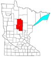
Crow Wing County Minnesota Incorporated and Unincorporated areas Ironton Highlighted.svg
Location of Ironton
within Crow Wing County, Minnesota
Coordinates: 46°28′54″N94°00′00″W / 46.48167°N 94.00000°W / 46.48167; -94.00000
Country United States
State Minnesota
County Crow Wing
Area
[1]
  Total2.14 sq mi (5.53 km2)
  Land1.45 sq mi (3.75 km2)
  Water0.69 sq mi (1.78 km2)
Elevation
[2]
1,181 ft (360 m)
Population
 (2020)
  Total576
  Density397.79/sq mi (153.61/km2)
Time zone UTC-6 (Central (CST))
  Summer (DST) UTC-5 (CDT)
ZIP code
56455
Area code 218
FIPS code 27-31274 [3]
GNIS feature ID2395439 [2]

Ironton is a city in Crow Wing County, Minnesota, United States. The population was 572 at the 2010 census. [4] It is part of the Brainerd Micropolitan Statistical Area.

Contents

Ironton is on the Cuyuna iron range, from which its name is derived. [5] It is immediately adjacent to its twin city of Crosby.

History

Ironton was platted in September 1910. Ironton was incorporated in June 1911. The post office at Ironton was established in 1910. [6]

Geography

According to the United States Census Bureau, the city has a total area of 2.00 square miles (5.18 km2), of which 1.48 square miles (3.83 km2) is land and 0.52 square miles (1.35 km2) is water. [7] Minnesota State Highway 210 and County Road 30 are the main routes in the community.

Demographics

Historical population
CensusPop.Note
1920 1,165
1930 1,033−11.3%
1940 827−19.9%
1950 8280.1%
1960 724−12.6%
1970 562−22.4%
1980 537−4.4%
1990 5533.0%
2000 498−9.9%
2010 57214.9%
2020 5760.7%
U.S. Decennial Census

2010 census

As of the census [8] of 2010, there were 572 people, 261 households, and 135 families living in the city. The population density was 386.5 inhabitants per square mile (149.2/km2). There were 299 housing units at an average density of 202.0 per square mile (78.0/km2). The racial makeup of the city was 95.8% White, 1.0% Native American, 0.3% Asian, 0.2% Pacific Islander, 0.3% from other races, and 2.3% from two or more races. Hispanic or Latino of any race were 1.2% of the population.

There were 261 households, of which 28.4% had children under the age of 18 living with them, 32.6% were married couples living together, 11.9% had a female householder with no husband present, 7.3% had a male householder with no wife present, and 48.3% were non-families. 41.0% of all households were made up of individuals, and 19.2% had someone living alone who was 65 years of age or older. The average household size was 2.19 and the average family size was 3.00.

The median age in the city was 36.7 years. 27.8% of residents were under the age of 18; 6.8% were between the ages of 18 and 24; 22.7% were from 25 to 44; 25.3% were from 45 to 64; and 17.3% were 65 years of age or older. The gender makeup of the city was 47.7% male and 52.3% female.

2000 census

As of the census [3] of 2000, there were 498 people, 231 households, and 130 families living in the city. The population density was 333.2 inhabitants per square mile (128.6/km2). There were 263 housing units at an average density of 176.0 per square mile (68.0/km2). The racial makeup of the city was 99.40% White, 0.40% Native American, and 0.20% from two or more races. 46.8% were of American, 9.5% German, 9.5% Swedish, 8.6% Norwegian and 5.9% Irish ancestry according to Census 2000.

There were 231 households, out of which 26.4% had children under the age of 18 living with them, 42.4% were married couples living together, 9.1% had a female householder with no husband present, and 43.7% were non-families. 39.8% of all households were made up of individuals, and 26.4% had someone living alone who was 65 years of age or older. The average household size was 2.16 and the average family size was 2.88.

In the city, the population was spread out, with 27.1% under the age of 18, 6.8% from 18 to 24, 22.9% from 25 to 44, 17.7% from 45 to 64, and 25.5% who were 65 years of age or older. The median age was 40 years. For every 100 females, there were 81.1 males. For every 100 females age 18 and over, there were 75.4 males.

The median income for a household in the city was $22,813, and the median income for a family was $30,729. Males had a median income of $27,222 versus $17,143 for females. The per capita income for the city was $12,949. About 13.7% of families and 17.5% of the population were below the poverty line, including 16.5% of those under age 18 and 23.5% of those age 65 or over.

Related Research Articles

<span class="mw-page-title-main">Ramsey, Minnesota</span> City in Minnesota, United States

Ramsey is a suburban city 22 miles (35 km) north-northwest of downtown Minneapolis in Anoka County, Minnesota, United States. The population was 27,646 at the 2020 census. It is a northwest suburb of the Twin Cities.

<span class="mw-page-title-main">Backus, Minnesota</span> City in Minnesota, United States

Backus is a city in Cass County, Minnesota, United States. The population was 250 at the 2010 census. It is part of the Brainerd Micropolitan Statistical Area.

<span class="mw-page-title-main">Lake Shore, Minnesota</span> City in Minnesota, United States

Lake Shore is a city in Cass County, Minnesota, United States. The population was 1,056 at the 2020 census. It is part of the Brainerd Micropolitan Statistical Area.

<span class="mw-page-title-main">Pillager, Minnesota</span> City in Minnesota, United States

Pillager is a city in Cass County, Minnesota, United States. It's population was 469 at the 2010 census. It is part of the Brainerd Micropolitan Statistical Area.

<span class="mw-page-title-main">Crosby, Minnesota</span> City in Minnesota, United States

Crosby is a city in Crow Wing County, Minnesota, United States. The population was 2,386 at the 2010 census. It is part of the Brainerd Micropolitan Statistical Area. Crosby is adjacent to its twin city of Ironton, in the Cuyuna iron range.

<span class="mw-page-title-main">Crosslake, Minnesota</span> City in Minnesota, United States

Crosslake is a city in Crow Wing County, Minnesota, United States. The population was 2,141 at the 2010 census. It is part of the Brainerd Micropolitan Statistical Area.

<span class="mw-page-title-main">Cuyuna, Minnesota</span> City in Minnesota, United States

Cuyuna is a city in Crow Wing County, Minnesota, United States. The population was 332 at the 2010 census. It is part of the Brainerd Micropolitan Statistical Area.

<span class="mw-page-title-main">Deerwood, Minnesota</span> City in Minnesota, United States

Deerwood is a city in Crow Wing County, Minnesota, United States. The population was 526 at the 2020 census. It is part of the Brainerd Micropolitan Statistical Area.

<span class="mw-page-title-main">Riverton, Minnesota</span> City in Minnesota, United States

Riverton is a city in Crow Wing County, Minnesota, United States. The population was 117 at the 2010 census. It is part of the Brainerd Micropolitan Statistical Area.

<span class="mw-page-title-main">Trommald, Minnesota</span> City in Minnesota, United States

Trommald is a city in Crow Wing County, Minnesota, United States. The population was 98 at the 2010 census. It is part of the Brainerd Micropolitan Statistical Area.

<span class="mw-page-title-main">Deer Creek, Minnesota</span> City in Minnesota, United States

Deer Creek is a city in Otter Tail County, Minnesota, United States. The population was 330 at the 2020 census.

<span class="mw-page-title-main">Erhard, Minnesota</span> City in Minnesota, United States

Erhard is a city in Otter Tail County, Minnesota, United States. The population was 132 at the 2020 census.

<span class="mw-page-title-main">Henning, Minnesota</span> City in Minnesota, United States

Henning is a city in Otter Tail County, Minnesota, United States. The population was 854 at the 2020 census.

<span class="mw-page-title-main">Urbank, Minnesota</span> City in Minnesota, United States

Urbank is a city in Otter Tail County, Minnesota, United States. The population was 52 at the 2020 census.

<span class="mw-page-title-main">Maplewood, Minnesota</span> City in Minnesota, United States

Maplewood is a city in Ramsey County, Minnesota, United States. The population was 42,088 at the 2020 census. Maplewood is ten minutes' drive from downtown Saint Paul. It stretches along the northern and eastern borders of Saint Paul.

<span class="mw-page-title-main">Ironton, Missouri</span> City in Missouri, United States

Ironton is a city in Iron County, Missouri, United States. The population was 1,475 at the 2020 census. It is the county seat of Iron County, and is located 12 miles south of Belgrade.

<span class="mw-page-title-main">Federal Dam, Minnesota</span> City in Minnesota, United States

Federal Dam is a city in Cass County, Minnesota, United States, near Leech Lake. The population was 110 at the 2010 census. It is part of the Brainerd Micropolitan Statistical Area.

<span class="mw-page-title-main">Minnesota Lake, Minnesota</span> City in Minnesota, United States

Minnesota Lake is a city in Blue Earth and Faribault counties in the State of Minnesota. The population was 661 at the 2020 census. The bulk of the city is in Faribault County; a small part extends into Blue Earth County.

<span class="mw-page-title-main">Ironton, Wisconsin</span> Village in Wisconsin, United States

Ironton is a village in Sauk County, Wisconsin, United States, along the Little Baraboo River. The population was 253 at the 2010 census. The village is located within the Town of Ironton.

Ironton is a town in Sauk County, Wisconsin, United States. The population was 650 at the 2000 census. The town was named from deposits of iron ore in the area. The Village of Ironton is located within the town.

References

  1. "2020 U.S. Gazetteer Files". United States Census Bureau. Retrieved July 24, 2022.
  2. 1 2 U.S. Geological Survey Geographic Names Information System: Ironton, Minnesota
  3. 1 2 "U.S. Census website". United States Census Bureau . Retrieved January 31, 2008.
  4. "2010 Census Redistricting Data (Public Law 94-171) Summary File". American FactFinder. U.S. Census Bureau, 2010 Census. Retrieved April 23, 2011.[ dead link ]
  5. Warren Upham (1920). Minnesota Geographic Names: Their Origin and Historic Significance. Minnesota Historical Society. p.  158.
  6. Upham, Warren (2001). Minnesota Place Names: A Geographical Encyclopedia. Minnesota Historical Society Press. p. 159. ISBN   978-0-87351-396-8.
  7. "US Gazetteer files 2010". United States Census Bureau. Archived from the original on July 2, 2012. Retrieved November 13, 2012.
  8. "U.S. Census website". United States Census Bureau . Retrieved November 13, 2012.