Related Research Articles

Route 35 is a state highway in the U.S. state of New Jersey, primarily traveling through the easternmost parts of Middlesex, Monmouth, and Ocean counties. It runs 58.11 mi (93.52 km) from the entrance to Island Beach State Park in Berkeley Township, Ocean County to an intersection with Route 27 in Rahway, Union County. Between Seaside Park and Mantoloking, Route 35 follows the right-of-way of the former Pennsylvania Railroad along the Jersey Shore. The route heads through Point Pleasant Beach and crosses the Manasquan River on the Brielle Bridge, meeting Route 34 and Route 70 at the former Brielle Circle in Wall Township. From there, Route 35 heads north and intersects Route 138, an extension of Interstate 195, continuing north through Monmouth County before crossing the Victory Bridge over the Raritan River into Perth Amboy, where the route continues north to Rahway.

Kennedy Township is a township in Allegheny County, Pennsylvania, United States, located 10 miles west of Pittsburgh and 12 miles east of Pittsburgh International Airport. The population was 8,701 at the 2020 United States Census.

Stowe Township is a township in Allegheny County, Pennsylvania, United States. The population was 6,362 at the 2010 census.
The Millionaires' Mile, Millionaires' Row, Billionaires Row, Golden Mile or Alpha Street are the exclusive residential neighborhoods of various cities, often along one scenic strip such as a riverside or hilltop drive, or a wide city boulevard.

The Allegheny County Belt System color codes various county roads to form a unique system of routes in Allegheny County, Pennsylvania, and around the city of Pittsburgh.

Marshall-Shadeland is a neighborhood on Pittsburgh, Pennsylvania's North Side. It has a zip codes of both 15212 and 15214, and has representation on Pittsburgh City Council by the council member for District 1.
The 49-Mile Scenic Drive is a designated scenic road tour highlighting much of San Francisco, California. It was created in 1938 by the San Francisco Down Town Association to showcase the city's major attractions and natural beauty during the 1939 Golden Gate International Exposition.
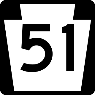
Pennsylvania Route 51 is a major state highway that is located in Western Pennsylvania in the United States. It runs for 89 miles (143 km) from Uniontown to the Ohio state line near Darlington, where it connects with Ohio State Route 14.

Pennsylvania Route 232 (PA 232) is a 25.2-mile-long (40.6 km) state highway located in southeastern Pennsylvania. The southern terminus of the route is at U.S. Route 1 (US 1)/US 13 at the Oxford Circle in Philadelphia. The northern terminus is at PA 32 in the borough of New Hope, Bucks County, on the banks of the Delaware River. The route passes through the urban areas of Northeast Philadelphia as Oxford Avenue, serving the Lawncrest, Burholme, and Fox Chase neighborhoods. Upon entering Montgomery County, PA 232 becomes Huntingdon Pike and through suburban areas, serving the communities of Rockledge, Huntingdon Valley, and Bryn Athyn. The route passes through more suburban development in Bucks County as Second Street Pike, running through Southampton and Richboro. In Wrightstown Township, PA 232 enters rural areas and becomes Windy Bush Road as it heads north to New Hope.

Pennsylvania Route 73 (PA 73) is a 62.32-mile (100.29 km) long east–west state highway in southeastern Pennsylvania. It runs from PA 61 near Leesport southeast to the New Jersey state line on the Tacony–Palmyra Bridge over the Delaware River in Philadelphia, where the road continues south as New Jersey Route 73. The route passes through rural areas of Berks County, crossing U.S. Route 222 (US 222) in Maiden Creek before heading southeast through Oley and Boyertown. PA 73 continues into Montgomery County and intersects PA 100 in Gilbertsville and PA 29 in Schwenksville before it heads into the northwest suburbs of Philadelphia. The route passes through Skippack and intersects US 202 in Center Square, PA 309 in Springfield Township, and PA 611 near Jenkintown. PA 73 continues through Northeast Philadelphia on Cottman Avenue, crossing US 1 and US 13 before coming to an interchange with Interstate 95 (I-95) near the Tacony–Palmyra Bridge.
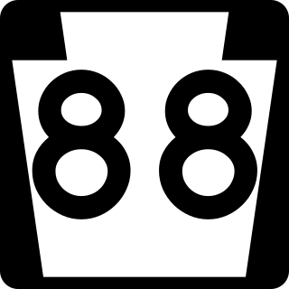
Pennsylvania Route 88 is a 68-mile-long (109 km) north–south state highway located in southwestern Pennsylvania. The southern terminus of the route is at U.S. Route 119 (US 119) in Point Marion less than 2 miles (3 km) from the Pennsylvania-West Virginia border. The northern terminus is at PA 51 in Pittsburgh. PA 88 runs parallel to the Monongahela River for almost its entire length.

Pennsylvania Route 380, also known as J.F. Bonetto Memorial Highway and within the city of Pittsburgh Bigelow Boulevard, Baum Boulevard and Frankstown Road, is a 32.80-mile-long (52.8 km) state highway in western portions of the U.S. state of Pennsylvania. The western terminus of the route is at Interstate 579 in downtown Pittsburgh near PPG Paints Arena. The eastern terminus is at Pennsylvania Route 286 in Bell Township, near the hamlet of Wakena.

U.S. Route 1 (US 1) is a major north–south U.S. Route, extending from Key West, Florida, in the south to Fort Kent, Maine, at the Canada–United States border in the north. In the U.S. state of Pennsylvania, US 1 runs for 81 miles (130 km) from the Maryland state line near Nottingham northeast to the New Jersey state line at the Delaware River in Morrisville, through the southeastern portion of the state. The route runs southwest to northeast and serves as a major arterial road through the city of Philadelphia and for many of the suburbs in the Delaware Valley metropolitan area. South of Philadelphia, the road mostly follows the alignment of the Baltimore Pike. Within Philadelphia, it mostly follows Roosevelt Boulevard. North of Philadelphia, US 1 parallels the route of the Lincoln Highway. Several portions of US 1 in Pennsylvania are freeways, including from near the Maryland state line to Kennett Square, the bypass of Media, the concurrency with Interstate 76 and the Roosevelt Expressway in Philadelphia, and between Bensalem Township and the New Jersey state line.
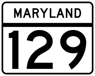
Maryland Route 129 is a state highway in the U.S. state of Maryland, running north-northwesterly from U.S. Route 40 and MD 295 in the city of Baltimore into Baltimore County, ending at Garrison Forest Road east of Reisterstown. The route leaves downtown on the one-way pair of McCulloh Street and Druid Hill Avenue, and then uses the entire length of Park Heights Avenue to the end. MD 129 connects Downtown Baltimore with Druid Hill Park using McCulloh Street and Druid Hill Avenue. As Park Heights Avenue, the state highway is one of two primary radial routes in the northwestern part of the city, providing access to The Maryland Zoo and Pimlico Race Course. In Baltimore County, MD 129 passes through Pikesville, where it has a junction with Interstate 695 (I-695) and serves an affluent rural area north of Pikesville and east of Reisterstown.
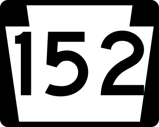
Pennsylvania Route 152 (PA 152) is a 25.3-mile-long (40.7 km) state highway located in the U.S. state of Pennsylvania. The route travels north–south from an interchange with PA 309 located in the Cedarbrook neighborhood of Cheltenham Township in Montgomery County north to another interchange with PA 309 located northeast of Telford in Bucks County. PA 152 is known as Limekiln Pike for most of its length. From the southern terminus, the route passes through suburban areas to the north of Philadelphia, serving Dresher, Maple Glen, and Chalfont. North of Chalfont, PA 152 runs through rural suburbs of Philadelphia before reaching Silverdale. Past here, the road continues northwest through Perkasie, where it turns southwest and passes through Sellersville before reaching its northern terminus.

Pennsylvania Route 487 is a 64.2-mile-long (103.3 km), north–south state highway running from PA 61 in Shamokin Township, Northumberland County, to PA 87 in Dushore, Sullivan County. In Bloomsburg, PA 487 and US 11 share a brief wrong-way concurrency. After its brief concurrency with PA 118, PA 487 goes up a steep grade through Ricketts Glen State Park. PA 487 is used to carry traffic up the Fishing Creek valley.

U.S. Route 13 (US 13) is a United States Numbered Highway running from Fayetteville, North Carolina, north to Morrisville, Pennsylvania. The route runs for 49.359 miles (79.436 km) through the Delaware Valley in the U.S. state of Pennsylvania. The route enters the state from Delaware in Marcus Hook, Delaware County. It continues northeast through Delaware County, passing through the city of Chester before heading through suburban areas along Chester Pike to Darby. US 13 enters the city of Philadelphia on Baltimore Avenue and runs through West Philadelphia to University City, where it turns north along several city streets before heading east across the Schuylkill River along Girard Avenue. The route turns north and heads to North Philadelphia, where it runs northeast along Hunting Park Avenue. US 13 becomes concurrent with US 1 on Roosevelt Boulevard, continuing into Northeast Philadelphia. US 13 splits southeast on a one-way pair of streets before heading northeast out of the city on Frankford Avenue. The route continues into Bucks County as Bristol Pike, heading northeast to Bristol, where it turns into a divided highway. US 13 becomes a freeway in Tullytown and continues north to its terminus at US 1 in Falls Township, near Morrisville. US 13 roughly parallels Interstate 95 (I-95) through its course in Pennsylvania.

Pennsylvania Route 247 is a 50.5-mile-long (81.3 km) state highway located in Lackawanna, Susquehanna, and Wayne counties in Pennsylvania. The southern terminus is at Interstate 84 (I-84) in Mount Cobb. The northern terminus is at PA 370 in Preston Park. The route heads north from I-84 in Lackawanna County and crosses the Moosic Mountains before it heads into suburban areas northeast of Scranton, serving Jessup, Blakely, and Archbald. In this area, PA 247 has an interchange with the U.S. Route 6 freeway in Jessup and intersects US 6 Business in Archbald. Past here, the route continues north into rural areas in northern Lackawanna County. PA 247 heads into the southeastern part of Susquehanna County and passes through Forest City, where it forms a short concurrency with PA 171. The route continues into Wayne County and heads east before curving to the north and continuing to its terminus at PA 370.
The streets of St. Louis, Missouri, United States, and the surrounding area of Greater St. Louis are under the jurisdiction of the City of St. Louis Street Department. According to the department's Streets Division, there are 1,000 miles (1,600 km) of streets and 600 miles (970 km) of alleys within the city.
References
- ↑ "STOWE TOWNSHIP". stowetwp.com. Retrieved December 4, 2013.