
Linda Vista is a community in San Diego, California, United States. Located east of Mission Bay, north of Mission Valley, and south-east of Tecolote Canyon, it lies on a mesa overlooking Mission Valley to the south and Mission Bay and the Pacific Ocean to the west. It is also home to the University of San Diego.

Mount Hope is an ethnically diverse, hilly urban neighborhood of the City of San Diego, California. Located in the southeastern portion of the city, Mount Hope is named for the large municipal Mount Hope Cemetery, which encompasses approximately 115 acres (0.47 km2) of the community. The neighborhood contains a mixture of residential, industrial, commercial, and cemetery uses.

Bankers Hill, also known as Park West and formerly known as Florence Heights, is a long-established uptown San Diego neighborhood near Balboa Park. It is bordered to the north by Hillcrest at Upas Street, to the south by Downtown, to the east by Balboa Park, and to the west by Interstate 5, Little Italy and the neighborhood known as Midtown. A more constricted definition of the neighborhood sets its eastern boundary as Fourth Avenue and its western boundary as First Avenue.
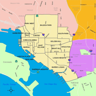
South Park is a neighborhood in San Diego, California adjacent to the southeast corner of Balboa Park. It stands out in San Diego for its tree-lined streets and walkable business district.
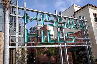
Mission Hills is an upscale affluent neighborhood of San Diego, California, United States. It is located on hills just south of the San Diego River valley and north of downtown San Diego, overlooking Old Town, Downtown San Diego, and San Diego Bay.
Allied Gardens is a residential neighborhood in the eastern Navajo community of San Diego, California. It neighbors San Carlos to the east, Del Cerro to the south, the College Area to the southeast and Grantville to the southwest.
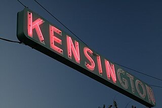
Kensington is a neighborhood of San Diego, California. Its borders are defined by Interstate 15 to the west, Interstate 8 to the north, Fairmount Avenue to the east, and El Cajon Boulevard to the south. Its neighboring communities are Normal Heights to the west, and City Heights to the south. Kensington is part of San Diego City Council District 9. In the United States House of Representatives, Kensington is in California's 53rd congressional district, represented by Democrat Sara Jacobs,

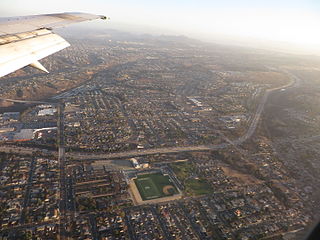
Grantville is a middle-class neighborhood in the city of San Diego, in California. It borders the communities of Allied Gardens, San Carlos, Tierrasanta and Mission Valley East.

The Marina district is a neighborhood in the southwest section of Downtown San Diego, California along the San Diego Bay.
El Cerrito is a neighborhood of the Mid-City region of San Diego, California. El Cerrito is a residential neighborhood, consisting mostly of suburban homes, with some commercial activity along the streets that define its borders.
Cortez Hill is a neighborhood located in the northeast part of Downtown San Diego, California.

Birdland is a neighborhood in San Diego, California. It is located between California State Route 163, Interstate 805 and Mission Valley. Most of the streets in the area are named after different bird species, hence the name of the community.
La Playa is a bayfront neighborhood in the Point Loma community of San Diego, California. It is bordered by the San Diego Bay on the east, Naval Base Point Loma on the south, the Wooded Area neighborhood to the west and Point Loma Village/Roseville-Fleetridge to the north. It lies across a channel from Shelter Island.

Alta Vista is a small neighborhood in southeastern San Diego City, California, United States. It is bordered by National City to the west, Bay Terraces to the east, Encanto and Valencia Park to the north.

The Wooded Area is a neighborhood within the community of Point Loma, San Diego, California. It encompasses the hilltop area south of Talbot Street on both sides of Catalina Boulevard; the area west of Catalina is also referred to as the College Area. The Wooded Area borders Naval Base Point Loma to the south, La Playa to the east, Roseville-Fleetridge to the north, and Sunset Cliffs and Point Loma Nazarene University to the west. The boundaries of the neighborhood are not universally agreed upon, with different maps showing different borders.
Chollas View is an urban community in the southeastern section of the city of San Diego. It is bordered by Webster and California State Route 94 on the north, Mount Hope and Interstate 805 on the west, Emerald Hills and Euclid Avenue on the east, and Lincoln Park and the San Diego Trolley on the south. Major thoroughfares include Market Street and 47th Street.

Valencia Park is an urban community in the southeastern section of the city of San Diego. It is bordered by Emerald Hills and Market Street on the north, Lincoln Park and Euclid Avenue on the west, Encanto on the east, and Alta Vista and National City, California on the south. Major thoroughfares include Imperial Avenue, Churchward Street, and Valencia Parkway.
Shirley Ann Place is a one-block-long street in the University Heights neighborhood of San Diego, California. The block, between Madison Ave. and Monroe Ave. and west of Texas Street, was designated the Shirley Ann Place Historic District by the City of San Diego for its 1920s Spanish Colonial Revival bungalows.

The Asian Pacific Thematic Historic District (APTHD), San Diego's historic Chinatown, is an eight-block district adjacent to and in part overlapping with the Gaslamp Quarter Historic District. The APTHD is bounded by Market Street on the north, 2nd Ave. on the west, 6th Ave. on the east and J St. on the south. 22 structures are considered historically contributing.
Fairmount Park is a neighborhood of San Diego, California. Its borders are defined by Interstate 15 to the west, Interstate 805 to the east and California Highway 94 to the south. Its neighboring communities are South Park and Golden Hill to the west, Azalea Park and City Heights to the east, and Webster to the south. It is primarily residential, mostly single-family homes, with a small commercial area along Home Avenue including several restaurants and convenience stores. Bayridge is a small neighborhood within Fairmount Park on its westernmost knoll, identifiable by its outstanding views and well-maintained townhouse development. Fairmount Park is 3 miles from Downtown San Diego. Chollas Creek runs through it.
