Ismay, Montana

Last updated

Ismay, Montana
Custer County Montana Incorporated and Unincorporated areas Ismay Highlighted.svg
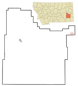
Location of Ismay, Montana
Usa edcp location map.svg
Red pog.svg
Ismay, Montana
Location in the United States
Coordinates: 46°29′58″N104°47′37″W / 46.49944°N 104.79361°W / 46.49944; -104.79361
Country United States
State Montana
County Custer
Area
[1]
  Total0.42 sq mi (1.09 km2)
  Land0.42 sq mi (1.09 km2)
  Water0.00 sq mi (0.00 km2)
Elevation
[2]
2,526 ft (770 m)
Population
 (2020)
  Total17
  Density40.48/sq mi (15.64/km2)
Time zone UTC-7 (Mountain (MST))
  Summer (DST) UTC-6 (MDT)
ZIP code
59336
Area code 406
FIPS code 30-38950
GNIS feature ID0794947 [2]

Ismay is a town in Custer County, Montana, United States. There is a post office at Ismay, and a church, and no other businesses or services. The population was 17 at the 2020 census. The town is the least-populous incorporated municipality in the state of Montana. [3]

Contents

The town's name is an amalgamation of Isabella and May, the names of the daughters of Albert J Earling, division superintendent (later president) of the Chicago, Milwaukee and St. Paul Railway. [4] [5] Other communities with related names include Earling, Iowa; Marmarth, North Dakota; and Alberton, Montana. As a publicity stunt coordinated by Kansas City radio station KYYS in 1993, the town unofficially took the name of Joe, Montana, after the NFL quarterback Joe Montana. [6] [7]

The town's history and contemporary state (circa 1995) is discussed at length in travel writer Jonathan Raban's book, Bad Land: An American Romance . According to Raban, Ismay's story is emblematic of the settlement and depopulation of the northern Great Plains.

Geography

Ismay is located at 46°29′58″N104°47′37″W / 46.49944°N 104.79361°W / 46.49944; -104.79361 (46.499497, -104.793590). [8]

According to the United States Census Bureau, the town has a total area of 0.42 square miles (1.09 km2), all land. [9]

Ismay lies between Baker, Montana and Terry on the BNSF Railway's Hettinger Subdivision. [10] The route was once a mainline segment of the Milwaukee Road. [11]

Demographics

Historical population
CensusPop.Note
1920 344
1930 277−19.5%
1940 176−36.5%
1950 1823.4%
1960 59−67.6%
1970 40−32.2%
1980 31−22.5%
1990 19−38.7%
2000 2636.8%
2010 19−26.9%
2020 17−10.5%
U.S. Decennial Census [12] [3]

2020 census

As of the 2020 census, [13] there were 17 people living in 12 households. The median household income was $56,539.[ citation needed ]

2010 census

As of the 2010 census, [14] there were 19 people, 9 households, and 5 families living in the town. The population density was 45.2 inhabitants per square mile (17.5/km2). There were 13 housing units at an average density of 31.0 per square mile (12.0/km2). The racial makeup of the town was 100.0% White.

There were 9 households, of which 33.3% had children under the age of 18 living with them, 55.6% were married couples living together, and 44.4% were non-families. 44.4% of all households were made up of individuals, and 22.2% had someone living alone who was 65 years of age or older. The average household size was 2.11 and the average family size was 3.00.

The median age in the town was 46.5 years. 26.3% of residents were under the age of 18; 0% were between the ages of 18 and 24; 21.1% were from 25 to 44; 42.1% were from 45 to 64; and 10.5% were 65 years of age or older. The gender makeup of the town was 57.9% male and 42.1% female.

2000 census

At the 2000 census, there were 26 people, 7 households, and 7 families living in the town. The population density was 62.5 inhabitants per square mile (24.1/km2). There were 8 housing units at an average density of 19.2 per square mile (7.4/km2). The racial makeup of the town was 100.00% White. Hispanic or Latino of any race were 3.85% of the population.

There were 7 households, of which 71.4% had children under the age of 18 living with them, 100.0% were married couples living together, and 0.0% were non-families. No households were made up of individuals, and none had someone living alone who was 65 years of age or older. The average household size was 3.71 and the average family size was 3.71.

Age distribution was 42.3% under the age of 18, 34.6% from 25 to 44, 19.2% from 45 to 64, and 3.8% who were 65 years of age or older. The median age was 30 years. For every 100 females there were 100.0 males. For every 100 females age 18 and over, there were 114.3 males.

The median household income was $32,083, and the median family income was $32,083. The per capita income for the town was $9,852. None of the population and none of the families were below the poverty line.

See also

Related Research Articles

<span class="mw-page-title-main">Wibaux County, Montana</span> County in Montana, United States

Wibaux County is a county in the U.S. state of Montana. As of the 2020 census, the population was 937, making it the fourth-least populous county in Montana. Its county seat is Wibaux.

<span class="mw-page-title-main">Masardis, Maine</span> Town in Maine, United States

Masardis is a town in Aroostook County, Maine, United States. The population was 204 at the 2020 census.

Great Pond is a town in Hancock County, Maine, United States. The population was 61 at the 2020 census.

Caratunk is a town in Somerset County, Maine, United States. The population was 81 at the 2020 census.

Danforth is a town in Washington County, Maine, United States. The town was named for proprietor Thomas Danforth. The population was 587 at the 2020 census. The town contains the villages of Danforth and Eaton. East Grand High School is located in Danforth.

Carlston Township is a township in Freeborn County, Minnesota, United States. The population was 332 at the 2000 census.

<span class="mw-page-title-main">Conception Junction, Missouri</span> City in Missouri, United States

Conception Junction is a city in Nodaway County, Missouri, United States, near the Platte River. The population was 177 at the 2020 census.

<span class="mw-page-title-main">Jordan, Montana</span> Town in Montana, United States

Jordan is a town in and the county seat of Garfield County, Montana, United States. The population was 356 at the 2020 census. It is Garfield County's only incorporated community.

<span class="mw-page-title-main">Dodson, Montana</span> Town in Montana, United States

Dodson is a town in Phillips County, Montana, United States. The population was 125 at the 2020 census.

<span class="mw-page-title-main">Froid, Montana</span> Town in Montana, United States

Froid is a town in Roosevelt County, Montana, United States. The population was 195 at the 2020 census. Froid was named for the French word for "cold".

<span class="mw-page-title-main">Outlook, Montana</span> Town in Montana, United States

Outlook is a small rural village in Sheridan County, Montana, United States. The population was 84 at the 2020 census. The village includes a post office which services Outlook and the hamlet of Raymond, as well as the surrounding countryside.

<span class="mw-page-title-main">Kevin, Montana</span> Town in Montana, United States

Kevin is a town in Toole County, Montana, United States. The population was 154 at the 2020 census, equal to the 2010 Census population. The town was named after Thomas Kevin, superintendent of the Alberta Railway & Irrigation Company. Locals pronounce Kevin with a long E, like Keevin.

<span class="mw-page-title-main">Broadview, Montana</span> Town in Montana, United States

Broadview is a town in Yellowstone County, Montana, United States. The population was 139 at the 2020 census.

<span class="mw-page-title-main">Ragan, Nebraska</span> Village in Nebraska, United States

Ragan is a village in Harlan County, Nebraska, United States. The population was 38 at the 2010 census.

Lorraine is a town in Jefferson County, New York, United States. The population was 1,037 at the 2010 census, up from 930 in 2000. The town is named after Lorraine, a region in France.

<span class="mw-page-title-main">Fultonham, Ohio</span> Village in Ohio, United States

Fultonham is a village in Muskingum County, Ohio, United States. The population was 115 at the 2020 census. It is part of the Zanesville micropolitan area. Fultonham was named for postmaster Robert Fulton.

<span class="mw-page-title-main">Westport, Oklahoma</span> Town in Oklahoma, United States

Westport is a town in Pawnee County, Oklahoma, United States. The population was 298 at the 2010 census, a gain of 12.9 percent over the figure of 264 in 2000.

<span class="mw-page-title-main">East Hopewell Township, Pennsylvania</span> Township in Pennsylvania, United States

East Hopewell Township is a township in York County, Pennsylvania, United States. The population was 2,416 at the 2020 census. It is served by the South Eastern School District which provides a public education.

<span class="mw-page-title-main">Summit, South Carolina</span> Town in South Carolina, United States

Summit is a town in Lexington County, South Carolina, United States. The population was 402 at the 2010 census. It is part of the Columbia, South Carolina Metropolitan Statistical Area.

<span class="mw-page-title-main">Poplar, Wisconsin</span> Village in Wisconsin, United States

Poplar is a village in Douglas County, Wisconsin, United States. The population was 603 at the 2010 census.

References

  1. "ArcGIS REST Services Directory". United States Census Bureau. Retrieved September 5, 2022.
  2. 1 2 U.S. Geological Survey Geographic Names Information System: Ismay, Montana
  3. 1 2 "U.S. Census website". United States Census Bureau . Retrieved November 2, 2021.
  4. "Origins of Names on Milwaukee". Roundup Record-Tribune & Winnett Times. August 22, 1940. p. 6. Retrieved April 27, 2015.
  5. Raban, J., Bad Land: An American Romance, Picador 1996, ISBN   0-330-34621-0
  6. "Ismay". Montana Place Names Companion. Montana Historical Society. Retrieved April 4, 2021.
  7. Hanson, Amy Beth (July 2, 1993). "No ordinary Ismay". The Missoulian . Associated Press. p. D1. Retrieved February 20, 2023 via Newspapers.com.
  8. "US Gazetteer files: 2010, 2000, and 1990". United States Census Bureau. February 12, 2011. Retrieved April 23, 2011.
  9. "US Gazetteer files 2010". United States Census Bureau. Archived from the original on July 2, 2012. Retrieved December 18, 2012.
  10. "Montana Division Timetable No. 4" (PDF). BNSF Railway. 2002.
  11. "South Dakota State Rail Plan" (PDF). South Dakota Department of Transportation. June 2022.
  12. United States Census Bureau. "Census of Population and Housing" . Retrieved August 14, 2013.
  13. "U.S. Census website". United States Census Bureau. Retrieved August 31, 2022.
  14. "U.S. Census website". United States Census Bureau . Retrieved December 18, 2012.

Further reading