Itimbiri River

Last updated
Itimbiri River
Democratic Republic of the Congo relief location map.jpg
Red pog.svg
Location
CountryDemocratic Republic of the Congo
Physical characteristics
Source 
  coordinates 2°53′45″N24°02′53″E / 2.895840°N 24.047941°E / 2.895840; 24.047941
Mouth Congo River
  coordinates
2°03′57″N22°41′33″E / 2.065824°N 22.692626°E / 2.065824; 22.692626
Discharge 
  minimum125 cubic metres per second (4,400 cu ft/s)
  maximum1,300 cubic metres per second (46,000 cu ft/s)

The Itimbiri River (Swahili : Mto Itimbiri) is a right tributary of the Congo River, which it joins above Bumba. At one time it was important as a navigable waterway for transporting good from the northeast of the country down to the Congo.

Contents

Course

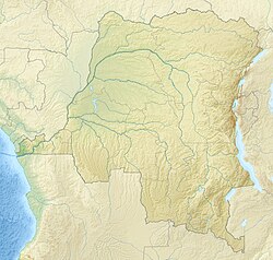
The Itimbiri River originates in Bas-Uélé, then flows through Mongala, and in its lower reaches defines the border between Mongala and Tshopo. [1] The Itimbiri is formed by the confluence of the Rubi River and the Likati River. [2] [lower-alpha 1] The Rubi River originates in the east of Bas-Uélé and flows west through Buta. The Likati River originates to the west, then flows through Likati and southeast to join the Rubi. Likati lies to the south of Bondo on the Uele River. [1]

The Itimbiri flows in a general southwest direction. Water volumes range from 125 to 1,300 cubic metres per second (4,400 to 45,900 cu ft/s), with the main flood in November and a secondary flood in August, and lowest water in February or early March. The river is very winding and generally has a sandy bottom, apart from the section upstream from Ibembo, where the bottom is very hard gravel. During low water the river widens and splits into several branches, making navigation by large vessels difficult. [2] The average elevation is 380.27 metres (1,247.6 ft). [3]

Biology

The Itimbiri, Aruwimi and Lindi/Tshopo rivers are the main right bank tributaries of the Congo River downstream from the Boyoma Falls in the Cuvette Centrale (Central Basin). This is a flat area of lowland rainforest. [4] As of 2015 about 231 fish species had been identified from the Itimbiri. [5] Mormyridae was the most dominant family in the Itimbiri basin as well as in the Aruwimi and Lindi/Tshopo basins. [6]

Human presence

In 1890 the Belgian officers Léon Roget and Jules Alexandre Milz travelled up the Itimbiri River from Bumba, then the Likati River, reached the Uele River in the region of Djabir (Bondo [lower-alpha 2] ) and descended it almost to its junction with the Mbomou River. [8]

A railway line (Vicicongo line) connected Bondo on the Uele with Aketi on the Itimbiri. The line was reopened in April 2005 after being closed for 14 years. [9] At one time the Itimbiri was the second most important tributary of the Congo in terms of tonnage transported after the Kasaï River. It was used for cargo from Aketi, at the head of the Chemins de fer vicinaux du Zaïre (CVZ) down to its mouth, a distance of 255 kilometres (158 mi). Cargo was transferred to the Congo River boats at Bumba, 28 kilometres (17 mi) downstream from its mouth. [2]

Notes

  1. As of August 2020 OpenStreetMap showed the section from the confluence of the Likati and the Rubi down to the confluence of the Tele River and Rubi as the Rubi River. [1] This disagrees with the 1973 description from the Académie royale des Sciences d'Outre-Mer, which seems more plausible. [2]
  2. At the time, towns and villages were given the names of their chiefs. Djabir, named after the Sultan Djabir, was later called Bakango and today is called Bondo. [7]

Citations

  1. 1 2 3 Relation: Itimbiri (9084).
  2. 1 2 3 4 Lederer 1973, p. 8.
  3. Itimbiri, River DGF.
  4. Decru et al. 2017, p. 226.
  5. Decru 2015.
  6. Decru et al. 2017, p. 225.
  7. Kjerland & Bertelsen 2014, p. 353.
  8. Ergo 2013, p. 2.
  9. Equateur : reprise du trafic ferroviaire Bumba-Aketi.

Sources

Related Research Articles

<span class="mw-page-title-main">Buta, Democratic Republic of the Congo</span> Provincial capital and city in Bas-Uele, DR Congo

Buta is a city in the northern Democratic Republic of the Congo, lying on the Rubi River, a tributary of the Itimbiri River. It is the capital of Bas-Uele province. As of 2012, it had an estimated population of 55,313.

<span class="mw-page-title-main">Aketi (town)</span> Place in Bas-Uele, Democratic Republic of the Congo

Aketi is a town in the Bas-Uele Province of the Democratic Republic of the Congo. It is the seat of Aketi Territory. As of 2009 it had an estimated population of 38,588.

<span class="mw-page-title-main">Aketi Territory</span> Territory in Bas-Uele, Democratic Republic of Congo

Aketi Territory is a territory in the Bas-Uele Province of the Democratic Republic of the Congo. The administrative capital is located at Aketi. The territory borders Bondo Territory to the north, Buta Territory to the east, Basoko Territory to the south, Bumba Territory to the west in Mongala Province and Yakoma Territory in Nord-Ubangi Province to the northwest. Rivers include the Likati River, Zoki River, Maze River, Tinda River, Tshimbi River, Elongo River, Aketi River, Yoko River and Lese River along the southern territorial border.

Likati River is a river of northern Democratic Republic of the Congo, a tributary of the Itimbiri River. It flows through Aketi Territory in Bas-Uele District.

<span class="mw-page-title-main">Vicicongo line</span> Railway in the Democratic Republic of Congo

Chemins de fer des Uele is a 600 mm narrow-gauge line in the north east of the Democratic Republic of the Congo. It was built between 1924 and 1937 as a portage railway bypassing Congo River rapids.

Likati is a town in the Aketi Territory of Bas-Uélé Province in the north of the Democratic Republic of the Congo (DRC).

<span class="mw-page-title-main">Districts of the Belgian Congo</span>

The Districts of the Belgian Congo were the primary administrative divisions when Belgium annexed the Congo Free State in 1908, each administered by a district commissioner. In 1914 they were distributed among four large provinces, with some boundary changes. In 1933 the provinces were restructured into six, again with boundary changes. The number of districts fluctuated between 12 and 26 through splits and consolidations, first rising, then falling, then rising again.

<span class="mw-page-title-main">Stanleyville District</span> District in Orientale, Democratic Republic of the Congo

Stanleyville District was a district of the Belgian Congo and Democratic Republic of the Congo. It went through various changes in extent. Between 1933 and 1963 it had roughly the same extent as the current Tshopo province.

Uele District was a district of the Congo Free State and the Belgian Congo. It roughly corresponded to the current provinces of Bas-Uélé and Haut-Uélé.

Bangala District was a district of the Congo Free State and the Belgian Congo. It went through various significant changes in extent. The eastern part very roughly corresponded to the present province of Mongala.

<span class="mw-page-title-main">Tshopo River</span> River in Democratic Republic of the Congo

The Tshopo River is a river in the Democratic Republic of the Congo. It flows through the north of the city of Kisangani and joins the Lindi River just before that river enters the Congo River. It gives its name to the province of Tshopo.

The Nzoro River is a river in the Democratic Republic of the Congo. It is a right tributary of the Kibali River. It is used to supply hydroelectric power to the Kibali Gold Mine.

Jules Alexandre Milz was a Belgian soldier who was active in exploring the northeast of the Congo Free State. He traveled extensively in Uele District, where he resolved the question of whether the Uele River was the upper portion of the Ubangi River. He was second in command of an expedition to the Nile in 1891–1892, and took over command after the leader died.

<span class="mw-page-title-main">Rubi River</span> River in Democratic Republic of the Congo

The Rubi River is a left tributary of the Itimbiri River, which forms where the Rubi joins the Likati River.

<span class="mw-page-title-main">Léon Roget</span>

Léon Roget was a Belgian soldier and colonial administrator who was active in the Congo Free State. He was the first commander of the Force Publique, the armed force used to police the colony.

<span class="mw-page-title-main">Willem Frans Van Kerckhoven</span> Belgian soldier, explorer and colonial administrator

Willem Frans Van Kerckhoven, or Guillaume François van Kerckhoven was a Belgian soldier, explorer, colonial administrator who was active in the service of the International Association of the Congo and the subsequent Congo Free State. He is known for his extended expedition through the Uele River basin and onward towards the Nile, which was responsible for the deaths of over 1,800 people and established a Belgian presence in the region. Van Kerckhoven died in an accident before reaching the Nile.

<span class="mw-page-title-main">Ernest Baert</span> Belgian soldier, explorer and colonial administrator

Ernest Baert was a Belgian soldier, explorer and colonial administrator who was active in the Congo Free State.

<span class="mw-page-title-main">Société des Chemins de Fer Vicinaux du Congo</span>

The Société des Chemins de Fer Vicinaux du Congo, known as CVC or Vicicongo, was a railway company that operated the narrow gauge Vicicongo line and provided trucking services in the northeast Belgian Congo, and then in the Democratic Republic of the Congo between 1924 and 1974. It provided transport for agricultural goods produced in the northeast that were shipped on the Congo River to Léopoldville (Kinshasa). After independence in 1960 there were civil disturbances and the railway was poorly maintained. The company was taken over by the state in 1974. Later there were further disturbances in which the stations were destroyed and the rolling stock used as a source of metal. The track is decrepit and no longer usable.

<span class="mw-page-title-main">Sultan Djabir</span>

Sultan Djabir was ruler of a region on the Uele River in what is now the Democratic Republic of the Congo. He engaged in the ivory and slave trade with Muslims from the north and with Belgians from the south. Eventually he was forced to flee to the Sudan when he refused to pay tribute to the Congo Free State.