| Jackson Bridge | |
|---|---|
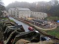
 Scholes Road Junction | |
 Jackson Bridge Location within West Yorkshire | |
| Population | 1,380 (for Hepworth & Jackson bridge) [1] |
| OS grid reference | SE164075 |
| Civil parish | |
| Metropolitan borough | |
| Metropolitan county | |
| Region | |
| Country | England |
| Sovereign state | United Kingdom |
| Post town | HOLMFIRTH |
| Postcode district | HD9 |
| Dialling code | 01484 |
| Police | West Yorkshire |
| Fire | West Yorkshire |
| Ambulance | Yorkshire |
| UK Parliament | |
Jackson Bridge is a small village in the civil parish of Holme Valley in the Metropolitan Borough of Kirklees in West Yorkshire, England and within the postal district of Holmfirth. It is situated next to the A616, Huddersfield to Penistone, road.