Jackson Hill (Georgia)

Last updated

Coordinates: 34°15′59″N85°09′48″W / 34.2664822°N 85.1632836°W / 34.2664822; -85.1632836

Geographic coordinate system Coordinate system

A geographic coordinate system is a coordinate system that enables every location on Earth to be specified by a set of numbers, letters or symbols. The coordinates are often chosen such that one of the numbers represents a vertical position and two or three of the numbers represent a horizontal position; alternatively, a geographic position may be expressed in a combined three-dimensional Cartesian vector. A common choice of coordinates is latitude, longitude and elevation. To specify a location on a plane requires a map projection.

Jackson Hill downtown Rome, Georgia Jackson Hill (Georgia) viewed from Chief John Ross Pedestrian Bridge, Mar 2018.jpg
Jackson Hill downtown Rome, Georgia

Jackson Hill is a summit in Rome, Georgia. [1] With an elevation of 751 feet (229 m), Jackson Hill is the 905th highest summit in the state of Georgia. [2] The hill considered to be one of the Seven Hills of Rome, Georgia. [3] [4]

Summit A point on a surface that is higher in elevation than all points immediately adjacent to it, in topography

A summit is a point on a surface that is higher in elevation than all points immediately adjacent to it. The topographic terms acme, apex, peak, and zenith are synonymous.

Rome, Georgia City in Georgia, United States

Rome is the largest city in the county seat of Floyd County, Georgia, United States. Located in the foothills of the Appalachian Mountains, it is the principal city of the Rome, Georgia, Metropolitan Statistical Area, which encompasses all of Floyd County. At the 2010 census, the city had a population of 36,303. It is the largest city in Northwest Georgia and the 19th largest city in the state.
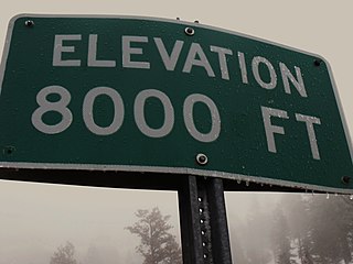
Elevation Height of a geographic location above a fixed reference point

The elevation of a geographic location is its height above or below a fixed reference point, most commonly a reference geoid, a mathematical model of the Earth's sea level as an equipotential gravitational surface . The term elevation is mainly used when referring to points on the Earth's surface, while altitude or geopotential height is used for points above the surface, such as an aircraft in flight or a spacecraft in orbit, and depth is used for points below the surface.

Jackson Hill was named for the local Jackson family, the original owners. [5]

Related Research Articles

Mount Berry is an unincorporated community contiguous with the main campus of Berry College in Floyd County, Georgia, United States, bordering the city of Rome. Mount Berry Mall, the shopping mall serving Rome, is in the Mount Berry area. It is part of the Rome, Georgia Metropolitan Statistical Area. The ZIP Code for Mount Berry is 30149.

Oostanaula River river in the United States of America

The Oostanaula River is a principal tributary of the Coosa River, about 49 miles (79 km) long, formed by the confluence of the Conasauga and Coosawattee in northwestern Georgia in the United States. Via the Coosa and Alabama rivers, it is part of the watershed of the Mobile River, which flows to the Gulf of Mexico.

Chetoogeta Mountain Tunnel

The Chetoogeta Mountain Tunnel refers to two different railroad tunnels passing through Chetoogeta Mountain in Tunnel Hill, Georgia, United States.

Georgia Northwestern Technical College (GNTC) is a technical college serving nine counties across northwestern Georgia. It is a member of Georgia’s system of technical colleges that operate under the Technical College System of Georgia (TCSG) and an institution of higher learning that provides occupational education, skills training, and workforce development to support the educational, economic, and community development at its five campuses in Walker County Campus, Floyd County Campus, Gordon County Campus, Polk County Campus, and Whitfield-Murray Campus.

The Pocket (Floyd County, Georgia) A valley/basin in the US State of Georgia

The Pocket is a basin in northern Floyd County, Georgia. The valley was named as such due to how Horn Mountain curved in a way that it formed a pocket.

Silver Hill is an unincorporated community in Chattooga County, in the U.S. state of Georgia.

Everett Springs, Georgia human settlement in United States of America

Everett Springs is an unincorporated community in Floyd County, in the U.S. state of Georgia.

Horseleg Mountain

Horseleg Mountain is a summit in Floyd County, Georgia, in the United States. With an elevation of 1,322 feet (403 m), Horseleg Mountain is the 735th highest summit in the state of Georgia.

Johns Mountain Mountain in the US State of Georgia

Johns Mountain is a summit in the U.S. state of Georgia. With an elevation of 1,683 feet (513 m), Johns Mountain is the 666th highest summit in the state of Georgia. The mountain is located inside the Chattahoochee-Oconee National Forest.

Lumpkin Hill mountain in Georgia, United States of America

Lumpkin Hill is a summit in Rome, Georgia. With an elevation of 640 feet (200 m), Lumpkin Hill is the 914th highest summit in the state of Georgia. The hill is considered to be one of the Seven Hills of Rome, Georgia.

Blossom Hill (Georgia) mountain in United States of America

Blossom Hill is a summit in Rome, Georgia. With an elevation of 784 feet (239 m), Blossom Hill is the 901st highest summit in the state of Georgia. It is considered to be one of the Seven Hills of Rome, Georgia. Jackson Hill is located about 0.3 miles (0.48 km) south of the summit.

Old Shorter Hill

Old Shorter Hill is a summit in Rome, Georgia. With an elevation of 676 feet (206 m), Old Shorter Hill is the 910th highest summit in the US state of Georgia. It is considered to be one of the Seven Hills of Rome, Georgia.

Six Mile is an unincorporated community in Floyd County, in the U.S. state of Georgia.

Turkey Mountain (Georgia) mountain in Georgia, United States of America

Turkey Mountain is a summit in Floyd County, Georgia. With an elevation of 1,122 feet (342 m), Turkey Mountain is the 808th highest summit in the state of Georgia.

Baugh Mountain mountain in United States of America

Baugh Mountain is a summit in Gordon County, Georgia. With an elevation of 1,138 feet (347 m), Baugh Mountain is the 802nd highest summit in the state of Georgia.

Oostanaula is an unincorporated community in Gordon County, in the U.S. state of Georgia.

Cassandra is an unincorporated community in Walker County, in the U.S. state of Georgia.

Cedar Grove is an unincorporated community in Walker County, in the U.S. state of Georgia. It is approximately seven miles (11 km) from LaFayette, the county seat.

Naomi, Georgia human settlement in United States of America

Naomi is an unincorporated community in Walker County, in the U.S. state of Georgia.

References

  1. U.S. Geological Survey Geographic Names Information System: Jackson Hill (Georgia)
  2. "Jackson Hill". Peakery.com. Retrieved 25 April 2015.
  3. Wilson, CC. The Seven Hills of Rome. RomeGeorgia.com. 23 February 2002. Retrieved 17 March 2018.
  4. Denmon, Shirley. The Enchanted Land Eighth Hill. (2012). pp. 5. ISBN   9781452089553
  5. "Floyd County". Calhoun Times. September 1, 2004. p. 76. Retrieved 24 April 2015.