
The Florida panhandle is the northwestern part of the U.S. state of Florida. It is a salient roughly 200 miles (320 km) long, bordered by Alabama on the north and the west, Georgia on the north, and the Gulf of Mexico to the south. Its eastern boundary is arbitrarily defined. It is defined by its southern culture and rural geography relative to the rest of Florida, as well as closer cultural links to French-influenced Louisiana, Mississippi, and Alabama. Its major communities include Pensacola, Navarre, Destin, Panama City Beach, and Tallahassee.
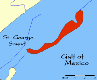
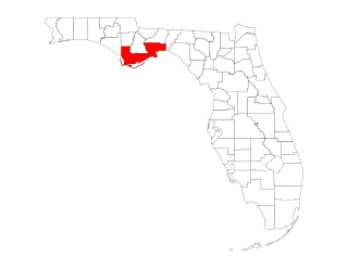
Dog Island is located in the northwestern Florida Gulf coast, just 3.5 mi (5.6 km) off-shore from Carrabelle, in Franklin County, Florida. There is, by reservation, ferry transportation to Dog Island on weekends.

Bald Point State Park is a Florida State Park located south of Ochlockonee Bay, approximately seven miles southeast of Panacea, on St. James Island in Alligator Point, Tallahassee's closest beach, off U.S. 98, in Franklin County northwestern Florida. The address is 146 Box Cut. Park was named after Bald Point cape on eastern tip of St. James Island in Ochlockonee Bay.

The Apalachee were an Indigenous people of the Southeastern Woodlands, specifically an Indigenous people of Florida, who lived in the Florida Panhandle until the early 18th century. They lived between the Aucilla River and Ochlockonee River, at the head of Apalachee Bay, an area known as the Apalachee Province. They spoke a Muskogean language called Apalachee, which is now extinct.
Tocobaga was the name of a chiefdom of Native Americans, its chief, and its principal town during the 16th century. The chiefdom was centered around the northern end of Old Tampa Bay, the arm of Tampa Bay that extends between the present-day city of Tampa and northern Pinellas County. The exact location of the principal town is believed to be the archeological Safety Harbor site. This is the namesake for the Safety Harbor culture, of which the Tocobaga are the most well-known group.

Spanish Florida was the first major European land-claim and attempted settlement-area in northern America during the European Age of Discovery. La Florida formed part of the Captaincy General of Cuba, the Viceroyalty of New Spain, and the Spanish Empire during Spanish colonization of the Americas. While its boundaries were never clearly or formally defined, the territory was initially much larger than the present-day state of Florida, extending over much of what is now the southeastern United States, including all of present-day Florida plus portions of Georgia, South Carolina, North Carolina, Alabama, Mississippi, and the Florida Parishes of Louisiana. Spain based its claim to this vast area on several wide-ranging expeditions mounted during the 16th century. A number of missions, settlements, and small forts existed in the 16th and to a lesser extent in the 17th century; they were eventually abandoned due to pressure from the expanding English and French colonial settlements, the collapse of the native populations, and the general difficulty in becoming agriculturally or economically self-sufficient. By the 18th century, Spain's control over La Florida did not extend much beyond a handful of forts near St. Augustine, St. Marks, and Pensacola, all within the boundaries of present-day Florida.

The maritime history of Florida describes significant past events relating to the U.S. state of Florida in areas concerning shipping, shipwrecks, and military installations and lighthouses constructed to protect or aid navigation and development of the Florida peninsula.

The St. Marks Light is the second-oldest light station in Florida, United States. It is located on the east side of the mouth of the St. Marks River, on Apalachee Bay.
Apalachee Bay is a bay in the northeastern Gulf of Mexico occupying an indentation of the Florida coast to the west of where the Florida peninsula joins the United States mainland. It is bordered by Taylor, Jefferson, Wakulla, and Franklin counties.
The Forgotten Coast refers to a largely undeveloped and sparsely populated coastline in the panhandle of the US state of Florida. The trademarked term was first used in 1992, but the Forgotten Coast's exact extent is not agreed upon.

Mission San Luis de Apalachee was a Spanish Franciscan mission built in 1656 in the Florida Panhandle, two miles west of the present-day Florida Capitol Building in Tallahassee, Florida. It was located in the descendent settlement of Anhaica capital of Apalachee Province. The mission was part of Spain's effort to colonize the Florida Peninsula and to convert the Timucuan and Apalachee Indians to Christianity. The mission lasted until 1704 when it was evacuated and destroyed to prevent its use by an approaching militia of Creek Indians and South Carolinians.
Guale was a historic Native American chiefdom of Mississippian culture peoples located along the coast of present-day Georgia and the Sea Islands. Spanish Florida established its Roman Catholic missionary system in the chiefdom in the late 16th century.

The Big Bend of Florida, United States, is an informally named geographic region of North Florida where the Florida Panhandle transitions to the Florida Peninsula south and east of Tallahassee. The region is known for its vast woodlands and marshlands and its low population density relative to much of the state. The area is home to the largest single spring in the United States, the Alapaha Rise, and the longest surveyed underwater cave in the United States, the 32-mile (51 km) Wakulla-Leon Sinks cave system.

Beginning in the second half of the 16th century, the Kingdom of Spain established a number of missions throughout La Florida in order to convert the Native Americans to Roman Catholicism, to facilitate control of the area, and to obstruct regional colonization by other Protestants, particularly, those from England and France. Spanish Florida originally included much of what is now the Southeastern United States, although Spain never exercised long-term effective control over more than the northern part of what is now the State of Florida from present-day St. Augustine to the area around Tallahassee, southeastern Georgia, and some coastal settlements, such as Pensacola, Florida. A few short-lived missions were established in other locations, including Mission Santa Elena in present-day South Carolina, around the Florida peninsula, and in the interior of Georgia and Alabama.

George Robert Fischer was an American underwater archaeologist, considered the founding father of the field in the National Park Service. A native Californian, he did undergraduate and graduate work at Stanford University, and began his career with the National Park Service in 1959, which included assignments in six parks, the Washington, D.C. Office, and the Southeast Archaeological Center from which he retired in 1988. He began teaching courses in underwater archaeology at Florida State University in 1974 and co-instructed inter-disciplinary courses in scientific diving techniques. After retirement from the NPS his FSU activities were expanded and his assistance helped shape the university's program in underwater archaeology.
Apalachicola Province was a group or association of towns located along the lower part of the Chattahoochee River in present-day Alabama and Georgia. The Spanish so called it because they perceived it as a political entity under the leadership of the town of Apalacicola. It is believed that before the 17th century, the residents of all the Apalachicola towns spoke the Hitchiti language, although other towns whose people spoke the Muscogee language relocated among the Apalachicolas along the Chattahoochee River in the middle- to later- 17th century. All of the Apalachicola towns moved to central Georgia at the end of the 17th century, where the English called them "Ochese Creek Indians". They moved back to the Chattahoochee River after 1715, with the English then calling them "Lower Creeks", while the Spanish called them "Ochese".
The Indigenous peoples of Florida lived in what is now known as Florida for more than 12,000 years before the time of first contact with Europeans. However, the indigenous Floridians living east of the Apalachicola River had largely died out by the early 18th century. Some Apalachees migrated to Louisiana, where their descendants now live; some were taken to Cuba and Mexico by the Spanish in the 18th century, and a few may have been absorbed into the Seminole and Miccosukee tribes.
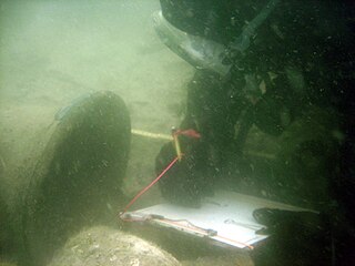
Charles T. Meide Jr., known as Chuck Meide, is an underwater and maritime archaeologist and currently the Director of LAMP, the research arm of the St. Augustine Lighthouse & Maritime Museum located in St. Augustine, Florida. Meide, of Syrian descent on his father's side, was born in Jacksonville, Florida, and raised in the adjacent coastal town of Atlantic Beach. He earned BA and MA degrees in Anthropology with a focus in underwater archaeology in 1993 and 2001 from Florida State University, where he studied under George R. Fischer, and undertook Ph.D. studies in Historical Archaeology at the College of William and Mary starting the following year. Meide has participated in a wide array of shipwreck and maritime archaeological projects across the U.S., especially in Florida, and throughout the Caribbean and Bermuda and in Australia and Ireland. From 1995 to 1997 he participated in the search for, discovery, and total excavation of La Salle's shipwreck, La Belle , lost in 1686. From December 1997 to January 1998 he served as Co-Director of the Kingstown Harbour Shipwreck Project, an investigation sponsored by the Institute of Maritime History and Florida State University into the wreck of the French frigate Junon (1778) lost in 1780 in St. Vincent and the Grenadines. In 1999 he directed the Dog Island Shipwreck Survey, a comprehensive maritime survey of the waters around a barrier island off the coast of Franklin County, Florida, and between 2004 and 2006 he directed the Achill Island Maritime Archaeology Project off the coast of County Mayo, Ireland. Since taking over as Director of LAMP in 2006, he has directed the First Coast Maritime Archaeology Project, a state-funded research and educational program focusing on shipwrecks and other maritime archaeological resources in the offshore and inland waters of Northeast Florida. In 2009, during this project, Meide discovered the "Storm Wreck," a ship from the final fleet to evacuate British troops and Loyalist refugees from Charleston at the end of the Revolutionary War, which wrecked trying to enter St. Augustine in late December 1782. He led the archaeological excavation of this shipwreck site each summer from 2010 through 2015, overseeing the recovery of thousands of well-preserved artifacts.
The Pensacola were a Native American people who lived in the western part of what is now the Florida Panhandle and southwestern Alabama for centuries before first contact with Europeans until early in the 18th century. They spoke a Muskogean language. They are the source of the name of Pensacola Bay and the city of Pensacola. They lived in the area until the mid-18th century, but were thereafter assimilated into other groups.

This is a timeline of the U.S. state of Florida.
