
James Street is a street in the Marylebone district of the City of Westminster, London, off Oxford Street, that is known for the high number of restaurants and bars that it contains.
James Street is a street in the Marylebone district of the City of Westminster, London, off Oxford Street, that is known for the high number of restaurants and bars that it contains.

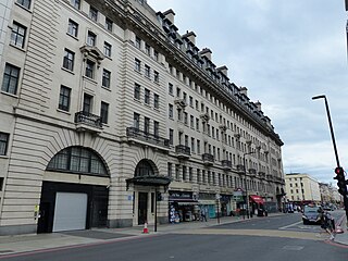
James Street runs from the junction of Mandeville Place and Wigmore Street in the north to the junction of Oxford Street and Gilbert Street in the south. On its western side it is joined by Gray's Yard in the north, which is a gated cul-de-sac with flats above, Picton Place and Barrett Street.
James Street was laid out around 1761–9. [1]
In 1936, the London County Council tried to rename the street Marylebone High Street, along with Thayer Street and Mandeville Place so that the whole north–south route from Oxford Street to Marylebone Road would have the same name. The proposal was opposed by both the occupants of Mandeville Place, who felt that they did not want to lose the higher class associations of the street in order to be associated with shopkeepers, and the shopkeepers and small traders of the other streets who worried about the cost of the change, possible customer confusion, and the association with Marylebone Road rather than the posher Oxford Street they were nearer. The proposal did not go ahead. [2] [3]
The street is mostly composed of terraced houses with small shops and restaurants on the ground floor and some larger buildings on the western side.
Number 56 on the east side is a grade II listed building with Historic England. [1]

The Bakerloo line is a London Underground line that runs from Harrow & Wealdstone in suburban north-west London to Elephant & Castle in south London, via the West End. Printed in brown on the Tube map, it serves 25 stations, 15 of which are underground, over 23.2 kilometres (14.4 mi). It runs partly on the surface and partly through deep-level tube tunnels.

Marylebone station is a Central London railway terminus and connected London Underground station in the Marylebone area of the City of Westminster. On the National Rail network, it is also known as London Marylebone and is the southern terminus of the Chiltern Main Line to Birmingham. An accompanying Underground station is on the Bakerloo line, sited between Edgware Road and Baker Street stations in Transport for London's fare zone 1.

The Metropolitan Borough of St Marylebone was a metropolitan borough of the County of London from 1900 to 1965. It was based directly on the previously existing civil parish of St Marylebone, Middlesex, which was incorporated into the Metropolitan Board of Works area in 1855, retaining a parish vestry, and then became part of the County of London in 1889.

Aylesbury railway station is a railway station in Aylesbury, Buckinghamshire, England, on the London–Aylesbury line from London Marylebone via Amersham. It is 38 miles (61 km) from Aylesbury to Marylebone. A branch line from Princes Risborough on the Chiltern Main Line terminates at the station. It was the terminus for London Underground's Metropolitan line until the service was cut back to Amersham in 1961. The station was also known as Aylesbury Town under the management of British Railways from c. 1948 until the 1960s.

Oxford railway station is a mainline railway station, one of two serving the city of Oxford, England. It is about 0.5 miles (800 m) west of the city centre, north-west of Frideswide Square and the eastern end of Botley Road. It is the busiest station in Oxfordshire, and the fourth busiest in South East England.

Walton Street is on the eastern edge of the Jericho district of central Oxford, England.

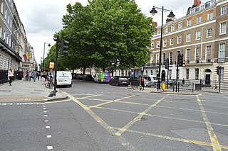
Bryanston Square is an 800-by-200-foot garden square in Marylebone, London. Terraced buildings surround it — often merged, converted or sub-divided, some of which remain residential. The southern end has the William Pitt Byrne memorial fountain. Next to both ends are cycle parking spaces.

The New Road was a toll road built across fields around the northern boundaries of London, the first part of which opened in 1756. The route comprises the modern-day A501.
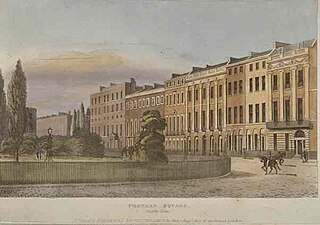
Portman Square is a garden square in Marylebone, central London, surrounded by townhouses. It was specifically for private housing let on long leases having a ground rent by the Portman Estate, which owns the private communal gardens. It marks the western end of Wigmore Street, which connects it to Cavendish Square to the east.

The A40 is a major trunk road connecting London to Fishguard, Wales. The A40 in London starts in the City of London and passes through six London Boroughs: Camden, Westminster, Kensington & Chelsea, Hammersmith & Fulham, Ealing and Hillingdon, to meet the M40 motorway junction 1 at Denham, Buckinghamshire.
Portland Place is a street in the Marylebone district of central London. Named after the 3rd Duke of Portland, the unusually wide street is home to the BBC's headquarters Broadcasting House, the Chinese and Polish embassies, the Royal Institute of British Architects and numerous residential mansion blocks.

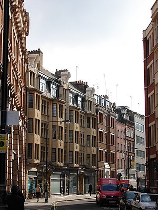
Thayer Street is a street in the Marylebone district of the City of Westminster, London, that contains four listed buildings.
Hinde Street is a street in the Marylebone district of the City of Westminster, London, that contains the Hinde Street Methodist Church and was home to the novelist Rose Macaulay until her death.

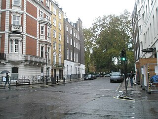
Mandeville Place is a street in the Marylebone district of the City of Westminster, London, the buildings in which are notably more impressive than those to the immediate north and south.

Homer Row is a street in the Marylebone district of the City of Westminster, London, that runs form Old Marylebone Road in the north to the junction of Crawford Place and Crawford Street in the south.

Crawford Place is a street in the Marylebone district of the City of Westminster, London. The street was developed in the first decade of the 1800s and was original known as John Street West.

Marylebone Lane is one of the original streets of the Marylebone district of the City of Westminster, London. It runs from Oxford Street in the south to Marylebone High Street in the north, its winding shape following the course of the River Tyburn that it once ran alongside and pre-dating the grid pattern of the other streets in the area. Today the lane is largely composed of small shops, cafes and restaurants with some small apartment blocks. There are some larger commercial buildings at the southern end near Oxford Street.
Newman Street is a street in the City of Westminster. It runs from the junction of Mortimer Street, Cleveland Street, and Goodge Street in the north to Oxford Street in the south and is joined on its western side by Eastcastle Street.
Chiltern Court, Baker Street, London, is a large block of flats at the street's northern end, facing Regent's Park and Marylebone Road. It was built between 1927 and 1929 above Baker Street tube station by the Metropolitan Railway.

Chiltern Street is a road in the Marylebone area of Central London. Located in the City of Westminster, it runs north to south connecting Marylebone Road and Blandford Street. Baker Street runs parallel a little way to the west. It meets Dorset Street, Crawford Street and Paddington Street along its route. Manchester Square is located beyond the southern end of the street.
![]() Media related to James Street, Marylebone at Wikimedia Commons
Media related to James Street, Marylebone at Wikimedia Commons
| | This London road or road transport-related article is a stub. You can help Wikipedia by expanding it. |