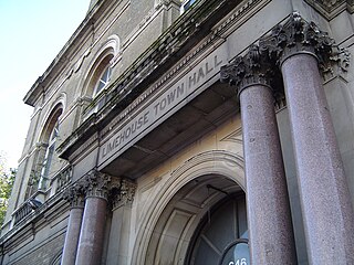
Limehouse is a district in the London Borough of Tower Hamlets in East London. It is 3.9 miles (6.3 km) east of Charing Cross, on the northern bank of the River Thames. Its proximity to the river has given it a strong maritime character, which it retains through its riverside public houses and steps, such as The Grapes and Limehouse Stairs. It is part of the traditional county of Middlesex. It became part of the ceremonial County of London following the passing of the Local Government Act 1888, and then part of Greater London in 1965. It is located between Stepney to the west and north, Mile End and Bow to the northwest, Poplar to the east, and Canary Wharf and Millwall to the south, and stretches from the end of Cable Street and Butcher Row in the west to Stainsby Road near Bartlett Park in the east, and from West India Dock and the River Thames in the south to Salmon Lane and Rhodeswell Road in the north.

Poplar is a district in East London, England, the administrative centre of the borough of Tower Hamlets. Five miles (8 km) east of Charing Cross, it is part of the East End.

Poplar was a local government district in the metropolitan area of London, England. It was formed as a district of the Metropolis in 1855 and became a metropolitan borough in the County of London in 1900. It comprised Poplar, Millwall, Bromley-by-Bow and Bow.

The West India Docks are a series of three docks, quaysides and warehouses built to import goods from and export goods and occasionally passengers to the British West Indies on the Isle of Dogs in London the first of which opened in 1802. Following their commercial closure in 1980, the Canary Wharf development was built around the wet docks by narrowing some of their broadest tracts.

Blackwall is an area of Poplar, in the London Borough of Tower Hamlets, East London. The neighbourhood includes Leamouth and the Coldharbour conservation area.
The Limehouse Basin in Limehouse, in the London Borough of Tower Hamlets provides a navigable link between the Regent's Canal and the River Thames, through the Limehouse Basin Lock. A basin in the north of Mile End, near Victoria Park connects with the Hertford Union Canal leading to the River Lee Navigation. The dock originally covered an area of about 15 acres (60,703 m2). The Basin lies between the Docklands Light Railway (DLR) line and historic Narrow Street. Directly to the east is a small park, Ropemaker's Fields.

The Royal Victoria Dock is the largest of three docks in the Royal Docks of east London, now part of the redeveloped Docklands.

Bristol Harbour is the harbour in the city of Bristol, England. The harbour covers an area of 70 acres. It is the former natural tidal river Avon through the city but was made into its current form in 1809 when the tide was prevented from going out permanently. A tidal by-pass was dug for 2 miles through the fields of Bedminster for the river, known as the "River Avon New Cut", "New Cut", or simply "The Cut". It is often called the Floating Harbour as the water level remains constant and it is not affected by the state of the tide on the river in the Avon Gorge, The New Cut or the natural river southeast of Temple Meads to its source.

Shadwell Basin is a housing and leisure complex built around a disused dock in Wapping, London. The old dock was formerly part of the London Docks, a group of docks built by the London Dock Company at Wapping as part of the wider docks of the Port of London, and historically in Shadwell from where it takes its name.

The Samuda Estate is on the east side of Manchester Road, in Cubitt Town on the Isle of Dogs. With 505 dwellings it is home to about 1,500 people and covers 11.4 acres (4.6 ha).

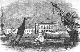
The East India Docks were a group of docks in Blackwall, east London, north-east of the Isle of Dogs. Today only the entrance basin and listed perimeter wall remain visible.
Poplar was a railway station located on the East India Dock Road in Poplar, London. It was opened in 1866 by the North London Railway. It was the southern passenger terminus of the NLR, although goods trains ran on to connect to the London and Blackwall Railway (LBR) for the East India Docks or to the LBR's Millwall Extension Railway for the West India Docks.
Blackwall was a railway station in Blackwall, London, that served as the eastern terminus of the Commercial Railway. It was located on the south side of the East India Docks, near the shore of the River Thames, 3 miles 43 chains (5.7 km) down-line from the western terminus at Fenchurch Street.

The Port of Hull is a port at the confluence of the River Hull and the Humber Estuary in Kingston upon Hull, in the East Riding of Yorkshire, England.
The City Canal was a short, and short-lived, canal excavated across the Isle of Dogs in east London, linking two reaches of the River Thames. Today, it has been almost completely reconstructed to form the South Dock of the West India Docks.
Blackwall Yard is a small body of water that used to be a shipyard on the River Thames in Blackwall, engaged in ship building and later ship repairs for over 350 years. The yard closed in 1987.

Poplar Dock is a small dock in east London. It connects to the Blackwall Basin of the West India Docks and, although independent of this system, has never had a direct connection to the Thames.

Bathurst Basin is a small triangular basin adjoining the main harbour of the city of Bristol, England. The basin takes its name from Charles Bathurst, who was a Bristol MP in the early 19th century.

Coldharbour is a street and wider conservation area in Blackwall, lying on the north bank of the River Thames, east of Canary Wharf. The area is said to be "[t]he sole remaining fragment of the old hamlet of Blackwall" and "one of the last examples of the narrow streets which once characterised the river's perimeter".

West India Pier is a pier on the River Thames in the Isle of Dogs area of London. It can be found beside the Anchorage Point and Millennium Harbour housing developments at the end of Cuba Street.


