Jarrettsville, Maryland

Last updated
Jarrettsville, Maryland
Jarrettsville.jpg
Chrome Hill Road (2021)
Harford County Maryland Incorporated and Unincorporated areas Jarrettsville Highlighted.svg
Location of Jarrettsville, Maryland
Coordinates: 39°36′17″N76°28′40″W / 39.60472°N 76.47778°W / 39.60472; -76.47778 Coordinates: 39°36′17″N76°28′40″W / 39.60472°N 76.47778°W / 39.60472; -76.47778
CountryUnited States
State Maryland
County Harford
Area
[1]
  Total8.66 sq mi (22.43 km2)
  Land8.63 sq mi (22.37 km2)
  Water0.03 sq mi (0.07 km2)
Elevation
669 ft (204 m)
Population
 (2020)
  Total2,888
  Density334.45/sq mi (129.13/km2)
Time zone UTC−5 (Eastern (EST))
  Summer (DST) UTC−4 (EDT)
ZIP code
21084
Area code 410
FIPS code 24-42325
GNIS feature ID0585205

Jarrettsville is an unincorporated community and census-designated place (CDP) in Harford County, Maryland, United States. The population was 2,888 at the 2020 census. [2]

Contents

History

The area was originally called Carmon. [3] [4] The town was named for the Jarrett family, who farmed the area during the 1800s and were one of the first pioneer families of the United States. In 1771, Abraham Jarrett was granted 2,380 acres of land near the falling branch area to which was used for the production of hogshead barrels mainly used for the transportation of tobacco. In the same year Abraham Jarrett purchased other areas in and around the Jarrettsville area. Abraham Jarrett married Martha Bussey and had 7 children. [5] My Lady's Manor was listed on the National Register of Historic Places in 1978, and includes portions of Jarrettsville. [6] Other sources attribute the naming of Jarrettsville to the grandson of Abraham Jarrett, Luther M. Jarrett, a state delegate and farmer. [3] [4] [7] [8]

Geography

Jarrettsville is located in northwestern Harford County at 39°36′7″N76°28′21″W / 39.60194°N 76.47250°W / 39.60194; -76.47250 (39.601954, 76.472404). [9] Maryland Route 23 passes through the center of the town, leading southeast 9 miles (14 km) to Bel Air, the county seat, and northwest 12 miles (19 km) to the Pennsylvania border north of Norrisville. Maryland Route 165 passes through the center of Jarrettsville as well, leading northeast 12 miles to the Pennsylvania border near Cardiff and south 8 miles (13 km) to Baldwin. Jarrettsville is 30 miles (48 km) northeast of downtown Baltimore.

According to the United States Census Bureau, the CDP has a total area of 8.6 square miles (22.4 km2), of which 0.03 square miles (0.07 km2), or 0.29%, are water. [10]

Demographics

Historical population
CensusPop.Note
2020 2,888
U.S. Decennial Census [11]

As of the census [12] of 2000, there were 2,756 people, 900 households, and 781 families residing in the CDP. The population density was 315.8 inhabitants per square mile (121.9/km2). There were 918 housing units at an average density of 105.2 per square mile (40.6/km2). The racial makeup of the CDP was 97.21% White, 1.16% African American, 0.15% Native American, 0.29% Asian, 0.33% from other races, and 0.87% from two or more races. Hispanic or Latino of any race were 0.54% of the population.

There were 900 households, out of which 43.7% had children under the age of 18 living with them, 77.6% were married couples living together, 6.4% had a female householder with no husband present, and 13.2% were non-families. 11.1% of all households were made up of individuals, and 5.4% had someone living alone who was 65 years of age or older. The average household size was 3.05 and the average family size was 3.30.

In the CDP, the population was spread out, with 28.9% under the age of 18, 6.5% from 18 to 24, 26.4% from 25 to 44, 29.0% from 45 to 64, and 9.2% who were 65 years of age or older. The median age was 39 years. For every 100 females, there were 101.3 males. For every 100 females age 18 and over, there were 97.3 males.

The median income for a household in the CDP was $69,632, and the median income for a family was $81,771. Males had a median income of $51,524 versus $31,905 for females. The per capita income for the CDP was $29,246. None of the families and 1.4% of the population were living below the poverty line, including no under eighteens and 11.6% of those over 64.

Notable people

Related Research Articles

<span class="mw-page-title-main">Brooklyn Park, Maryland</span> Census-designated place in Maryland, United States

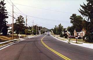
Brooklyn Park is a census-designated place (CDP) in Anne Arundel County, Maryland, United States. The population was 14,373 at the 2010 census.

<span class="mw-page-title-main">Ferndale, Maryland</span> Census-designated place in Maryland, United States

Ferndale is a census-designated place (CDP) in Anne Arundel County, Maryland, United States. At the 2010 census, the population was 16,746.

<span class="mw-page-title-main">Maryland City, Maryland</span> Census-designated place in Maryland, United States

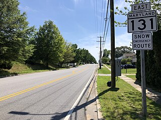
Maryland City is a census-designated place (CDP) in Anne Arundel County, Maryland, United States. The population was 16,093 at the 2010 census. It is located east of Laurel, just over the border with Prince George's County, and it has a Laurel ZIP Code. Maryland City mostly consists of an older, compact housing development and is adjacent to Fort Meade army base. A large newer development on the north side of Maryland Route 198 is known as Russett and is included within the Maryland City CDP.

<span class="mw-page-title-main">Pumphrey, Maryland</span> Unincorporated community in Maryland, United States

Pumphrey is an unincorporated community and former census-designated place (CDP) in Anne Arundel County, Maryland, United States. At the 2000 census, the population was 5,317. It was split between the Linthicum and Brooklyn Park CDPs for the 2010 census.

<span class="mw-page-title-main">Bowleys Quarters, Maryland</span> Census-designated place in Maryland, United States

Bowleys Quarters is an unincorporated community and census-designated place in Baltimore County, Maryland, United States, with a population of 6,755 at the 2010 census.

<span class="mw-page-title-main">Carney, Maryland</span> Census-designated place in Maryland, United States

Carney is an unincorporated community and census-designated place in Baltimore County, Maryland, United States. The population was 29,941 at the 2010 census.

<span class="mw-page-title-main">Cockeysville, Maryland</span> Census-designated place in Maryland, United States

Cockeysville is a census-designated place (CDP) in Baltimore County, Maryland, United States. The population was 20,776 at the 2010 census.

<span class="mw-page-title-main">Kingsville, Maryland</span> Census-designated place in Maryland, United States

Kingsville is a semi-rural, unincorporated community and census-designated place in Baltimore County, Maryland, United States. It is a close-knit and rustic community bounded by the Little Gunpowder Falls river and the Big Gunpowder Falls river which join to form the Gunpowder River. The population of Kingsville was 4,318 at the 2010 census.

<span class="mw-page-title-main">Lochearn, Maryland</span> Census-designated place in Maryland, United States

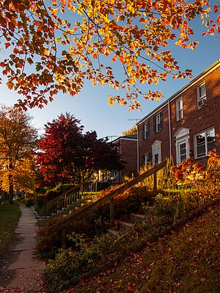
Lochearn is an unincorporated community and census-designated place in Baltimore County, Maryland, United States, located immediately to the west of the City of Baltimore. Per the 2020 census, the population was 25,511.

<span class="mw-page-title-main">Mays Chapel, Maryland</span> Census-designated place in Maryland, United States

Mays Chapel is an unincorporated community and census-designated place in Baltimore County, Maryland, United States. The population was 11,420 at the 2010 census.

<span class="mw-page-title-main">Milford Mill, Maryland</span> Census-designated place in Maryland, United States

Milford Mill is an unincorporated community and census-designated place in Baltimore County, Maryland, United States. Per the 2020 census, the population was 30,622.

<span class="mw-page-title-main">Parkville, Maryland</span> Census-designated place in Maryland, United States

Parkville is an unincorporated community and census-designated place in Baltimore County, Maryland, United States. As of the 2010 census, the population was 30,734.

<span class="mw-page-title-main">Randallstown, Maryland</span> Census-designated place in Maryland, United States

Randallstown is an unincorporated community and census-designated place in Baltimore County, Maryland, United States. It is named after Christopher and Thomas Randall, two 18th-century tavern-keepers. At that time, Randallstown was a tollgate crossroads on the Liberty Turnpike, a major east–west thoroughfare. It is a suburb of Baltimore, with a population of 33,655 as of the 2020 census. As of 2020 it was 72 percent African American. In the 1990s, Randallstown transitioned to a majority African American community.

<span class="mw-page-title-main">Rosedale, Maryland</span> Census-designated place in Maryland, United States

Rosedale is an unincorporated community and census-designated place in Baltimore County, Maryland, United States. The population was 19,257 at the 2010 United States Census.

<span class="mw-page-title-main">Bel Air North, Maryland</span> Census-designated place in Maryland, United States

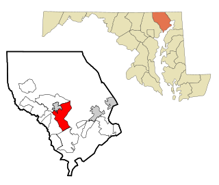
Bel Air North is a census-designated place (CDP) in Harford County, Maryland, United States. It is situated immediately north of the incorporated town of Bel Air. As of the 2010 census, the CDP population was 30,568, up from 25,798 in 2000.

<span class="mw-page-title-main">Bel Air South, Maryland</span> Census-designated place in Maryland, United States

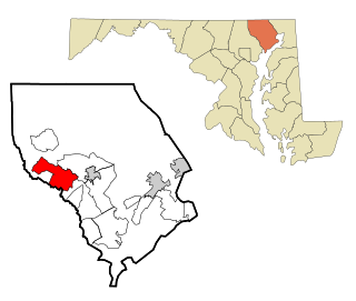
Bel Air South is a census-designated place (CDP) in Harford County, Maryland, United States. The population was 47,709 at the 2010 census, up from 39,711 in 2000.

<span class="mw-page-title-main">Fallston, Maryland</span> Census-designated place in Maryland, United States

Fallston is a census-designated place (CDP) in Harford County, Maryland, United States. The population was 8,958 at the 2010 census, up from 8,427 in 2000. Fallston is a semi-rural community consisting mostly of farms and suburban-like developments.

<span class="mw-page-title-main">Perryman, Maryland</span> Census-designated place in Maryland, United States

Perryman is an unincorporated community and census-designated place (CDP) in Harford County, Maryland, United States. The population was 2,342 at the 2010 census.

<span class="mw-page-title-main">Pleasant Hills, Maryland</span> Census-designated place in Maryland, United States

Pleasant Hills is a census-designated place (CDP) in Harford County, Maryland, United States. The population was 3,379 at the 2010 census, up from 2,851 in 2000. There is no post office with the designation "Pleasant Hills"; most of the residents have either Fallston or Kingsville addresses and consider themselves as belonging to those communities.

<span class="mw-page-title-main">Riverside, Harford County, Maryland</span> Census-designated place in Maryland, United States

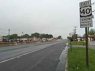
Riverside is a census-designated place (CDP) in Harford County, Maryland, United States. The population was 6,425 at the 2010 census. The term "Riverside" is generally used interchangeably with "Belcamp"; both names are accepted for the U.S. Postal Service's ZIP Code of 21017. However, the original community of Belcamp is located south of U.S. Route 40, outside the Riverside CDP.

References

  1. "2020 U.S. Gazetteer Files". United States Census Bureau. Retrieved April 26, 2022.
  2. "Explore Census Data". data.census.gov. Retrieved 2022-06-30.
  3. 1 2 "Sinclair House (HA-1307)" (PDF). Maryland State Archives . 2004-02-18. Archived (PDF) from the original on 2023-03-20. Retrieved 2023-03-19.
  4. 1 2 McKinsey, Folger (1941-10-20). "Romance of Early Maryland Hovers Over Jarrettsville". The Baltimore Sun . p. 6. Retrieved 2023-03-19 via Newspapers.com. Open Access logo PLoS transparent.svg
  5. "Ancestry® | Family Tree, Genealogy & Family History Records". www.ancestry.com. Retrieved 2022-06-30.
  6. "National Register Information System". National Register of Historic Places . National Park Service. April 15, 2008.
  7. "Doctor Over Half Century". The Evening Sun. 1911-04-22. p. 3. Retrieved 2023-03-19 via Newspapers.com. Open Access logo PLoS transparent.svg
  8. "Dr. J. H. Jarrett Dead at His Home in Towson". The Baltimore Sun . 1922-02-13. p. 14. Retrieved 2023-03-19 via Newspapers.com. Open Access logo PLoS transparent.svg
  9. "US Gazetteer files: 2010, 2000, and 1990". United States Census Bureau. 2011-02-12. Retrieved 2011-04-23.
  10. "Geographic Identifiers: 2010 Demographic Profile Data (G001): Jarrettsville CDP, Maryland". American Factfinder. U.S. Census Bureau. Retrieved July 13, 2017.[ dead link ]
  11. "Census of Population and Housing". Census.gov. Retrieved June 4, 2016.
  12. "U.S. Census website". United States Census Bureau . Retrieved 2008-01-31.