
The River Teme rises in Mid Wales, south of Newtown, and flows southeast roughly forming the border between England and Wales for several miles through Knighton before becoming fully English in the vicinity of Bucknell and continuing east to Ludlow in Shropshire, then to the north of Tenbury Wells on the Shropshire/Worcestershire border there, on its way to join the River Severn south of Worcester. The whole of the River Teme was designated as an SSSI, by English Nature, in 1996.

Clun is a town in south west Shropshire, England, and the Shropshire Hills Area of Outstanding Natural Beauty. The 2011 census recorded 680 people living in the town. Research by the Campaign for the Protection of Rural England suggests that Clun is one of the most tranquil locations in England.
The River Clun runs mostly through Shropshire, England and joins the River Teme at Leintwardine, Herefordshire. The Clun Valley is part of the Shropshire Hills AONB.

Anchor is a remote hamlet in southwest Shropshire, England. The hamlet is the most westerly place in Shropshire.

Clungunford is a village and civil parish in south Shropshire, England, located near the border with Herefordshire.

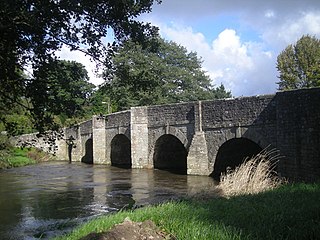
Leintwardine is a small to mid-size village and civil parish in north Herefordshire, England, close to the border with Shropshire.

Little Hereford is a small village and civil parish in Herefordshire, England. The civil parish includes the hamlet of Middleton. The population of the civil parish at the 2011 census was 394.
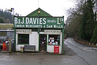
Bucknell is a village and civil parish in south Shropshire, England. The village lies on the River Redlake, within 660 yards (600 m) of the River Teme and close to the border of Wales and Herefordshire. It is about 6 miles (9.7 km) east of Knighton and is set within the Shropshire Hills Area of Outstanding Natural Beauty.

Buckton and Coxall is a civil parish in north Herefordshire, England.
Walford, Letton and Newton is a civil parish in north Herefordshire, England, close to the border with Shropshire. The population of this civil parish at the 2011 census was 179.

Beckjay is a hamlet in the south of the English county of Shropshire.
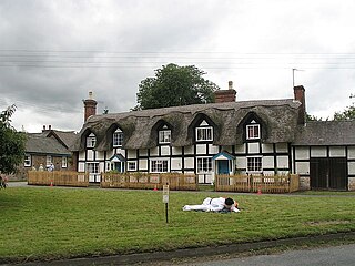
Brampton Bryan is a small village and civil parish situated in north Herefordshire, England close to the Shropshire and Welsh borders.
The A4113 road is a single-carriageway road that runs from Knighton in Powys to Bromfield in Shropshire, United Kingdom, passing through north Herefordshire.

Shelderton is a hamlet in south Shropshire, England. It is located just southeast of the village of Clungunford and is part of that village's civil parish.

The Herefordshire Trail is a long distance footpath in Herefordshire, England.
Croft Ambrey is an Iron Age hill fort in Herefordshire, England.

Broadward is a dispersed hamlet in south Shropshire, England, situated by the border with Herefordshire. It is in the civil parish of Clungunford, a village approximately 2 miles (3.2 km) to the north.

Marlow is a hamlet in north Herefordshire, England.
Heath is a dispersed hamlet in north Herefordshire, England.

Munslow is a hundred of Shropshire, England. It was formed with the amalgamation of the Anglo-Saxon hundreds of Patton and Culvestan during the reign of Henry I. Hundreds in England had various judicial, fiscal and other local government functions, their importance gradually declining from the end of manorialism to the latter part of the 19th century.
