
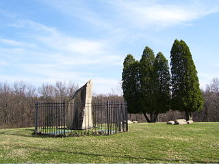
Jeannette is a city in Westmoreland County, Pennsylvania, United States. Jeannette was founded in 1888. The city got its name from one of the original city fathers, who wished to honor his wife, Jeannette McLaughlin, by giving the new town her first name: Jeannette. The city celebrated its 125th anniversary in July 2013. The population was 9,654 according to the 2010 census.
Penn Township is a township in Westmoreland County, Pennsylvania, United States.

Kennedy Township is a township in Allegheny County, Pennsylvania, United States, located 10 miles west of Pittsburgh and 12 miles east of Pittsburgh International Airport. The population was 8,701 at the 2020 United States Census.

Dundas is a community and town in Hamilton, Ontario, Canada. It is nicknamed the Valley Town because of its topographical location at the bottom of the Niagara Escarpment on the western edge of Lake Ontario. The population has been stable for decades at about twenty thousand, largely because it has not annexed rural land from the protected Dundas Valley Conservation Area.

Yangmei District is a district in southwestern Taoyuan City, Taiwan. The centre of the district is Yangmei town itself. The traditional residents are Hakka people.
Midland Independent School District is a public school district in Midland, Texas. Midland ISD contains 40 campuses, two 6A high schools, 24 elementary schools, and two early education centers.
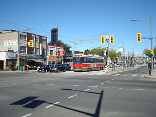
Earlscourt is a neighbourhood in Toronto, Ontario, Canada. It is centred on St. Clair Avenue West, with Dufferin Street, Davenport Road, and Old Weston Road forming its boundaries. It is contained within the larger city-recognized neighbourhood of Corso Italia-Davenport.

Utica Community Schools (UCS) is a public school district located in Macomb County, Michigan in the Metropolitan Detroit area. UCS serves the city of Utica, the majority of Shelby Township, the northern portion of Sterling Heights, and parts of Ray, Washington, and Macomb townships in the U.S. state of Michigan. UCS is the second-largest school district in the state of Michigan. Mr. Robert Monroe is the current superintendent of Utica Community Schools. UCS provides education for 29,519 students in kindergarten through 12th grade. There are presently 15,305 elementary students, 6,578 junior high students, and 7,636 senior high students.

Dorset Park is a neighbourhood in Toronto, Ontario, Canada. It is located in the western part of the district of Scarborough. The neighbourhood is bordered by Highway 401 to the north, Midland Avenue to the east, Lawrence Avenue to the south, and Birchmount Road to the west. Kennedy Road runs along the neighbourhood's centre north and south and Ellesmere Road runs along the centre east and west. The area south of Lawrence Avenue, north of the hydro corridor, is known as McGregor Park and is often included as part of Dorset Park.

Eglinton East, historically known as Knob Hill, is a residential and commercial neighbourhood in Toronto, Ontario, Canada. It is bounded by Stansbury Crescent, Citadel Drive, and West Highland Creek to the north, Midland Avenue to the west, the CNR rail line, Brimley Road, and Eglinton Avenue to the south, and Bellamy Road North to the east.

Fox Chapel Area School District is a public school district located in Allegheny County, Pennsylvania. It serves the boroughs of Aspinwall, Blawnox, Fox Chapel, and Sharpsburg, along with Indiana and O'Hara Townships. It is located approximately 12 miles from downtown Pittsburgh. The district has four elementary sites, a middle school, and high school. There are approximately 4,600 students enrolled in the school district.
The Sto-Rox School District is a suburban, public school district in Allegheny County, Pennsylvania. The district encompasses the borough of McKees Rocks along with Stowe Township. Sto-Rox School District encompasses approximately 3 square miles (7.8 km2). According to 2000 federal census data, it serves a resident population of 13,330 people. By 2010, the district's population declined to 12,468 people. In 2009, Sto-Rox School District residents' per capita income was $15,833, while the median family income was $33,343 a year. In the Commonwealth, the median family income was $49,501 and the United States median family income was $49,445, in 2010. By 2013, the median household income in the United States rose to $52,100.

United Junior Senior High School is a small, rural public secondary school located in East Wheatfield Township, Pennsylvania, United States. The school serves the borough of Armagh and the townships of Brush Valley, Buffington, East Wheatfield, and West Wheatfield. It is the sole junior senior high school operated by the United School District. The building is located on the same campus as the sole elementary school in the district. The United Cyber Academy is for district students K-12. High school students may choose to attend Indiana County Technology Center for training in the construction and mechanical trades as well as other careers. The ARIntermediate Unit IU28 provides the district with a wide variety of services like specialized education for disabled students and hearing, background checks for employees, state mandated recognizing and reporting child abuse training, speech and visual disability services and professional development for staff and faculty.

The Albert Gallatin Area School District is a large, rural, public school district located in Fayette County, Pennsylvania. It is named after Albert Gallatin former U.S. Secretary of the Treasury, planner of the Lewis and Clark expedition, engineer of the financial details of the Louisiana Purchase, and founder of New York University. It serves the Boroughs of Masontown, Fairchance, Point Marion, and Smithfield. It also serves German, Springhill, Georges, and Nicholson Townships. It encompasses approximately 142 square miles (370 km2). According to 2000 US federal census data, Albert Gallatin Area School District serves a resident population of 25,282. By 2010, the District's population declined to 23,852 people. The educational attainment levels for the Albert Gallatin Area School District population were 82.4% high school graduates and 11.9% college graduates. The District is one of the 500 public school districts of Pennsylvania.
The Allentown School District is a large, urban public school district located in Allentown, Pennsylvania in the Lehigh Valley region of eastern Pennsylvania. The district is the fourth largest school district in Pennsylvania as of the 2016-17 academic year.
Penn Hills School District (PHSD) is a mid-sized public school district located in Pittsburgh, serving Penn Hills, which is about 10 miles (16 km) east of Downtown Pittsburgh, and a small portion of Wilkins Township.

Horace Howard Furness High School is a secondary (9th-12th) school in South Philadelphia. It is part of the School District of Philadelphia.
The Steel Valley School District is a small, suburban public school district in the state of Pennsylvania. It is located to the southeast of the city of Pittsburgh. It serves the boroughs of Homestead, Munhall, and West Homestead, former mill towns. The Steel Valley School District encompasses approximately four square miles. According to 2005 local census data, it served a resident population of 18,340. In 2009, the district's resident per capita income was $16,902, while median family income was $40,295.

The Boyertown Area School District is a large public school district which covers portions of Berks and Montgomery Counties in southeastern Pennsylvania. When the Boyertown Area School District was formed in 1953 it was one of the largest in the state, encompassing 100 square miles (260 km2). In Berks County it covers the Boroughs of Bally, Bechtelsville and Boyertown and Colebrookdale Township, Douglass Township, Earl Township and Washington Township. In Montgomery County it covers Douglass Township, New Hanover Township and Upper Frederick Township.

Karn City Area School District is a public school district in Butler County, Clarion County, and Armstrong County, Pennsylvania. The district serves the boroughs of Chicora, Fairview, Karns City, Petrolia, and Bruin and the townships of Parker, Fairview, and Donegal in Butler County, the townships of Perry, Sugarcreek, and Bradys Bend in Armstrong County, and the borough of East Brady and Brady Township in Clarion County. There are two K-6 elementary schools- Chicora and Sugarcreek Elementaries, as well as Karns City Junior-Senior High School. The district encompasses approximately 125 square miles (320 km2). According to 2000 federal census data, it serves a resident population of 10,720.
