Related Research Articles

Cuttack district is one of the 30 districts of Odisha state in India. It is located in the coastal part of the state and its administrative headquarters are located in the city of Cuttack. As of 2011 Census, after Ganjam, it is the second most populous district of Odisha, with a population of 2,624,470. The name is an anglicized form of Kataka or Katak meaning Fort – referring to the Barabati Fort. The district is bisected by the river Mahanadi and its numerous distributaries and occupies a large portion of the river's delta. It is bounded by the Angul, Dhenkanal, Nayagarh and Khurda districts to the west while its southern and eastern boundaries touch Puri, Jagatsinghpur, Kendrapara and Jajpur districts.
Kendrapara District is an administrative district of Odisha state in eastern India. The town of Kendrapara is the district headquarters. Kendrapara District is situated in the eastern portion of the state, and is bounded on the north by Bhadrak district, on the east by the Bay of Bengal, on the south by Jagatsinghpur District, on the west by Cuttack District on the northwest by Jajpur District.

Jajpur is (pronounced) a district of Odisha state in eastern India. The Odisha Government carried out a re-organisation of districts of Odisha in 1993. The erstwhile Cuttack district was split into multiple districts with Jajpur being one of them. The district came into being on 1 April 1993.

Kendrapara is a small town and a municipality in the Kendrapara district of the Indian state of Odisha. It is the capital of Kendrapara district.
Jagatsinghpur is a town and a municipality in Jagatsinghpur district in the Indian state of Odisha. It is also the headquarters of Jagatsinghpur district. It got the recognition as a new district on 1 April 1993 formerly it was a sub-division of cuttack district. Paradip Port, Oil refinery and fertilizer factory are located in Jagatsinghpur district. Devi, Alaka, Biluakhai, Kusumi, Hansua, Kuanria and Lunijhara rivers belong to this district.

Nagri Kalan is a census town in Baghmara CD block in Dhanbad Sadar subdivision of Dhanbad district in the Indian state of Jharkhand.
Pattamundai is a town and a municipality in Kendrapara district in the Indian state of Odisha, located on the centre of SH-9A from Cuttack to Chandbali along the south end of Brahmani River. It is also the headquarter of Pattamundai Block.
Shiblibari is a census town in Nirsa CD block in Dhanbad Sadar subdivision of Dhanbad district in the Indian state of Jharkhand.

Sreerampur Uttarpara is a community development block that forms an administrative division in Srirampore subdivision of Hooghly district in the Indian state of West Bengal.
Karilopatna (Karilo patna, Karilo patana, is a village near Patkura in Kendrapara district in the Indian state of Odisha.
Jeenagora is a neighbourhood in Dhanbad in Dhanbad Sadar subdivision of Dhanbad district of Jharkhand.
Rajkanika is a town and block of Kendrapara district in the Indian state of Odisha.
Namatara is an Indian village situated in the Kendrapara district of Odisha. It is located on the bank of Kharosrota river, 150 km away from Bhubaneswar, the capital of Odisha. It is under the Rajkanika block and Aul tehsil. This village is approximately 22 km from Rajkanika. It is a habitat for 3601 people according to the 2011 census of India. This village has higher literacy than the state as it has 78.13% in compared to 72.87% of Odisha. It has 4 schools including high school and middle schools.
Boro is a village, with a police station, in the Manbazar II CD block in the Manbazar subdivision of Purulia district in the state of West Bengal, India.
Satbankura is a village and a gram panchayat in the Garhbeta III CD block in the Medinipur Sadar subdivision of the Paschim Medinipur district in the state of West Bengal, India. The headquarters of this block are located here.
Dhaneswarpur is a village, in the Dantan II CD block in the Kharagpur subdivision of the Paschim Medinipur district in the state of West Bengal, India.
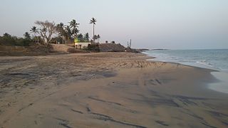
Dekani is a village under Khurusia Grampanchayat of Mahakalpara Block of Kendrapara district, Odisha state, India. As of the 2011 Census of India, it had a population of 519, of which 275 were male and 244 were female. The people are from different castes and belongs to Naisthika Hindus. It is 14 km from the Paradeep port Trust and just 7 km from Bhutmundai.
Kora is a village in the Kendrapara tehsil, Kendrapara district, Odisha state, India. It is located off the north side of the Cuttack-Kendrapara Road, about 75 km from Cuttack, 16 km beyond Kendrapara, and 16 km from Pattamundai. According to the 2011 census, it had 530 households and 2,410 inhabitants and 84.6% literacy rate.
Bardubhi is a village in Bardubhi Panchayat in Dhanbad CD block in Dhanbad Sadar subdivision of Dhanbad district in the Jharkhand state of India. Majority is Rajput caste is in the village.

Chhichhaura is a village in Deenshah Gaura block of Rae Bareli district, Uttar Pradesh, India. It is located 20 km from Raebareli, the district headquarters. As of 2011, it has a population of 862 people, in 157 households. It has one primary school and no healthcare facilities.
References
Coordinates: 20°39′12″N86°34′50″E / 20.653255°N 86.580521°E
| | This article about a location in Kendrapara district, Odisha, India is a stub. You can help Wikipedia by expanding it. |