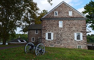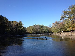
Upper Makefield Township is a township in Bucks County, Pennsylvania, United States. The population was 8,190 at the 2010 census. It has the eighth highest per capita income among Pennsylvania townships. Its multimillion-dollar homes, top-notch public schools and easy commute to New York City and Princeton and has led to its ranking as Best Place to Live in the Suburbs in Philadelphia Magazine's Best Places to Live list. Additionally, it has been listed as the Philadelphia area's second-most expensive suburb and the 287th richest neighborhood in the United States, with a mean household income of $306,081. The area has also been listed an alternative to the Hamptons for the summer by New York Magazine.

Wrightstown Township is a township in Bucks County, Pennsylvania, United States. The population was 2,995 at the 2010 census.

Neshaminy Creek is a 40.7-mile-long (65.5 km) stream that runs entirely through Bucks County, Pennsylvania, rising south of the borough of Chalfont, where its north and west branches join. Neshaminy Creek flows southeast toward Bristol Township and Bensalem Township to its confluence with the Delaware River. The name "Neshaminy" originates with the Lenni Lenape and is thought to mean "place where we drink twice". This phenomenon refers to a section of the creek known as the Neshaminy Palisades, where the course of the water slows and changes direction at almost a right angle, nearly forcing the water back upon itself. These palisades are located in Dark Hollow Park, operated by the county, and are flanked by Warwick Township to the south and Buckingham Township to the north.
Mill Creek is a tributary of Neshaminy Creek, one of three tributaries of the Neshaminy which all share the same name, and one of six in Bucks County, Pennsylvania which share the name. The Geographic Name Information System I.D. is 1181118, U.S. Department of the Interior Geological Survey I.D. is 02596.
Robin Run is a dammed headwater major tributary of the Delaware River with a drainage area of 22.69 square miles that is 1.69 miles north 1.69 miles north of Mill Creek's Confluence with the Neshaminy Creek on the border of Buckingham and Wrightstown Townships), The headwaters originate in Buckingham Township, Bucks County, Pennsylvania and the stream flows generally southeast to its confluence with Mill Creek in Wrightstown Township.
Watson Creek is a tributary of Mill Creek, Bucks County, Pennsylvania., contained totally in Buckingham Township, Bucks County, Pennsylvania flows to its confluence with Lahaska Creek to form Mill Creek. The Geographic Name Information System I.D. is 1190689, U.S. Department of the Interior Geological Survey I.D. is 02626.
Lahaska Creek is a tributary of Mill Creek in Wrightstown Township, Bucks County, Pennsylvania. The Geographic Name Information System I.D. is 1178763, U.S. Department of the Interior Geological Survey I.D. is 02632.
Queen Anne Creek is a tributary of Mill Creek, part of the Delaware River drainage basin in Bucks County, Pennsylvania. Rising just north of Fallsington, it meets with its confluence with Mill Creek in Bristol Township.

Buck Creek is a tributary of the Delaware River, rising in Lower Makefield Township, Bucks County, Pennsylvania and meeting its confluence at the Delaware River's 138.00 river mile.
Brock Creek is a tributary of Buck Creek, rising in Lower Makefield Township, Bucks County, Pennsylvania, and meets its confluence at Buck Creek's 0.60 river mile in Yardley Borough.
Dyers Creek is a tributary of the Delaware River wholly contained within Lower Makefield Township, Bucks County, Pennsylvania.
Houghs Creek is a tributary of the Delaware River in Bucks County, Pennsylvania, contained wholly within Upper Makefield Township.

Pidcock Creek is a tributary of the Delaware River in Bucks County, Pennsylvania. Rising in Buckingham Township, it flows into the Delaware in Solebury Township after a short side trip within Upper Makefield Township.
Curls Run is a tributary of Pidcock Creek in Bucks County, Pennsylvania, part of the Delaware River drainage basin.
Core Creek is a tributary of the Neshaminy Creek in Bucks County, Pennsylvania. Rising in Lower Makefield Township, it flows in the Stockton Formation until it meets its confluence with the Neshaminy in Middletown Township. At one time it powered seven mills along its length.
Geddes Run is a tributary of the Tohickon Creek contained wholly within Plumstead Township, Bucks County, Pennsylvania, in the United States.
Deep Run is a tributary of the Tohickon Creek in Bedminster Township, Bucks County, Pennsylvania in the United States.
Haycock Creek is a tributary of the Tohickon Creek in Bucks County, Pennsylvania in the United States and is part of the Delaware River watershed.
Beaver Creek is a tributary of Tinicum Creek in Bridgeton, Nockamixon, and Tinicum Townships in Bucks County, Pennsylvania, in the United States. The creek is part of the Delaware River watershed.
Gallows Run is a tributary of the Delaware River in Springfield and Nockamixon Townships, in Bucks County, Pennsylvania in the United States.


