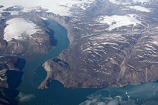
Clavering Island is a large island in eastern Greenland off Gael Hamke Bay, to the south of Wollaston Foreland.
Brønlundhus, on some maps also Brønlundfjord, is a former research station and radio station located on the western shore of Jørgen Brønlund Fjord in southern Peary Land, in northern Greenland. It is named after Greenlandic Arctic researcher Jørgen Brønlund, or after the namesake fjord on which it is located. It is close to the mouth of Jørgen Brønlund Fjord where it opens into Independence Fjord.

Myggbukta, meaning "Mosquito Bay" in Norwegian, was a Norwegian whaling, meteorological and radio station located on the coast of Eastern Greenland in present-day King Christian X Land.
Buskø was a small Norwegian sealer, seized by the U.S. Coast Guard in East Greenland in September 1941, before U.S. entry into the war. She was bringing supplies and rotating personnel for the Norwegian hunting stations there. The episode is notable not only for the uproar in the American press when Buskø was towed to Boston as a prize, but also because it is frequently but incorrectly listed as being the first American capture of an enemy surface vessel in the war. Finally, President Franklin D. Roosevelt had frequently asserted that Germany would attempt to establish a foothold in Greenland, and the way this episode was presented seemed to bear him out. The affair was a notable early initiative in the North Atlantic weather war.

Kangerlussuaq Fjord is a fjord in eastern Greenland. It is part of the Sermersooq municipality.
Lindenow Fjord or Kangerlussuatsiaq, is a fjord in the King Frederick VI Coast, Kujalleq municipality, southern Greenland.

King Frederick VI Coast is a major geographic division of Greenland. It comprises the coastal area of Southeastern Greenland in Sermersooq and Kujalleq municipalities fronting the Irminger Sea of the North Atlantic Ocean. It is bordered by King Christian IX Land on the north and the Greenland Ice Sheet to the west.
Thorland is a peninsula in the King Frederick VI Coast, southeastern Greenland. It is a part of the Sermersooq municipality.

Adolf S. Jensen Land is a peninsula in the southern limit of King Frederick VIII Land, northeastern Greenland. Administratively it belongs to the NE Greenland National Park area.
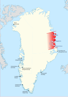
Queen Margrethe II Land is a peninsula in the northern limit of King Christian X Land, northeastern Greenland. Administratively it belongs to the NE Greenland National Park area.

The Denmark expedition, also known as Denmark Expedition to Greenland's Northeast Coast, and as the Danmark Expedition after the ship, was an expedition to the northeast of Greenland in 1906–1908.
Ardencaple Fjord is a fjord in King Christian X Land, northeastern Greenland. Administratively it is part of the Northeast Greenland National Park.

Antarctic Haven is a bay in King Christian X Land, Northeastern Greenland.
Peters Bay is a bay of the Greenland Sea in King Christian X Land, Greenland. Administratively it belongs to the NE Greenland National Park area.
Cape Simpson is a headland in the Greenland Sea, Northeast Greenland. Administratively it is part of the NE Greenland National Park.

Torgilsbu was a Norwegian hunting, meteorological and radio station located on the King Frederick VI Coast, Southeastern Greenland.
Finnsbu was a Norwegian hunting, meteorological and radio station located on the King Frederick VI Coast, Southeastern Greenland.
Storfjord was a Norwegian hunting, meteorological and radio station ("Storfjord/LMR") located in King Christian IX Land, Eastern Greenland.

Young Sound is a marine channel with a fjord structure in King Christian X Land, East Greenland. Administratively it is part of the Northeast Greenland National Park zone.
Grandjean Fjord is a fjord in King Christian X Land, East Greenland. Administratively it is part of the Northeast Greenland National Park zone.