Jordans, Buckinghamshire

Last updated

Jordans
JordansStore.JPG
Jordans Village Store
Buckinghamshire UK location map.svg
Red pog.svg
Jordans
Location within Buckinghamshire
Population700 
OS grid reference SU975916
Unitary authority
Ceremonial county
Region
Country England
Sovereign state United Kingdom
Post town BEACONSFIELD
Postcode district HP9
Dialling code 01494
Police Thames Valley
Fire Buckinghamshire
Ambulance South Central
UK Parliament
List of places
UK
England
Buckinghamshire
51°37′N0°35′W / 51.61°N 0.59°W / 51.61; -0.59

Jordans is a village in Chalfont St Giles parish, Buckinghamshire, England, and the civil parish of Hedgerley. It is a centre for Quakerism, holds the burial place of William Penn, founder of the Province of Pennsylvania, and so is a popular place with American visitors. It also contains the Mayflower Barn, made from ship timbers sometimes claimed to be from the Mayflower . Some 245 households and 700 residents are served by a nursery, primary school, youth hostel, village hall and community shop. Forty of the houses and cottages and 21 flats are owned by a non-profit society that manages the village and its amenities. [1]

Contents

Heritage

Two of several suggested origins of the name Jordans appear in a book on the history of the village: "Little is known of Jordans Farm before the seventeenth century.... It has been suggested that the name comes from some connection with a manorial family of Jourdemain... but a more probable origin is in an early owner or occupant called Jordan." Jordans Farm is known as Old Jordans today, and that building together with the Mayflower Barn date back to the 16th century. [2]

Quakerism

In the 17th century the village became a centre for Quakerism. It has one of the oldest Friends meeting houses in the country, whose cemetery is the burial place of William Penn, founder of the Province of Pennsylvania, as well as other notable Quakers. Close by is Old Jordans, originally a farmhouse, sold by the Quakers for development in March 2006. Old Jordans was used during World War I as a training centre for the Friends' Ambulance Unit.

Meeting House

Jordans Friends Meeting House was built in 1688 shortly after the Declaration of Indulgence. The meeting room retains most of its original brick, including the bare brick floor, glass, panelling and benches. It suffered a serious fire on 10 March 2005, when the modern extension was virtually destroyed and the roof of the original 17th-century meeting room severely damaged. The interior of the original meeting room escaped relatively unscathed, but suffered some water and smoke damage.

Mayflower Barn

Mayflower Barn. Mayflower Barn - geograph.org.uk - 87669.jpg
Mayflower Barn.

Within the grounds of Old Jordans is the Mayflower Barn on the edge of the Chiltern hills in the South Buckinghamshire countryside, about midway between London and Oxford.

The farm name seems to date back to the late Middle Ages. Its known history begins in 1618 when Thomas Russell bought it. Part of the present farmhouse was already there and Thomas Russell added to it in 1624, also building a substantial new barn with timbers from a ship. Despite suppositions, it cannot be shown that they came from the Mayflower , the ship that carried the Pilgrim Fathers from Plymouth to New England. [3] [4]

A piece of the timber was taken from the Mayflower Barn, placed in the Peace Arch built by Sam Hill and opened in September 1921. Besides the completion of the Pacific highway from the Canadian boundary to Mexico, the arch also marked a century of peace between the United States and the UK. [5] A plaque shows where the timber was taken from the Mayflower Barn. The Barn was a tourist attraction to visitors from all over the world, particularly the Americas, but is now privately owned and closed to the public.

Education

Jordans has a primary school, Jordans County First School, and Jordan's Village Nursery School. The school, in Puers Lane, is state-funded, for years 1, 2 and Reception (Ages 5–8) as a feeder for Seer Green School, Thorpe House School and Gayhurst School. It has about 60 pupils with a student/teacher ratio of 1:12. The head since 2015 has been Hannah Bancroft.

The nursery is in the Village Hall behind the store in Green West Road. [6]

Transport

Jordans lies 5 miles (8.0 km) north-west of the intersection of the M25 and M40 motorways (Junction 16/1A). It is served by Seer Green and Jordans railway station, 1.2 miles (1.9 km) away on the London–Birmingham Chiltern Main Line of Chiltern Railways. Jordans is served on Tuesday and Friday by a bus service from the village to the Tesco in Loudwater. (380, Red Eagle). [7]

Leisure and amenities

Jordans has a "pop-up pub" named The Jolly Quaker, open on the first Friday of each month. Its monthly Cinema Club "Jordans Picture House" opens on the second Friday and sometimes on the second Sunday of the month from October to May. Both operate from the village hall in Green West Road behind the village store.

Several annual events take place: a summer fair, usually in June; a sports day; an annual cricket match, and a village supper to commemorate the founding of the village on the nearest Saturday to its anniversary each February. The Jordans Tennis Club in the village holds about seven roll-ups each year. In June 2019, the village marked its centenary with an event on the village green.

Jordans Village Community Store opened in 1922. It sells the usual staples and some own-brand preserves, and includes a sub-post office. It is subsidized by a voluntary Shop Amenity Charge of £5 or £10 per month paid by about half the households in the village.

Five views of the allotments Jordansallotments.jpg
Five views of the allotments

Jordans has eight allotments, located next to the tennis court. The allotments used to be located in Crutches Lane, and were moved to allow a development of four homes for the elderly, built in 2008.

Notable residents

In birth order:

Related Research Articles

<span class="mw-page-title-main">Amersham</span> Human settlement in England

Amersham is a market town and civil parish in Buckinghamshire, England, in the Chiltern Hills, 27 miles (43 km) northwest of central London, 15 miles (24 km) south-east of Aylesbury and 9 miles (14 km) north-east of High Wycombe. Amersham is part of the London commuter belt.

<span class="mw-page-title-main">Chalfont St Giles</span> Human settlement in England

Chalfont St Giles is a village and civil parish in southeast Buckinghamshire, England. It is in a group of villages called The Chalfonts, which also includes Chalfont St Peter and Little Chalfont.

<span class="mw-page-title-main">Denham, Buckinghamshire</span> Village and civil parish in Buckinghamshire, England

Denham is a village and civil parish in the unitary authority of Buckinghamshire, England, approximately 17 miles (27 km) from central London, 2 miles (3 km) northwest of Uxbridge and just north of junction 1 of the M40 motorway. The name is derived from the Old English for "homestead in a valley". It was listed in the Domesday Book of 1086 as Deneham. Denham contains the Buckinghamshire Golf Club.

<span class="mw-page-title-main">Hawridge</span> Human settlement in England

Hawridge is a small village in the Chilterns in the county of Buckinghamshire, England and bordering the county boundary with Hertfordshire. It is 3 miles (4.8 km) from Chesham, 4 miles (6.4 km) from both Tring and Berkhamsted. Hawridge is one of four villages making up Cholesbury-cum-St Leonards, a civil parish within Chiltern District.

<span class="mw-page-title-main">Holmer Green</span> Human settlement in England

Holmer Green is a village in the civil parish of Little Missenden, in Buckinghamshire, England. It is next to Hazlemere, about 3 miles (5 km) south of Great Missenden.

<span class="mw-page-title-main">Little Missenden</span> Human settlement in England

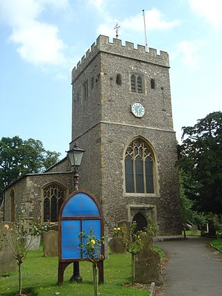
Little Missenden is a village and civil parish on the River Misbourne in Buckinghamshire, England. It is in the Chiltern Hills, about 3 miles (5 km) southeast of Great Missenden and 3 miles (5 km) west of Amersham. The village lies on the River Misbourne in the Misbourne valley.

<span class="mw-page-title-main">Meadle</span>

Meadle is a hamlet in the civil parish of Longwick-cum-Ilmer, in Buckinghamshire, England. It is located to the north of the village of Monks Risborough and near Little Kimble. The current population of Meadle is about 75. Most of the buildings are very old: farmhouses and labourers' cottages built in traditional red clay brick with thatched roofs. A small stream rises in the village and ultimately joins the Thames.

<span class="mw-page-title-main">Prestwood</span> Human settlement in England

Prestwood is a village in Buckinghamshire, England. It is located in the Chiltern Hills, about two miles west of Great Missenden and six miles north of High Wycombe.

<span class="mw-page-title-main">Radnage</span> Village in Buckinghamshire, England

Radnage is a village and civil parish in the Buckinghamshire district of Buckinghamshire, England. It is in the Chiltern Hills about two miles north east of Stokenchurch and six miles WNW of High Wycombe.

<span class="mw-page-title-main">Binfield Heath</span> Human settlement in England

Binfield Heath is a village and civil parish in South Oxfordshire, England, 2+12 miles (4 km) south-southwest of Henley-on-Thames and 3+12 miles (6 km) northeast of Reading on a southern knoll of the Chiltern Hills. The 2011 Census recorded the parish population as 709. The village has a Congregational Church, ground for polo, Michelin star chef-run restaurant, and public house. 12 of its 294 homes are listed buildings.

<span class="mw-page-title-main">Chiltern Open Air Museum</span> Attraction in Buckinghamshire, England

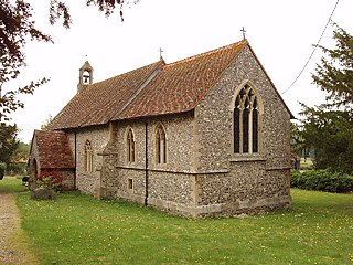
Chiltern Open Air Museum (COAM) is an independent open-air museum of vernacular buildings and a tourist attraction located near Chalfont St Peter and Chalfont St. Giles in the Chiltern Hills, Buckinghamshire, England. Its collection consists mainly of historic buildings at risk of demolition that have been dismantled and reconstructed in the museum grounds in a process of structure relocation.

<span class="mw-page-title-main">Knotty Green</span> Human settlement in England

Knotty Green was once a rural hamlet in the Buckinghamshire Chiltern Hills. It is characterised by large houses set in their own extensive grounds and though it remains within the civil parish of Penn today it has become contiguous with the market town of Beaconsfield. Houses in the area of Knotty Green are often some of the most expensive in the country with houses often exceeding 6,000 sq ft, and £3 million in value.

<span class="mw-page-title-main">Offley</span> Human settlement in England

Offley is a civil parish in the English county of Hertfordshire, between Hitchin and Luton. The main village is Great Offley, and the parish also contains the nearby hamlets of Little Offley and The Flints. In the south-west of the parish, near Luton, there are the hamlets of Cockernhoe, Mangrove Green and Tea Green, and also the Putteridge Bury estate; these have LU2 postcodes and 01582 telephone numbers.

<span class="mw-page-title-main">Woodcote</span> Village in Oxfordshire, England

Woodcote is a village and civil parish in South Oxfordshire, about 5 miles (8 km) southeast of Wallingford and about 7 miles (11 km) northwest of Reading, Berkshire. It is in the Chiltern Hills, and the highest part of the village is 600 feet (180 m) above sea level. Woodcote lies between the Goring Road and the A4074. It is centred on the village green and Church Farm, with the village hall centred on the crossroads.

<span class="mw-page-title-main">Ruscombe</span> Human settlement in England

Ruscombe is a village and civil parish, east of Twyford in the Borough of Wokingham in Berkshire, England.

<span class="mw-page-title-main">Lewknor</span> Human settlement in England

Lewknor is a village and civil parish about 5 miles (8 km) south of Thame in Oxfordshire.The civil parish includes the villages of Postcombe and South Weston. The 2011 Census recorded the parish's population as 663.

<span class="mw-page-title-main">Jarvis Hall, Steyning</span> Church in West Sussex , United Kingdom

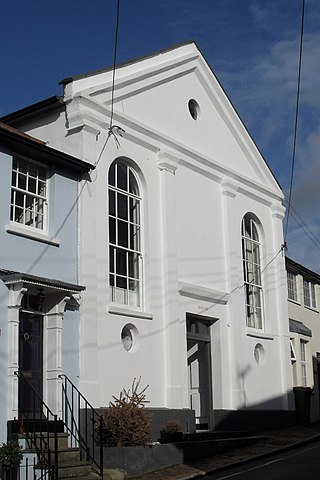
Jarvis Hall is a former Nonconformist chapel in the village of Steyning, in the Horsham district of the English county of West Sussex. Since its construction in 1835, the Classical-style building has been used by four different Nonconformist Christian denominations: the Countess of Huntingdon's Connexion, Wesleyan Methodists, the Salvation Army and Plymouth Brethren. The Brethren occupied it last and for the longest time. After about 150 years of religious use, it was sold for residential conversion. English Heritage has listed the former chapel at Grade II for its architectural and historical importance.

<span class="mw-page-title-main">Crowell, Oxfordshire</span> Human settlement in England

Crowell is a village and civil parish in Oxfordshire, about 4 miles (6.4 km) southeast of the market town of Thame and 1 mile (1.6 km) southwest of the village of Chinnor. The 2001 Census recorded the parish's population as 100. Crowell village is a spring line settlement at the source of a stream called the Pleck at the foot of the Chiltern Hills escarpment. The toponym "Crowell" is derived from the Old English for "crow's spring" or "crow's stream".

<span class="mw-page-title-main">Sutton Walmley and Minworth</span> Electoral ward in Birmingham, England

Sutton Walmley and Minworth is one of 69 electoral wards in Birmingham, England.

References

  1. "About – Jordans Village". Jordans Village Ltd. Retrieved 15 April 2016.
  2. "Home". Jordans Village.
  3. "Buckinghamshire Guide". Englands Christian Heritage. Archived from the original on 22 May 2010. Retrieved 20 December 2010.
  4. "The Mayflower after the Pilgrims". MayflowerHistory.com. Archived from the original on 24 September 2008. Retrieved 25 September 2008.
  5. "Washington Mayflower Peace Arch". Archived from the original on 11 October 2018. Retrieved 10 October 2018.
  6. "Prospectus". Archived from the original on 11 October 2018. Retrieved 10 October 2018.
  7. Timetable: Retrieved 11 August 2016.
  8. BBC.co.uk.