Sayyid is an honorific title of Hasanids and Husaynids Muslims, recognized as descendants of the Islamic prophet Muhammad through his grandsons, Hasan ibn Ali and Husayn ibn Ali, sons of Muhammad's daughter Fatima and his cousin and son-in-law Ali.
Muzaffarnagar is a city under Muzaffarnagar district in the Indian State of Uttar Pradesh. It is situated midway on the Delhi - Haridwar/Dehradun National Highway and is also well connected with the national railway network. It is known as the sugarbowl of Uttar Pradesh.

Saharanpur is a city and a municipal corporation in Uttar Pradesh, India. It is also the administrative headquarters of Saharanpur district.

Saharanpur district is the northernmost of the districts of Uttar Pradesh state, India. Bordering the states of Haryana, Himachal Pradesh and Uttarakhand, and close to the foothills of Shivalik range, it lies in the northern part of the Doab region.
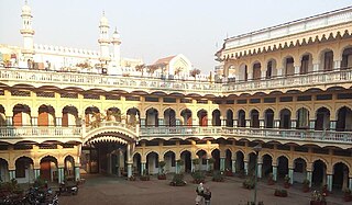
The Sultan ul Madaris Urdu: سُلطان المدارس; is a Shia Islamic Madrasa for higher religious education in Lucknow, India. Major course of studies include Jurisprudence, Theology and Islamic Literature.

Muzaffarnagar district is a district of Uttar Pradesh state in northern India. It is part of Saharanpur division. The city of Muzaffarnagar is the district headquarters. This district is the part of National Capital Region.

Bilgram is a town and a nagar palika parishad in Hardoi district in the state of Uttar Pradesh, India. It is located 16 miles (26 km) south of the city of Hardoi, on an elevated bluff that once formed the eastern bank of the Ganges. Important industries in Bilgram include ceramics and embroidery.
Jalali is a town and a nagar panchayat in Aligarh district in the Indian state of Uttar Pradesh.
Jansath is a town and a nagar panchayat in Muzaffarnagar district in the Indian state of Uttar Pradesh.
Jarwal is a town and a nagar panchayat in Bahraich district in the Indian state of Uttar Pradesh. It has an average elevation of 117 metres (383 feet). This place is 20 km away from historical Lodheshwar Mahadev Mandir located in Mahadeva Ram Nagar, that is well described in old mythological stories.
Jalalabad (Jalālābād) is a town and a nagar panchayat in Shamli district in the Indian state of Uttar Pradesh. It is a historical town situated on Delhi Saharanpur road. Dating back to the Mughal period, situated close to the borders of Haryana and Uttarakhand states, and surrounded by a very fertile agricultural region namely famous for plentiful yields in grains and fruits, Jalalabad is internationally famous for its wood carving work cottage industry. It is a thriving market of local agricultural produce, including basmati rice and mangoes. A variety of agro-based industrial enterprises - such as textile, sugar, paper and cigarette factories - are located around it. It is 41 km from Saharanpur and 40 km from Muzaffarnagar.
Mohan is a town and a nagar panchayat in Unnao district in the Indian state of Uttar Pradesh.

The Naqvis are people found predominantly in Iran, Iraq, and the South Asian countries. They claim descent from the Imam.
Mujhera is a village in the Jansath sub-division of Muzaffarnagar District in Uttar Pradesh. It is the seat of the Kundliwal branch of Sadaat-e-Bahra.
Hallaur or Hallor village is located in Domariyaganj Tehsil of Siddharthnagar district in Uttar Pradesh, India. Domariyaganj is the nearest town to Hallaur village.

The Sadaat Amroha or Amrohi Sayyid or Sayyid of Amroha are a community of Sayyids, historically settled in the town of Amroha, in the Indian state of Uttar Pradesh. Many members of the community migrated to Pakistan after independence and settled in Karachi, Sindh, Bewal - Rawalpindi - through Syed Dewan Shah Abdul Baqi Guzri Bewali bin Syed Abdul Wahid Guzri (Amroha) some descendants of whom settled in Azad Kashmir, from which some now also reside in the United Kingdom.

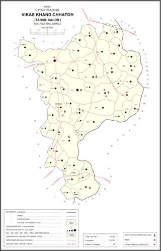
Nasirabad is a Nagar panchayat and a Gram Sabha in Chhatoh Block, Rae Bareli district in the state of Uttar Pradesh, India. It was declared a Nagar Panchayat in 2017. Located southeast of Jais on the road to Salon, Nasirabad is an old town partly built on an elevated area that covers the ruins of an ancient fort. It is one of the main Muslim centres in the district. Muslims make up about half the town's population, and the Shia and Sunni communities are both prominent. As of 2011, Nasirabad's population is 13,648, in 2,243 households. It is located 37 km from Raebareli the district headquarters. It is the headquarters of a nyaya panchayat that also includes 6 other villages.
Jamiul Uloom Jawadia, also known as Jawadia Arabic College, is a Deeni Madarasa of Shia Muslims in Banaras (Varanasi) India. Major course of studies include Jurisprudence, Theology and Islamic Literature.
The Abaqati family is a sub-branch of the Jarwal-Kintoor branch of Nishapuri Kazmi-Musavi Sayeds who trace their lineage to the Islamic prophet Muhammad through the eldest son of the great-grandson of Musa al-Kadhim, he was given a jagir in Jarwal-Kintoor by Sultan Muhammad Tughluq, his other two brothers were given jagirs in Budgam, Kashmir and Sylhet, Bengal.

The Barha dynasty was a Shi'a Indian Muslim dynasty that was influential in India during the era of Delhi Sultanate and Mughal Empire.


