Related Research Articles

Juan Bautista de Anza Bezerra Nieto was an expeditionary leader, military officer, and politician primarily in California and New Mexico under the Spanish Empire. He is credited as one of the founding fathers of Spanish California and served as an official within New Spain as Governor of the Province of New Mexico.

A presidio was a fortified base established by the Spanish Empire between the 16th and 18th centuries in areas in of their control or influence. The term is derived from the Latin word praesidium meaning protection or defense.
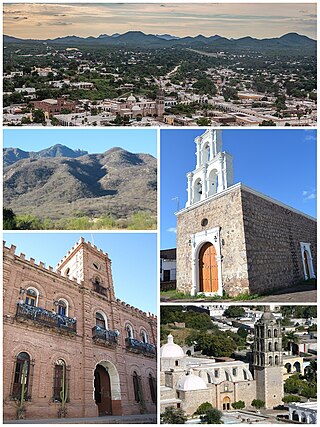
Álamos is a town in Álamos Municipality in the Mexican state of Sonora, in northwestern Mexico.

New Navarre was at first an informal name given to the silver-mining region north of Sinaloa. Just before his death in 1711, the Jesuit Eusebio Kino drew a map of the area with that name. Nuevo Navarre would have included the Pimeria Alta, where Kino spent 24 years establishing missions, along with the Navarrese Juan Matheo Manje. Later Nueva Navarra was a province in the Provincias Internas, one of the frontier provinces of the Viceroyalty of New Spain. Brigadier Pedro de Rivera, who visited the northern presidios from 1724 to 1728, suggested to the viceroy Juan de Acuña, Marquis of Casafuerte, the political and administrative reorganization of the northwest provinces. The viceroy supported the idea, and it was approved by Philip V of Spain in 1732, and executed the following year with the appointment of the first governor, Manuel Bernal de Huidobro, at that time mayor of Sinaloa. In the branches of government, finance and war, the governor was directly subject to the viceroy, while the field of justice was under the jurisdiction of the Royal Audience of Guadalajara of the Viceroyalty of New Spain. By 1806, the province was generally recognized as Sonora or Nueva Navarra, with the capital in Arizpe, and including the area comprising Sinaloa. After Independence Sonora y Sinaloa became one of the constituent states of the Mexican Republic. The Sonoran Desert ecoregion covers much of the state.

Francisco Hermenegildo Tomás GarcésO.F.M. was a Spanish Franciscan friar who served as a missionary and explorer in the colonial Viceroyalty of New Spain. He explored much of the southwestern region of North America, including present day Sonora and Baja California in Mexico, and the U.S. states of Arizona and California. He was killed along with his companion friars during an uprising by the Native American population, and they have been declared martyrs for the faith by the Catholic Church. The cause for his canonization was opened by the Church.

The Juan Bautista de Anza National Historic Trail is a 1,210-mile (1,950 km) trail extending from Nogales on the U.S.-Mexico border in Arizona, through the California desert and coastal areas in Southern California and the Central Coast region to San Francisco. The trail commemorates the 1775–1776 land route that Spanish commander Juan Bautista de Anza took from the Sonora y Sinaloa Province of New Spain in Colonial Mexico through to Las Californias Province. The goal of the trip was to establish a mission and presidio on the San Francisco Bay. The trail was an attempt to ease the course of Spanish colonization of California by establishing a major land route north for many to follow. It was used for about five years before being closed by the Quechan (Yuma) Indians in 1781 and kept closed for the next 40 years. It is a National Historic Trail administered by the National Park Service and was also designated a National Millennium Trail.

Tumacácori National Historical Park is located in the upper Santa Cruz River Valley in Santa Cruz County, southern Arizona. The park consists of 360 acres (1.5 km2) in three separate units. The park protects the ruins of three Spanish mission communities, two of which are National Historic Landmark sites. It also contains the landmark 1937 Tumacácori Museum building, also a National Historic Landmark.

Tubac Presidio State Historic Park, located in Tubac, Arizona, US, preserves the ruins of the Presidio San Ignacio de Tubac and various other buildings, thereby presenting a timeline of European settlement in this Southern Arizona town. The park contains a museum, a number of historic sites, an underground archeology exhibit displaying the excavated foundations of the Tubac Presidio, and a picnic area. Various cultural events are held on-site throughout the year, including Anza Days (October), Los Tubaqueños living history presentations, archeological tours, and nature walks. Until recently, the park was administered by Arizona State Parks but is the first park in the Arizona state park system. As a result of budget cutbacks, the Tubac Presidio was scheduled to be closed in 2010, but was rescued by local residents and the Tubac Historical Society. It is now operated by The Friends of the Presidio and staffed with dedicated volunteers.
Mission Los Santos Ángeles de Guevavi was founded by Jesuit missionary Fathers Kino and Salvatierra in 1691 as La Misión de San Gabriel de Guevavi, a district headquarters in what is now Arizona, near Tumacácori. Subsequent missionaries called it San Rafael and San Miguel, resulting in the common historical name of Los Santos Ángeles de Guevavi.

Mission San Cayetano de Calabazas, also known as Calabasas, is a Spanish Mission in the Sonoran Desert, located near present-day Tumacacori, Arizona, United States. The Mission was named for the Italian Saint Cajetan.
The Free Company of Volunteers of Catalonia was a military company of the Spanish Army serving in the Spanish colonial empire.
Arizpe is a small town and the municipal seat of the Arizpe Municipality in the north of the Mexican state of Sonora. It is located at 30°20'"N 110°09'"W. The area of the municipality is 2,806.78 sq.km. The population in 2005 was 2,959 of which 1,743 lived in the municipal seat as of the 2000 census.
Fronteras is the seat of Fronteras Municipality in the northeastern part of the Mexican state of Sonora. Frontera translates as Border. The elevation is 1,120 meters and neighboring municipalities are Agua Prieta, Nacozari and Bacoachi. The area is 2839.62 km2, which represents 1.53% of the state total.

Planchas de Plata, sometimes called Bolas de Plata is a historic silver-mining district near Nogales, Sonora, Mexico, and a few miles south of the border with the US state of Arizona. Native silver was discovered here in 1736 by Antonio Siraumea, a Yaqui Indian, on the Rancho Arizona of Bernardo de Urrea. Historian Donald Garate believes Urrea's Arizona Ranch to be the likely source of the name of the present US state of Arizona, and he claimed the origin of the name of the ranch was the Basque phrase "aritz ona". Other historians have, however, debated this. For more detail on the etymology of the name Arizona, see Arizona.
Toward the end of last October, between the Guevavi Mission and the ranchería called Arizona, some balls and slabs of silver were discovered, one of which weighed more than one hundred arrobas, a sample of which I am sending to you, Most Illustrious Lord. --Captain Juan Bautista de Anza to Bishop Benito Crespo, January 7, 1737.

The Presidio of San Ignacio de Túbac or Fort Tubac was a Spanish built fortress. The fortification was established by the Spanish Army in 1752 at the site of present-day Tubac, Arizona. Its ruins are preserved in the Tubac Presidio State Historic Park.

The Apache–Mexico Wars, or the Mexican Apache Wars, refer to the conflicts between Spanish or Mexican forces and the Apache peoples. The wars began in the 1600s with the arrival of Spanish colonists in present-day New Mexico. War between the Mexicans and the Apache was especially intense from 1831 into the 1850s. Thereafter, Mexican operations against the Apache coincided with the Apache Wars of the United States, such as during the Victorio Campaign. Mexico continued to operate against hostile Apache bands as late as 1915.

Antonio Pascual Narbona was a Spanish soldier from Mobile (Mauvila in Spanish) now in Alabama, who fought native American people in the northern part of Mexico around the turn of the nineteenth century. He supported the independence of Mexico from Spain in 1821. He was Governor of the territory of Santa Fe de Nuevo México from September 1825 until 1827.
Domingo Jironza Pétriz de Cruzate was a Spanish soldier who was Governor of New Mexico from 1683 to 1686, and again from 1689 to 1691. He came to office at a time a large part of the province of Santa Fe de Nuevo México was independent of Spanish rule due to the Pueblo Revolt. With limited resources, he was unable to reconquer the province.
Real de San Juan Bautista de Sonora was the location of one of the first silver mines in Sonora, then part of New Spain. Now ruined, it lies near to the town of Cumpas, founded in 1643 by the Jesuit missionary Egidio Monteffio.

Calabasas is a former populated place or ghost town, within the Census-designated place of Rio Rico, a suburb of Nogales in Santa Cruz County, Arizona.
References
- 1 2 Garate, Donald T. (2003). Juan Bautista de Anza: Basque Explorer in the New World, 1693-1740. Reno, Nevada: University of Nevada Press. p. [Preface] xiii. ISBN 0874176263.
- ↑ Tato, Manuel Estevan (2 February 1741). Statement, Basochuca (Report) (in Spanish). University of Texas, El Paso Manuscript Collection - informes militares, miscelaneas, matrimonios, entierros de Janos, Chihuahua, 1700-1835, one unnumbered folio; and Arizpe Mission Records, AZU 811, Roll 11.
[The] family moved to the family holdings at Basochuca after the death of Juan Bautista de Anza.