K Street Bridge

Last updated
The K Street Bridge in 1993. The near parts of the circular ramps were intended to connect to the unbuilt North Leg of the Inner Loop Expressway and have since been demolished. AERIAL VIEW OF WHITEHURST FREEWAY AND K STREET OVERPASS, LOOKING WEST - Rock Creek and Potomac Parkway, Washington, District of Columbia, DC HABS DC,WASH,686-5.tif
The K Street Bridge in 1993. The near parts of the circular ramps were intended to connect to the unbuilt North Leg of the Inner Loop Expressway and have since been demolished.
The span crossing Rock Creek in 2015. The three portions of the bridge built at different times are clearly distinguishable. K Street Bridge detail 2015.jpg
The span crossing Rock Creek in 2015. The three portions of the bridge built at different times are clearly distinguishable.

The K Street Bridge is a complex of bridges over Rock Creek and the Rock Creek and Potomac Parkway in Washington, D.C. The lower level of the bridge carries the surface street K Street, while the upper level carries the Whitehurst Freeway (U.S. Route 29) which terminates and merges into K Street immediately east of the bridge. The central bridge is flanked by two flyover ramps that connect to the nearby terminus of Interstate 66. [1] [2]

Contents

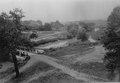
The first bridge on the site was a stone arch bridge constructed in 1792; it was only the second crossing of Rock Creek built, the first being at M Street. This bridge was found to be unstable and its center arch was demolished in 1795. In 1869, a wood bridge was constructed, and in 1907 it was replaced by a steel-plate girder bridge. [1]

The completion of the Rock Creek and Potomac Parkway in 1936 increased traffic on the K Street Bridge, necessitating its replacement. The lower level of the current bridge was constructed between 1939 and 1941, and the upper level, connecting to the Whitehurst Freeway, was constructed from 1947 to 1949. The designers of the current K Street Bridge also designed the Charles C. Glover Memorial Bridge farther up the river. The bridge is built of concrete, faced with gneiss. [1] The flanking ramps were constructed in the early 1960s. They initially contained unused branches intended to connect to the unbuilt North Leg of the Inner Loop Expressway. These ramps were demolished in the mid-1990s. [3] [4]

The bulk of the K Street Bridge, with its many ramps, was considered to be more of a visual barrier than the other bridges across Rock Creek. [1] This was a result of transportation efficiency taking precedence over aesthetic concerns in this case, perhaps because at the time of its construction the surrounding neighborhoods were industrial or poor residential areas. [3]

See also

Related Research Articles

Route 110, consisting of State Route 110 and Interstate 110 (I-110), is a state and auxiliary Interstate Highway in the Los Angeles metropolitan area of the U.S. state of California. The entire route connects San Pedro and the Port of Los Angeles with Downtown Los Angeles and Pasadena. The southern segment from San Pedro to Interstate 10 in downtown Los Angeles is signed as I-110, while the northern segment to Pasadena is signed as SR 110. The entire length of I-110, as well as SR 110 south of the Four Level Interchange with US 101, is the Harbor Freeway, and SR 110 north from US 101 to Pasadena is the historic Arroyo Seco Parkway, the first freeway in the western United States. I-110 is one of two 3-digit interstate designations to appear on opposite coasts; I-280 in California and New Jersey is the other.

The Capital Beltway is a 64-mile (103 km) Interstate Highway that surrounds Washington, D.C., the capital of the United States, and its inner suburbs in adjacent Maryland and Virginia. It is the basis of the phrase "inside the Beltway", used when referring to issues dealing with U.S. government and politics. The highway is signed as Interstate 495 (I-495) for its entire length, and its southern and eastern half runs concurrently with I-95.

Interstate 295 (I-295) in the U.S. state of Maryland and in Washington, D.C., also known as the Anacostia Freeway, is a 8.05-mile (12.96 km) spur route connecting I-95 / I-495 and Maryland Route 210 near the Potomac River to Interstate 695 and D.C. Route 295 in the Anacostia neighborhood of Washington, D.C.

Rock Creek and Potomac Parkway Parkway in Washington D.C.

The Rock Creek and Potomac Parkway, often known simply as the Rock Creek Parkway, is a parkway maintained by the National Park Service as part of Rock Creek Park in Washington, D.C. It runs next to the Potomac River and Rock Creek in a generally north–south direction, carrying four lanes of traffic from the Lincoln Memorial and Arlington Memorial Bridge north to a junction with Beach Drive near Connecticut Avenue at Calvert Street, N.W., just south of the National Zoological Park.

The George Washington Memorial Parkway, colloquially the G.W. Parkway, is a 25-mile-long (40 km) parkway that runs along the south bank of the Potomac River from Mount Vernon, Virginia, northwest to McLean, Virginia, and is maintained by the National Park Service (NPS). It is located almost entirely within Virginia, except for a short portion of the parkway northwest of the Arlington Memorial Bridge that passes over Columbia Island within the District of Columbia.

Theodore Roosevelt Bridge

The Theodore Roosevelt Bridge is a bridge crossing the Potomac River which connects Washington, D.C., with the Commonwealth of Virginia. The bridge crosses over Theodore Roosevelt Island, and carries Interstate 66/U.S. Route 50. The center lane in the bridge is reversible; the middle barrier is moved with a barrier transfer machine. It’s operated eastbound during the morning rush hour from 6-11 am. The bridge is named in honor of Theodore Roosevelt, the 26th President of the United States.

Key Bridge (Washington, D.C.) United States historic place

The Francis Scott Key Bridge, more commonly known as the Key Bridge, is a six-lane reinforced concrete arch bridge conveying U.S. Route 29 (US 29) traffic across the Potomac River between the Rosslyn neighborhood of Arlington County, Virginia, and the Georgetown neighborhood of Washington, D.C. Completed in 1923, it is Washington's oldest surviving road bridge across the Potomac River.

Clara Barton Parkway Parkway in Maryland and Washington D.C.

Clara Barton Parkway is an automobile parkway in the U.S. state of Maryland and the District of Columbia. The highway runs 6.8 miles (10.9 km) from MacArthur Boulevard in Carderock, Maryland, east to Canal Road at the Chain Bridge in Washington. Clara Barton Parkway is a two- to four-lane parkway that parallels the Potomac River in southwestern Montgomery County, Maryland, and the far western corner of Washington. The parkway provides access to the communities of Cabin John and Glen Echo and several units of the Chesapeake and Ohio Canal National Historical Park. The Maryland portion of the George Washington Memorial Parkway was constructed from Carderock past Interstate 495 (I-495) to Glen Echo in the early to mid-1960s. The parkway was proposed to continue west to Great Falls and east to Georgetown. However, these proposals never came to fruition and the parkway was extended only to the Chain Bridge in the early 1970s. The Maryland portion of the George Washington Memorial Parkway was renamed for Clara Barton, the founder of the American Red Cross, in 1989.

Dumbarton Bridge (Washington, D.C.) United States historic place

The Dumbarton Bridge, also known as the Q Street Bridge and the Buffalo Bridge, is a historic masonry arch bridge in Washington, D.C.

The Inner Loop was two planned freeways around downtown Washington, D.C. The innermost loop would have formed an oval centered on the White House, with a central freeway connecting the southern segment to the northern segment and then continuing on to Interstate 95. Interstate 95 would have met Interstate 66, Interstate 295, Interstate 695, and US 50 while traversing the Inner Loop. A second loop was an arc across the northern section of the city, beginning at East Capitol Street at the Anacostia River and using the Missouri Avenue NW and Nebraska Avenue NW commercial corridors to terminate in Georgetown.

U.S. Route 29 (US 29) in the District of Columbia is a U.S. highway which enters D.C. via Key Bridge from Arlington, Virginia, and exits at Silver Spring, Maryland. It predominantly follows city surface streets, although the portion of the route from Key Bridge east to 26th Street NW is an elevated highway. The elevated section of U.S. Route 29 in D.C. is better known as the Whitehurst Freeway. Called the city's most ridiculed bridge in 1989, there have been several attempts to have the Whitehurst Freeway torn down but cost and other considerations have stopped these proposals from being acted on.

P Street Bridge

The P Street Bridge or Lauzun's Legion Bridge is a 336-foot (102 m) concrete arch bridge that conveys P Street across Rock Creek and Rock Creek Park between the Georgetown and Dupont Circle neighborhoods of Northwest Washington, D.C. The first bridge at this site was constructed in 1855 and was replaced in 1935 by the current structure.

M Street Bridge

The M Street Bridge, also known as the M Street Overpass, carries M Street across Rock Creek and the Rock Creek and Potomac Parkway. It lies between the neighborhoods of Georgetown and Foggy Bottom in Northwest Washington, D.C. The non-arched design of the bridge contrasts with that of all the other bridges rising over the parkway.

Charles C. Glover Memorial Bridge

The Charles C. Glover Memorial Bridge or Massachusetts Avenue Bridge in Northwest Washington, D.C. conveys Massachusetts Avenue over Rock Creek and Rock Creek Park. The concrete arch bridge was constructed in 1939–41 and has a length of 386.2 feet (117.7 m).

Pennsylvania Avenue Bridge

The Pennsylvania Avenue Bridge conveys Pennsylvania Avenue across Rock Creek and the adjoining Rock Creek and Potomac Parkway, between the neighborhoods of Georgetown and Foggy Bottom in Northwest Washington, D.C. Pennsylvania Avenue terminates at M Street immediately west of the bridge.

Boulder Bridge United States historic place

The Boulder Bridge is a historic bridge located in the Washington, D.C. portion of Rock Creek Park, an urban national park listed on the National Register of Historic Places.

Shoreham Hill Bridge

The Shoreham Hill Bridge is a bridge carrying the Rock Creek and Potomac Parkway across Rock Creek in Washington, DC. It is the most upstream of three bridges where the Rock Creek and Potomac Parkway switches from one side of the river to the other, the others being the bridge near P Street and the L Street Bridge.

L Street Bridge

The L Street Bridge is a bridge carrying the Rock Creek and Potomac Parkway over Rock Creek in Washington, D.C. It is the most downstream of three bridges where the Parkway switches from one side of the river to the other, the others being the bridge near P Street and the Shoreham Hill Bridge. Despite its name, the bridge does not carry or cross L Street, but it is adjacent to L Street's western terminus.

Rock Creek and Potomac Parkway Bridge near P Street

The Rock Creek and Potomac Parkway Bridge near P Street is a bridge carrying the Rock Creek and Potomac Parkway across Rock Creek in Washington, DC. It is the middle of three bridges where the Rock Creek and Potomac Parkway switches from one side of the river to the other, the others being the L Street Bridge and the Shoreham Hill Bridge. The bridge is near the site of a historical river ford used by French soldiers traveling to Yorktown in 1781. The bridge is reinforced concrete faced in mica schist.

References

  1. 1 2 3 4 Ross, Amy (1992). Historic American Engineering Record (HAER) No. DC-20, " K Street Bridge " History and Description
  2. Historic American Buildings Survey (HABS) No. DC-697, " Rock Creek & Potomac Parkway " (Drawing 10)
  3. 1 2 Davis, Timothy (1992). Historic American Engineering Record (HAER) No. DC-697, " Rock Creek and Potomac Parkway " History and Description, pp. 13, 109, 125
  4. "Interstate 66". AARoads. Retrieved 20 April 2015.

Coordinates: 38°54′09″N77°03′28″W / 38.902531°N 77.057725°W / 38.902531; -77.057725