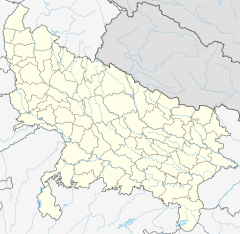
The Karmanasa River is a tributary of the Ganges. It originates in Kaimur district of Bihar and flows through the Indian states of Uttar Pradesh and Bihar. Along the boundary between Uttar Pradesh and Bihar it has the districts of Sonbhadra, Chandauli, Varanasi and Ghazipur on its left ; and the districts of Kaimur and Buxar on its right.
The Berach River, a tributary of the Banas River, is a river of Rajasthan state in western India. The river belongs to the Ganga River basin. The Berach originates in the hills of Udaipur district, northeast of Udaipur, and has a length of 157 km and basin area of 7,502 km². It flows northeast through Udaipur, Chittorgarh and Bhilwara districts, joining the Banas near Bigod village of Bhilwara district.
The Dhasan River is a river in central India. A right bank tributary of the Betwa River, it originates in Begumganj tehsil.

The Burhi Gandak River is a tributary of the Ganges. The Burhi (“Old”) Gandak flows parallel to and east of the Gandak River in an old channel.

The Linganamakki Dam was constructed by the Karnataka State Government in 1964. Located in the Kargal village of Sagara taluk, the dam has a length of 2.74 kilometres (1.70 mi) stretching across the Sharavathi river. It is located about 9 km from Jog Falls. It has an effective storage capacity of 4.29 cubic kms or 151.52 tmc ft of water. This dam too is basically used for generation of hydro electricity like Supa dam.
Ramganga is a tributary of the river Ganges, originating in Uttarakhand state, India.
Ong River is a tributary of Mahanadi river. It flows across Odisha and joins Mahanadi 240 km (150 mi) upstream of Sonepur where Tel merges. The river rises at an elevation of 457 m (1,499 ft) and runs 204 km (127 mi) before it meets Mahanadi. It drains an area of about 5,128 km2 (1,980 sq mi).

Sondur Dam is located in Dhamtari District of Chhattisgarh in India. It was constructed in 1988 across Sondur River. The catchment area of the Sondur river up to the dam is 518 km2.
The Mand River is a tributary of the Mahanadi in India. It joins the Mahanadi in Chandarpur, in Chhattisgarh, 28 km from the Odisha border and before the river reaches the Hirakud Dam.
Dudhawa Dam is located in Kanker district of Chhattisgarh in India. The construction of the dam began in 1953 and finished in 1964. It is built across the Mahanadi river in the village of Dudhawa, 21 km from Sihawa and 29 km from Kanker. The height of the dam is 24.53 m and the length 2,906.43 m. The reservoir has a catchment area of 625.27 km2. This is one of earthen dams, of which right flank embankment, there is rest house.
The Kiul River is a tributary of Ganges. It originates in Giridih of Jharkhand and flows through Lakhisarai, Sheikhpura and Jamui districts of the Indian state of Bihar and joins Harohar river in the Diara region.

The Kali River, commonly known as Kali Nadi, originates in the Upper Sivaliks and passes through Saharanpur, Muzaffarnagar and Baghpat districts, before merging with Hindon River, which goes on to merge with the Yamuna River, which itself goes to merge with the Ganga River, which finally merges with the Bay of Bengal. The total length of the river from its origin up to its confluence with the Hindon river is 150 km. The river is named Kali, because of the Hindu Goddess Kali.

The Punpun River is a tributary of the Ganges. It originates in Palamu district of Jharkhand and flows through Chatra, Aurangabad, Gaya and Patna districts of the Indian states of Jharkhand and Bihar. Punpun is a place named after the Punpun river in Patna which is situated on the bank of Punpun river. On the bank of Punpun people celebrate Chhath Puja.
Sukli is a river flowing through Chittorgarh district, Rajasthan, India. Karmai and Sukli are the major tributaries of the Jakham river. Sukli Dam was built on this river.
The Pashulok Barrage is a barrage located on the Ganges River just south of Rishikesh in Dehradun district, Uttarakhand, India.
Kedarnath Glacier is located in Garhwal Himalaya mountain ranges, in the state of Uttarakhand, India.
Arunavati river is a seasonal tributary of the Tapi river in India. It originates and flows from the Sangvi village and merges into the Tapi river near Uparpind village in Shirpur tehsil. The river flows mostly in monsoon.
The Ujh river is a tributary of the Ravi River that flows through the Pathankot in the Indian state

Sei Dam is an earthen gravity dam on the Sei River, a tributary of Sabarmati River, in Kotra tehsil in Udaipur district of Rajasthan, India. The primary purpose of the dam is to store water to be diverted to the Jawai Dam on the [[�Jawai River|Jawai River]] in Pali district.
The Panam Dam is constructed over the Panam River in India. It is located at Santrampur Taluka of Mahisagar district in Gujarat state. Panam is a tributary of the Mahi River, it originates from Devgadh Baria Taluka of Dahod district. The Panam river merges with the Mahi river 25 kilometres (16 mi) downstream of the Panam Dam.


