Kelakam Kélakam | |
|---|---|
 Kelakam | |
| Coordinates: 13°33′22″N11°44′27″E / 13.55611°N 11.74083°E | |
| Country | |
| Region | Diffa |
| Department | Maïné-Soroa |
Kelakam is a town in the Diffa Region, Maine-Soroa Department of southeastern Niger.
Kelakam Kélakam | |
|---|---|
| Kelakam | |
| Coordinates: 13°33′22″N11°44′27″E / 13.55611°N 11.74083°E | |
| Country | |
| Region | Diffa |
| Department | Maïné-Soroa |
Kelakam is a town in the Diffa Region, Maine-Soroa Department of southeastern Niger.
It lies on the RN1 east–west highway of which runs between Diffa and Niamey, about halfway between the larger towns of Goudoumaria to the west and Maine-Soroa to the southeast. The town lies around 150 km west-northwest from the regional capital of Diffa.
Situated in the Sahel region, the area around Kelakam is used for stock raising (cattle, goats, camels) [1] much of which involves seasonal transhumance, and intensive farming of cuvettes—rocky sinkholes which collect water in an otherwise dry land. Kelakam hosts a Saturday market. [2]
Kelakam is one site of ethnic Fula [3] pastoralist cooperatives formed as part of the UNDP "Nguigmi Peace Project". The project is designed to re-integrate former refugees and combatants from long simmering ethnic conflicts between Fula herders, and their Diffa Arab and Daza/Tubu neighbours over pasturage, water, and other land use. Fula pastoralists based around the town raise sheep and goats, and produce cheese and other agricultural products. [4]
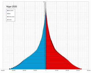
The demographic features of Nigeriens, the people of Niger consist of population density, ethnicity, education level, health of the populace, economic status, religious affiliations and other aspects of the population.
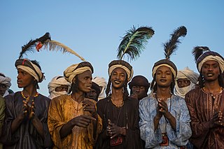
The Fula, Fulani, or Fulɓe people are an ethnic group in Sahara, Sahel and West Africa, widely dispersed across the region. Inhabiting many countries, they live mainly in West Africa and northern parts of Central Africa, South Sudan, Darfur, and regions near the Red Sea coast in Sudan. The approximate number of Fula people is unknown, due to clashing definitions regarding Fula ethnicity. Various estimates put the figure between 25 and 40 million people worldwide.

The music of Niger has developed from the musical traditions of a mix of ethnic groups; Hausa, the Zarma-Songhai, Tuareg, Fula, Kanuri, Toubou, Diffa Arabs and Gurma and the Boudouma from Lac Chad.
Diffa is a city and Urban Commune in the extreme southeast of Niger, near the border with Nigeria. It is the administrative seat of both Diffa Region, and the smaller Diffa Department. As of 2012, the commune had a total population of 56,437 people.

The regions of Niger are subdivided into 63 departments. Before the devolution program on 1999–2005, these departments were styled arrondissements. Confusingly, the next level up (regions) had, before 2002-2005 been styled departments. Prior to a revision in 2011, there had been 36 departments. Until 2010, arrondissements remained a proposed subdivision of departments, though none were used. The decentralisation process, begun in the 1995-1999 period replaced appointed Prefects at Departmental or Arrondissement level with elected councils, first elected in 1999. These were the first local elections held in the history of Niger. Officials elected at commune level are then selected as representatives at Departmental, regional, and National level councils and administration. The Ministry of Decentralisation was created to oversee this task, and to create a national consultative council of local officials.

Mopti is a town and an urban commune in the Inner Niger Delta region of Mali. The town is the capital of the Mopti Cercle and the Mopti Region. Situated 630 km northeast of Bamako, the town lies at the confluence of the Niger and the Bani Rivers and is linked by an elevated causeway to the town of Sévaré. The urban commune, which includes both Mopti and Sévaré, had a population of 114,296 in the 2009 census.

Diffa is one of the seven Regions of Niger, located in the southeast of the country. The capital of the region is Diffa.

Madaoua is a town and urban commune located in the Tahoua Region of Niger. It has a population of 127,254. It is seat of the Madaoua Department, forming the southwest corner of the Region, and is an Urban Commune.

Dongondoutchi is a commune in Niger. It is located about 300 km east of the capital Niamey and 40 km from the Nigerian border. It lies on national route 1 which links the capital to the towns of Maradi and Zinder to the east and the RN25 heading to north to Tahoua, Agadez and Arlit.
Goundam is a commune and town in north central Mali, in the Tombouctou Region. It is the capital of Goundam Cercle, one of five subdivisions of the Region. In the 2009 census the commune had a population of 16,253. The main ethnic groups are Songhay, Tuareg and Fulani.
The Departments of Niger are subdivided into communes. As of 2005, in the seven Regions and one Capital Area, there were 36 départements, divided into 265 communes, 122 cantons and 81 groupements. The latter two categories cover all areas not covered by Urban Communes or Rural Communes, and are governed by the Department, whereas Communes have elected councils and mayors. Additional semi-autonomous sub-divisions include Sultanates, Provinces and Tribes (tribus). The Nigerien government estimates there are an additional 17000 Villages administered by Rural Communes, while there are over 100 Quartiers administered by Urban Communes.

Goure is a Commune and town in southeastern Niger, Zinder Region, Goure Department, of which it is the seat. As of 2012, it had a population of 73,732.
Goudoumaria, Niger is a Commune and town in the southeast of the country, in Diffa Region, northwest of Diffa. Goudoumaria is an administrative post in the Maine-Soroa Department, and is approximately 50 km north of the Nigerian border and approximately 50 km east of the small city Soubdou.

Mainé-Soroa is a department of the Diffa Region in Niger. Its capital lies at the city of Mainé-Soroa.
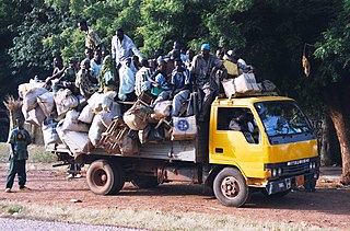
Seasonal migration, locally called the Exode, plays an important part of the economic and cultural life of the West African nation of Niger. While it is a common practice in many nations, Niger sees as much as a third of its rural population travel for seasonal labour, during the Sahelian nation's long dry season. Common patterns of seasonal travel have been built up over hundreds of years, and destinations and work vary by community and ethnic group.
The Kurtey people are a small ethnic group found along the Niger River valley in parts of the West African nations of Niger, Benin, Mali, and Nigeria. They are also found in considerable numbers in Ghana, Togo, Ivory Coast, and Burkina Faso.
Bankilaré is a village and rural commune in Niger. Bankilaré commune, centered on the town of the same name, is in Téra Department, Tillabéri Region, in the northwestern corner of the country. The town lies 60 km north of Departmental capital Téra, and around the same distance from the Burkina Faso border and the Mali border. As of 2012, it had a population of 84,893.

Harikanassou is a large village and rural commune in the Boboye Department of the Dosso Region of southwest Niger, 90.7 kilometres (56.4 mi) by road southeast of the capital of Niamey. At the time of the 2012 census, the rural community had 23,567 residents living in 3,340 households. Onion cultivation is a chief source of income for many, along with the cultivation of lettuce, beans, squashes, and tomatoes.
N'Guelbély is a village and rural commune in Niger.