Kensington, Minnesota

Last updated

Kensington
Douglas County Minnesota Incorporated and Unincorporated areas Kensington Highlighted.svg
Location of Kensington, Minnesota
Coordinates: 45°46′40″N95°41′44″W / 45.77778°N 95.69556°W / 45.77778; -95.69556
CountryUnited States
State Minnesota
County Douglas
Founded1887
Incorporated1891
Government
Area
[1]
  Total0.36 sq mi (0.93 km2)
  Land0.36 sq mi (0.93 km2)
  Water0.00 sq mi (0.00 km2)
Elevation
[2]
1,309 ft (399 m)
Population
 (2020) [3]
  Total266
  Estimate 
(2021) [4]
272
  Density743.02/sq mi (287.13/km2)
Time zone UTC-6 (CST)
  Summer (DST) UTC-5 (CDT)
ZIP code
56343
Area code 320
FIPS code 27-32768 [5]
GNIS feature ID2395510 [2]
Website kensingtonmn.com

Kensington is a city in Douglas County, Minnesota, United States. The population was 266 at the 2020 census. [3] The city is notable in Minnesota history for being the place where the Kensington Runestone was first displayed. It is now at a museum in nearby Alexandria, Minnesota.

Contents

History

Kensington was platted in 1887, and named after Kensington, in London. [6] A post office has been in operation in Kensington since 1887. [7] Kensington was incorporated in 1891. [6]

Geography

According to the United States Census Bureau, the city has an area of 0.36 square miles (0.93 km2), all land. [8]

Minnesota State Highway 55 serves as a main route in the community.

Demographics

Historical population
CensusPop.Note
1900 207
1910 24417.9%
1920 2523.3%
1930 28312.3%
1940 33719.1%
1950 3545.0%
1960 324−8.5%
1970 308−4.9%
1980 3317.5%
1990 295−10.9%
2000 286−3.1%
2010 2922.1%
2020 266−8.9%
2021 (est.)272 [4] 2.3%
U.S. Decennial Census [9]
2020 Census [3]

2010 census

As of the census of 2010, there were 292 people, 137 households, and 75 families residing in the city. The population density was 811.1 inhabitants per square mile (313.2/km2). There were 147 housing units at an average density of 408.3 per square mile (157.6/km2). The racial makeup of the city was 96.9% White, 0.3% African American, 1.0% Native American, 0.3% from other races, and 1.4% from two or more races. Hispanic or Latino of any race were 2.7% of the population.

There were 137 households, of which 23.4% had children under the age of 18 living with them, 44.5% were married couples living together, 8.8% had a female householder with no husband present, 1.5% had a male householder with no wife present, and 45.3% were non-families. 40.9% of all households were made up of individuals, and 17.5% had someone living alone who was 65 years of age or older. The average household size was 2.13 and the average family size was 2.89.

The median age in the city was 40.3 years. 20.2% of residents were under the age of 18; 8.4% were between the ages of 18 and 24; 26.7% were from 25 to 44; 27.1% were from 45 to 64; and 17.5% were 65 years of age or older. The gender makeup of the city was 50.3% male and 49.7% female.

2000 census

As of the census of 2000, there were 286 people, 132 households, and 67 families residing in the city. The population density was 1,093.9 inhabitants per square mile (422.4/km2). There were 148 housing units at an average density of 566.1 per square mile (218.6/km2). The racial makeup of the city was 97.55% White, 0.35% African American, 0.35% Native American, and 1.75% from two or more races. 35.4% were of German, 30.0% Norwegian, 8.7% Swedish and 5.3% Irish ancestry according to Census 2000.

There were 132 households, out of which 28.8% had children under the age of 18 living with them, 39.4% were married couples living together, 8.3% had a female householder with no husband present, and 49.2% were non-families. 40.9% of all households were made up of individuals, and 22.7% had someone living alone who was 65 years of age or older. The average household size was 2.17 and the average family size was 3.03.

In the city, the population was spread out, with 24.8% under the age of 18, 10.8% from 18 to 24, 26.2% from 25 to 44, 18.2% from 45 to 64, and 19.9% who were 65 years of age or older. The median age was 37 years. For every 100 females, there were 95.9 males. For every 100 females age 18 and over, there were 93.7 males.

The median income for a household in the city was $31,979, and the median income for a family was $39,750. Males had a median income of $26,250 versus $22,500 for females. The per capita income for the city was $14,932. About 5.1% of families and 14.8% of the population were below the poverty line, including 12.7% of those under the age of eighteen and 22.2% of those 65 or over.

Related Research Articles

<span class="mw-page-title-main">Carlton, Minnesota</span> City in Minnesota, United States

Carlton is a city in Carlton County, Minnesota, United States. The population was 948 at the 2020 census. It is the county seat of Carlton County. The town sits on the northwestern edge of Jay Cooke State Park.

<span class="mw-page-title-main">Lilydale, Minnesota</span> City in Minnesota, United States

Lilydale is a city in Dakota County, Minnesota, United States. The population was 623 at the 2010 census.

<span class="mw-page-title-main">Wanamingo, Minnesota</span> City in Minnesota, United States

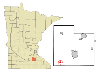
Wanamingo is a community in Goodhue County, Minnesota, United States, incorporated as a city. It lies along the North Fork of the Zumbro River. The population was 1,086 at the 2010 census.

<span class="mw-page-title-main">Independence, Minnesota</span> City in Minnesota, United States

Independence is a rural city in Hennepin County, Minnesota, United States. Most of the city is agricultural land with dense woods and numerous lakes. It is named after Lake Independence, a large lake on the community's eastern boundary.

<span class="mw-page-title-main">Cottonwood, Minnesota</span> City in Minnesota, United States

Cottonwood is a city in Lyon County, Minnesota, United States. The population was 1,212 at the 2010 census.

<span class="mw-page-title-main">Racine, Minnesota</span> City in Minnesota, United States

Racine is a city in Mower County, Minnesota, United States. The population was 458 at the 2020 census.

<span class="mw-page-title-main">Dovray, Minnesota</span> City in Minnesota, United States

Dovray is a city in Murray County, Minnesota, United States. The population was 58 at the 2020 census.

<span class="mw-page-title-main">Borup, Minnesota</span> City in Minnesota, United States

Borup is a city in Norman County, Minnesota, United States. The population was 96 at the 2020 census.

<span class="mw-page-title-main">Goodridge, Minnesota</span> City in Minnesota, United States

Goodridge is a small city in Pennington County, Minnesota, United States. The population was 112 at the 2020 census. The city is located within Goodridge Township, but is politically independent.

<span class="mw-page-title-main">Plummer, Minnesota</span> City in Minnesota, United States

Plummer is a city in Red Lake County, Minnesota, United States. The population was 276 at the 2020 census.

<span class="mw-page-title-main">Morristown, Minnesota</span> City in Minnesota, United States

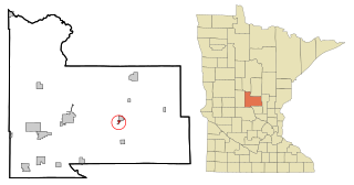
Morristown is a city in Rice County, Minnesota, United States. The population was 949 at the 2020 census.

<span class="mw-page-title-main">Orr, Minnesota</span> City in Minnesota, United States

Orr is a city in Saint Louis County, Minnesota, United States. The population was 211 at the 2020 census.

<span class="mw-page-title-main">Clarissa, Minnesota</span> City in Minnesota, United States

Clarissa is a city in Todd County, Minnesota, United States. The population was 681 at the 2010 census. It dropped to 661 inhabitants by the 2020 census.

<span class="mw-page-title-main">Lakeland, Minnesota</span> City in Minnesota, United States

Lakeland is a city in Washington County, Minnesota, United States. The population was 1,796 at the 2010 census.

<span class="mw-page-title-main">Oak Park Heights, Minnesota</span> City in Minnesota, United States

Oak Park Heights is a city in Washington County, Minnesota, United States. The population was 4,849 at the 2020 census.

<span class="mw-page-title-main">Odin, Minnesota</span> City in Minnesota, United States

Odin is a city in Watonwan County, Minnesota, United States, along the South Fork of the Watonwan River. The population was 123 at the 2020 census.

<span class="mw-page-title-main">St. Bonifacius, Minnesota</span> City in Minnesota, United States

Saint Bonifacius, often stylized as St. Bonifacius, is a small city in Hennepin County, Minnesota, United States, 25 miles west of Minneapolis. Settled in the 1850s, the town has a combination of rural and exurban features. It is completely surrounded by Minnetrista, Minnesota, and is close to the county line with Carver County. It hosted a Nike Hercules battery during the Cold War, one of four protecting Minneapolis–Saint Paul from Soviet bombers.

<span class="mw-page-title-main">Genola, Minnesota</span> City in Minnesota, United States

Genola is a city in Morrison County, Minnesota, United States. The population was 70 at the 2020 census.

<span class="mw-page-title-main">Fairmount, North Dakota</span> City in Richland County, North Dakota, United States

Fairmount is a city in Richland County, North Dakota, United States. The population was 343 at the 2020 census. Fairmount was founded in 1884. It is part of the Wahpeton, ND–MN Micropolitan Statistical Area.

<span class="mw-page-title-main">Rothsay, Minnesota</span> City in Minnesota, United States

Rothsay is a city in Otter Tail and Wilkin counties in the State of Minnesota. The population was 498 at the 2020 census. One of Rothsay's major tourist attractions is the large prairie chicken statue near the northwest outskirts of the town.

References

  1. "2020 U.S. Gazetteer Files". United States Census Bureau. Retrieved July 24, 2022.
  2. 1 2 U.S. Geological Survey Geographic Names Information System: Kensington, Minnesota
  3. 1 2 3 "Explore Census Data". United States Census Bureau . Retrieved May 10, 2022.
  4. 1 2 "City and Town Population Totals: 2020-2021". United States Census Bureau. August 21, 2022. Retrieved August 21, 2022.
  5. "U.S. Census website". United States Census Bureau . Retrieved January 31, 2008.
  6. 1 2 Upham, Warren (1920). Minnesota Geographic Names: Their Origin and Historic Significance. Minnesota Historical Society. p.  177.
  7. "Douglas County". Jim Forte Postal History. Retrieved May 20, 2015.
  8. "US Gazetteer files 2010". United States Census Bureau. Archived from the original on July 2, 2012. Retrieved November 13, 2012.
  9. "Census of Population and Housing". Census.gov. Retrieved June 4, 2015.