Kent Ridge Park

Last updated

Kent Ridge Park
CanopyWalk-KentRidgePark-Singapore-20070809.jpg
Kent Ridge Park
Type Urban park
Location Singapore
Area91.6 hectares (226 acres)
Created1954
StatusOpen all year
The Vigilante Drive entrance to Kent Ridge Park. In the background lies a decommissioned M114 155mm field howitzer donated by Singapore's Ministry of Defence (as of December 2015, the gun has been removed from display and the portion of the big sign that reads "This park has been adopted by the Army as The Army Green Park" has been boarded over.). KentRidgePark-sign-Singapore-20070809.jpg
The Vigilante Drive entrance to Kent Ridge Park. In the background lies a decommissioned M114 155mm field howitzer donated by Singapore's Ministry of Defence (as of December 2015, the gun has been removed from display and the portion of the big sign that reads "This park has been adopted by the Army as The Army Green Park" has been boarded over.).

Kent Ridge Park is a 47-hectare public park located in Kent Ridge, Singapore, between the National University of Singapore and the Singapore Science Park. Due to its undisturbed habitat and abundant plant life, it is a popular venue for bird-watchers and eco-tourists.

Contents

During the Second World War, a hill in the park was the site of one of the last and fiercest battles fought by the Malay Regiment against the invading Japanese army, the Battle of Bukit Chandu (also known as the Battle of Pasir Panjang), 1214 February 1942. [1]

The park was officially opened in 1954, and was gazetted by the National Heritage Board as one of 11 World War II sites in Singapore in 1995. [2] It is one of over 300 parks managed by Singapore's National Parks Board, NParks. [3]

History

Aerial panorama of Singapore's west coast, shot 2016. Kent Ridge sits to the right. Aerial panorama of West Coast Park, shot 2016.jpg
Aerial panorama of Singapore's west coast, shot 2016. Kent Ridge sits to the right.

The area occupied by Kent Ridge Park and the National University of Singapore was formerly known as Pasir Panjang Ridge, and was originally a lowland evergreen rainforest. The park's natural vegetation now consists of groves of Tembusu, Acacias and Dillenias. [4] When the first settlers arrived in Singapore in the early 19th century, they grew crops such as rubber, pepper, gambier and pineapple on the ridge. [5] During World War II, it was used as a fortress by the British in the defence of Singapore. Many of these plantations were either abandoned or destroyed during the Japanese Occupation (1942–1945), which allowed such crops to grow wild.

On 23 February 1954, the Governor of Singapore, Sir John Fearns Nicoll unveiled a plaque which declared the area had been renamed Kent Ridge to commemorate the visit by the Duchess of Kent and her son, the Duke of Kent, on 3 October 1952. The plaque was erected at the junction of what is now Kent Ridge Road and South Buona Vista Road. [6]

The park contains Bukit Chandu, alternatively known as Opium Hill (in Malay), after the opium processing factory owned by the British East India Company that was at the foot of the hill until 1910. [7] During 1214 February 1942, it was the site of the Battle of Bukit Chandu, fought by the 159 survivors of the Malay Regiment led by Lieutenant Adnan Bin Saidi against the 13,000 men of Lieutenant-General Mutaguchi Renya's 18th Division. [1] The Malay Regiment's position on the hill was overrun by the Japanese and the battle ended in hand-to-hand combat after the last few defenders ran out of ammunition. All the officers except one, Lieutenant Abbas Abdul-Manan, and most of the men, were massacred in the aftermath. [1]

The park today

The war museum, Reflections at Bukit Chandu, at 31K Bukit Chandu. The mural on the museum's wall is an artist's impression of the Battle of Bukit Chandu. ReflectionsatBukitChandu-Singapore-20070809.jpg
The war museum, Reflections at Bukit Chandu, at 31K Bukit Chandu. The mural on the museum's wall is an artist's impression of the Battle of Bukit Chandu.

Formerly used to house senior British Army officers, the last remaining black and white colonial bungalow at 31K Bukit Chandu has been restored and converted into a World War II war museum called Reflections at Bukit Chandu, commemorating the war and those who fought in it. Originally there were two smaller bungalows below 31K, but they were demolished in 1987 to make way for a public parking lot. There are three life-size statues and a plaque outside the museum, honoring the Malay Regiment and commemorating the lives of those who died. [8]

Kent Ridge Park, Labrador Park, and the war museum, are part of the Pasir Panjang Historic District, which focuses on World War II battlefield events in western Singapore. [7] Together with Fort Siloso at Sentosa and The Battle Box at Fort Canning, they serve as a reminder of an important chapter in Singapore's modern history. Near to the top of the ridge, there is a commemorative heritage site marker which shows the area where the Battle of Pasir Panjang of 1942 was fought. [2]

The park also has some decommissioned Singapore Army military equipment, consisting of two WWII-vintage US M114 155mm field howitzers and a French AMX-13 light tank on permanent outdoor display until December 2015, donated by the Ministry of Defence as part of its adoption of Kent Ridge Park as The Army Green Park in support of the National Parks Board "Adopt-a-Park" scheme to inculcate a greater ownership among the public of local parks and greenery. The park's facilities include fitness corners, look-out points, a nature trail, a multi-purpose court and a canopy walk. The highest point of the park is 61 metres above sea level, from where there is a panoramic view of the coast of Pasir Panjang and some of the Southern Islands, approximately 5 km off the south-western coast of Singapore. Islands such as Pulau Bukom and Pulau Semakau are visible on a clear day.

Kent Ridge park, Telok Blangah Hill Park, and Mount Faber Park are part of the Southern Ridges trail that links all 3 parks via connecting bridges and paths.

Plant and animal life

A section of the 280-metre long canopy walk in Kent Ridge Park CanopyWalk-KentRidgePark-Singapore-20070809.jpg
A section of the 280-metre long canopy walk in Kent Ridge Park

The park is managed by the National Parks Board, and is open daily to the public. Admission is free except for entrance to the war museum. The park is accessible via entrances on Vigilante Drive and Pepys Road, off Pasir Panjang Road. [9] Most of the remaining wild part of the park comprises secondary forest with plants native to Singapore and Peninsular Malaysia such as tembusu, angsana, white leaf fig, common pulai, Singapore rhododendron, pitcher plants, cicada tree and simpoh air. [10]

The trails through the park, including one for mountain biking, run almost parallel along the ridge. There is a natural pond with fishes and turtles in the north-west of the park. A 280-metre long canopy walk was completed in the eastern part of the park in October 2003, linking Kent Ridge Park to the war museum, Reflections at Bukit Chandu, enhancing the park's and museum's accessibility to the public. Along the walk, there are information boards providing educational information on the flora and fauna in the park. At the half-way point, there is a shelter for visitors to take a short break or to enjoy a scenic view of Normanton Park and the National Parks Board's plant nursery. [9]

It is one of four popular birdwatching sites on mainland Singapore along with Pasir Ris Park, Fort Canning Park and Sungei Buloh Wetland Reserve. [11] Birds found in the park include: white-crested laughing thrush, collared kingfisher, white-bellied sea eagle, banded woodpecker, pink-necked pigeon, blue-tailed bee-eater, white-breasted waterhen, and spotted dove. [12]

Eco-tours and heritage tours are regularly organised by various special interest groups such as the Nature Society Singapore and the Raffles Museum of Biodiversity Research, for students and the general public. [6]

See also

Related Research Articles

Bukit Timah Planning Area and HDB Estate in Central Region -----, Singapore

Bukit Timah, often abbreviated as Bt Timah, is a planning area and residential estate located in the westernmost part of the Central Region of Singapore. Bukit Timah lies roughly 10 kilometres (6.2 mi) from the Central Business District, bordering the Central Water Catchment to the north, Bukit Panjang to the northwest, Queenstown to the south, Tanglin to the southeast, Clementi to the southwest, Novena to the east and Bukit Batok to the west.

Queenstown, Singapore Planning Area and HDB Town in Central Region ----, Singapore

Queenstown is a planning area and satellite residential town situated on the south-westernmost fringe of the Central Region of Singapore. It borders Bukit Timah to the north, Tanglin to the northeast, Bukit Merah to the east and southeast, as well as Clementi to the northwest and west. Its southern and southwesternmost limits are bounded by the Pandan Strait.

Royal Malay Regiment infantry regiment of the Malaysian Army

The Royal Malay Regiment is the premier unit of the Malaysian Army's two infantry regiments. At its largest, the Malay Regiment comprised 27 battalions. At present, three battalions are parachute trained and form part of the Malaysian Army Rapid Deployment Force. Another battalion has been converted into a mechanised infantry battalion while the remaining battalions are standard light infantry. The 1st Battalion Royal Malay Regiment acts as the ceremonial foot guards battalion for the Yang di-Pertuan Agong, and is usually accompanied by the Central Band of the Royal Malay Regiment. As its name suggests, the regiment only recruits ethnic Malays.

Pasir Panjang Subzone of Queenstown Planning Area

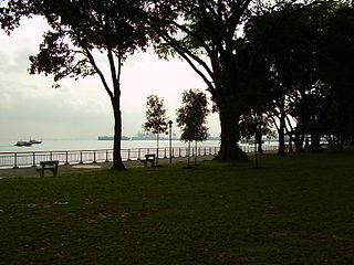
Pasir Panjang is an area located at the southern part of Queenstown in Singapore. Kent Ridge Park is a topographical feature which runs adjacent to Pasir Panjang.

Battle of Pasir Panjang Final battle in Singapore during World War 2 against the Japanese

The Battle of Pasir Panjang, which took place between 12 and 15 February 1942, was part of the final stage of the Empire of Japan's invasion of Singapore during World War II. The battle was initiated upon the advancement of elite Imperial Japanese Army forces towards Pasir Panjang Ridge on 13 February.

Pasir Panjang MRT station MRT station in Singapore

Pasir Panjang MRT station is an underground Mass Rapid Transit (MRT) station on the Circle line. As the name suggests, it is located in Pasir Panjang at the southern part of Queenstown planning area, Singapore. This station is situated underneath Pasir Panjang Road and Labrador Viaduct, next to the Pasir Panjang Food Centre, Currency House and Pasir Panjang container terminal. It is also near the Reflections at Bukit Chandu, a museum near the site of the Battle of Pasir Panjang.

Former Ford Factory

The Former Ford Factory is located along Upper Bukit Timah Road at Bukit Timah in Singapore. It is the place where British forces under Lieutenant-General Arthur Percival surrendered to Japanese forces under Lieutenant-General Yamashita Tomoyuki on 15 February 1942 after the Battle of Singapore. The Old Ford Motor Factory had since been gazetted as a National Monument in 2006, and converted into an exhibition gallery and archive named Memories at Old Ford Factory.

1st Malaya Infantry Brigade

The 1st Malaya Infantry Brigade was a regular infantry brigade formed in 1939 with its headquarters in Singapore immediately after the outbreak of hostilities in Europe. The Brigade participated in the Battle of Singapore against the Japanese until the surrender of the garrison in February 1942.

Labrador Nature Reserve

Labrador Nature Reserve, also known locally as Labrador Park, is located in the southern part of mainland Singapore. It is home to the only rocky sea-cliff on the mainland that is accessible to the public. Since 2002, 10 hectares of coastal secondary-type vegetation and its rocky shore have been gazetted as a nature reserve and its flora and fauna preserved by NParks.

Pasir Panjang Pillbox defensive structure built during World War II in Pasir Panjang, Singapore

Pasir Panjang Pillbox is a strengthened-concrete defensive structure from WWII, located in Pasir Panjang in the southwestern area of Singapore.

Bukit Chandu is a hill located in Kent Ridge in Singapore where the Battle of Bukit Chandu took place on 14 February 1942 during the Battle of Singapore in World War II.

Poh Ern Shih Temple Buddhist temple in Singapore

Poh Ern Shih is located on a small hilltop at Chwee Chian Road, off Pasir Panjang Road, on Singapore's southern coast. The Buddhist temple was built as a memorial to those who lost their lives during the Battle of Pasir Panjang in 1942, villagers as well as Allied and Japanese soldiers. The temple's first abbot, Sumangalo, an American Theravadin monk, was the first Westerner to be appointed abbot of a Buddhist temple in Singapore.

Malaysia's armed forces, which encompasses three major branches, originate from the formation of local military forces in the first half of the 20th century, during British colonial rule of Malaya and Singapore prior to Malaya's independence in 1957. The branches have undergone several restructuring, but fundamentally includes the army, navy and air force.

Fort Pasir Panjang Colonial Singapore defensive structure

Fort Pasir Panjang or Labrador Battery is located within the lush Labrador Park at the southern tip of Singapore island. It was one of the 11 coastal artillery forts built by the British in the 19th century to defend the western passageway into Keppel Harbour against piracy and foreign naval powers. During the 1942 Battle of Pasir Panjang, the fort played a supporting role but a limited one in defending the Malay Regiments against the Japanese invasion at Bukit Chandu. In 1995, the site was gazetted by the National Heritage Board as one of the 11 World War II sites in Singapore.

Battle of Kranji battle

The Battle of Kranji was the second stage of the Empire of Japan's plan for the invasion of Singapore during the Second World War. On 9 February 1942 the Imperial Japanese Army assaulted the north-western front of the British colony of Singapore. Their primary objective was to secure a second beachhead after their successful assault at Sarimbun Beach on 8 February, in order to breach the Jurong-Kranji defence line as part of their southward thrust towards the heart of Singapore City. Defending the shoreline between the Kranji River and the Johor–Singapore Causeway was the Australian 27th Brigade, led by Brigadier Duncan Maxwell, and one irregular company. On 10 February the Japanese forces suffered their heaviest losses while moving up the Kranji River, which caused them to panic and nearly aborted the operation. However, a series of miscommunications and withdrawals by Allied forces in the ensuing battles allowed the Japanese to swiftly gain strategic footholds, which eventually led to the fall of Singapore on 15 February 1942.

Southern Ridges 10km trail in southern Singapore

The Southern Ridges comprise 10 kilometres (6.2 mi) of trails connecting three parks along the southern ridge of Singapore. Some of the attractions along these trails include its greenery and the connecting bridges. This project linked up the parks between the Kent Ridge Park and HarbourFront. The idea to link these parks was coined in 2002 by Urban Redevelopment Authority (URA) and it took 2 years to complete and cost S$25.5 million.

Adnan Saidi Malayan soldier

Adnan bin Saidi was a Malayan military officer of the 1st Infantry Brigade who fought the Japanese at the Battle of Pasir Panjang in Singapore during World War II. He is considered a national hero in Singapore and Malaysia for his actions during the battle. His name is also the namesake for the Malaysian Infantry Fighting Vehicle (MIFV).

Reflections at Bukit Chandu War museum in Singapore

Reflections at Bukit Chandu is a World War II interpretive centre developed and managed by the National Archives of Singapore, located on Bukit Chandu off Pasir Panjang Road in Singapore.

Kent Ridge is the name of a ridge and a neighbourhood located in Pasir Panjang, in the Queenstown Planning Area of Singapore. The area is notable for housing two parks within the Southern Ridges, Kent Ridge Park and HortPark. The main campus of the National University of Singapore is located adjacent to it, straddling along the southern boundary of Kent Ridge. It has the Kent Ridge MRT station.

References

Notes

  1. 1 2 3 Foong (1997), "Fighting the Enemy in Pasir Panjang: The Role of the Malay Regiment", p. 295.
  2. 1 2 National Heritage Board (1995), "Battle of Pasir Panjang", p. 5.
  3. "About Us". National Parks Board. Archived from the original on 13 January 2008. Retrieved 25 January 2008.
  4. "Kent Ridge Park". National Parks Board. Archived from the original on 15 January 2008. Retrieved 25 January 2008.
  5. Thangamma (2006), "History of Kent Ridge Park", p. 144.
  6. 1 2 Sivasothi, N. "A Pasir Panjang/Kent Ridge Heritage". Raffles Museum of Biodiversity Research, National University of Singapore. Retrieved 22 January 2008.
  7. 1 2 Information obtained from on-site information board at the Reflections at Bukit Chandu war museum.
  8. At the launch of SCCI publication, "The Price of Peace" on 21 June 1997.
  9. 1 2 "Kent Ridge Park". National Parks Board. Archived from the original on 24 December 2007. Retrieved 12 January 2008.
  10. Thangamma (2006), "Flora of Kent Ridge Park", pp. 146–153.
  11. "Birdwatching Trails by National Parks". South West Community Development Council. Archived from the original on 6 September 2007. Retrieved 16 August 2007.
  12. Thangamma (2006), "Birds at Kent Ridge Park", pp. 154–157.

Bibliography

Coordinates: 1°17′1.53″N103°47′25.98″E / 1.2837583°N 103.7905500°E / 1.2837583; 103.7905500