
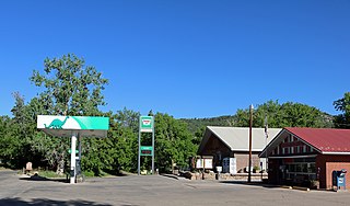
Kettle Creek is a stream in El Paso County, Colorado, in the United States. [1]
Kettle Creek was so named from an incident when a kettle was lost near its banks. [2]
Kettle Creek is a stream in El Paso County, Colorado, in the United States. [1]
Kettle Creek was so named from an incident when a kettle was lost near its banks. [2]

Gunnison County is a county located in the U.S. state of Colorado. As of the 2020 census, the population was 16,918. The county seat is Gunnison. The county was named for John W. Gunnison, a United States Army officer and captain in the Army Topographical Engineers, who surveyed for the transcontinental railroad in 1853.

The City of Fountain is a home rule municipality located in El Paso County, Colorado, United States. The city population was 29,802 at the 2020 United States Census, a +15.31% increase since the 2010 United States Census. Fountain is a part of the Colorado Springs, CO Metropolitan Statistical Area and the Front Range Urban Corridor.

The City of Fort Lupton is a Statutory City located in southern Weld County, Colorado, United States. The town population was 7,955 at the 2020 United States Census. Fort Lupton is a part of the Greeley, Colorado Metropolitan Statistical Area and the Front Range Urban Corridor.
The Lewis-Palmer School District (LPSD) is a school district in El Paso County, Colorado that serves the Tri-Lakes communities of Monument, Palmer Lake, Woodmoor and select areas of Colorado Springs.

John Evans was an American politician, physician, founder of various hospitals and medical associations, railroad promoter, governor of the territory of Colorado, and namesake of Evanston, Illinois; Evans, Colorado; and Mount Evans, Colorado.
KCME is an independent, listener-supported public radio station in Colorado Springs, Colorado, serving the Colorado Springs - Pueblo radio market. It is owned by Cheyenne Mountain Public Broadcast House, Inc., and airs a classical music radio format. Its slogan is "Local. Classical. Cultural". KCME's studios and administrative offices are at 1921 N. Weber Street in Colorado Springs. Its main broadcasting tower is on Cheyenne Mountain. KCME may be heard worldwide via internet streaming on www.kcme.org. KCME also broadcasts in the HD Radio digital format.
Johnstone Creek Provincial Park is a provincial park in British Columbia, Canada, located west of the confluence of Rock Creek and the Kettle River and the town of Rock Creek. The park has a roughly 38 hectare area, and is near to the Crowsnest Highway.

Cherry Creek is a neighborhood in Denver, Colorado, in the United States. It has many newer residences mixed in with some of Denver's older homes.
Kettle Creek is a 7.3-mile-long (11.7 km) tributary stream of the South Fork South Branch Potomac River in Hardy and Pendleton counties in West Virginia's Eastern Panhandle. Kettle Creek rises on Mitchell Knob and flows north along the eastern flanks of Sweedlin Hill through Sweedlin Valley in the George Washington National Forest.
Beulah is an unincorporated community and a post office located in Pueblo County, Colorado, United States. The Beulah Post Office has the ZIP code 81023. Beulah is a part of the Beulah Valley CDP. Beulah lies along State Highway 78 about 21 miles southwest of Pueblo, in the foothills of the Wet Mountains.

Cherry Creek Dam is a dam in Arapahoe County, Colorado southeast of Denver.
Rock Creek is the southern boundary of Cheyenne Mountain and a tributary of Fountain Creek at Fort Carson in Colorado.

Bear Creek Cañon Park is a high-country park located in Colorado Springs, Colorado with steep trails for hiking, mountain biking and horseback riding.
Roswell, now annexed into the city of Colorado Springs, Colorado, was a coal mine settlement near the northern bluffs of Colorado Springs and a 19th-century railroad junction. The town was located at roughly the present intersection of Fillmore Street and North Nevada Avenue in Colorado Springs.

Monument Creek is an El Paso County, Colorado, stream on the Arkansas River water basin. It flows south from Mount Deception through Pikeview and Monument, and into Colorado Springs, where it meets up with Fountain Creek. It is 27.2 miles (43.8 km) from its northernmost boundary with National Forest Lands to its confluence with Fountain Creek near the intersection of Interstate 25 and U.S. Route 24.

Ruxton Creek is a stream in Manitou Springs in El Paso County, Colorado. Named for British explorer and writer of the southwest, George Fredrick Augustus Ruxton, it is one of three main drainage basins in Manitou Springs. Ruxton Creek flows out of Englemann Canyon and into the town of Manitou Springs. Iron Springs geyser emanates from the creek and is one of the Manitou Mineral Springs.
St. Peter's Dome is a granite-topped peak on Pikes Peak massif in the Pike National Forest. The peak, at 9,528 feet (2,904 m) in elevation, is located in El Paso County, Colorado, above Colorado Springs. It is located about 8 miles (13 km) from Colorado Springs along Old Stage and Gold Camp Roads. Old Stage Road is picked up behind The Broadmoor and Gold Camp Road winds through Cheyenne Canyon.
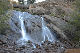
Cheyenne Creek is a stream in Colorado Springs, El Paso County, Colorado at 5,920 feet (1,800 m) in elevation. The stream is fed by the North Cheyenne Creek and South Cheyenne Creek and flows into Fountain Creek near Nevada Avenue, between Interstate 25 and the Pikes Peak Greenway trail. North Cheyenne Creek and South Cheyenne Creek flow through Teller and El Paso Counties. The source of South Cheyenne Creek is Mount Big Chief, near St. Peter's Dome, and it flows to Seven Falls.

Lytle is a ghost town located 12 miles south-west of Fountain in El Paso County, Colorado. The only building that remains is the Lytle School. The earlier name of the town was Turkey Creek. There was a Post Office from 1877 to 1881 and a Rural Post Office from 1885 to 1920.
Coordinates: 38°58′22.5″N104°48′10.5″W / 38.972917°N 104.802917°W
| | This article related to a river in Colorado is a stub. You can help Wikipedia by expanding it. |