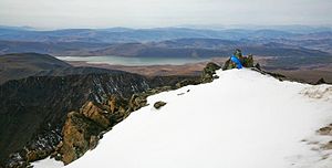
Mongolia is a landlocked country in East Asia, located between China and Russia. The terrain is one of mountains and rolling plateaus, with a high degree of relief. The total land area of Mongolia is 1,564,116 square kilometres. Overall, the land slopes from the high Altai Mountains of the west and the north to plains and depressions in the east and the south. The Khüiten Peak in extreme western Mongolia on the Chinese border is the highest point. The lowest point is at 560 m (1,840 ft), is the Hoh Nuur or lake Huh. The country has an average elevation of 1,580 m (5,180 ft).

Katon-Karagay National Park is the largest national park in Kazakhstan, located on the eastern edge of the country, in the Southern Altai Mountains. The park fills the west side of the "X" where the borders of Kazakhstan, Russia, China, and Mongolia meet. The highest peak in Siberia, is on the Russian border in the Katun Range. The park is in Katonkaragay District of East Kazakhstan Region, 1,000 kilometres (620 mi) southeast of the capital city of Astana.

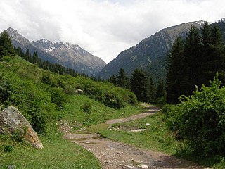
The Altai montane forest and forest steppe ecoregion covers patches of the subalpine forest belt on the Altai Mountains, crossing the border region where Russia, Kazakhstan, Mongolia and China meet. The region has high biodiversity, as it is located in transition zones between different ecoregions, altitudes, and climate zones. It is in the Palearctic realm, with a Cold semi-arid climate. It covers 35,199,998 km2 (13,590,795 sq mi).

The Selenge–Orkhon forest steppe ecoregion stretches across north central Mongolia, and follows the Selenga River northeast into Russia. The ecoregion is itself at high elevations, but surrounded by higher mountain ranges. As a transition zone between taiga and steppe, it features conifer forests on the north slopes of mountains, and pine/aspen stands on southern slopes. It has an area of 227,660 square kilometres (87,900 sq mi).

The Helanshan montane conifer forests ecoregion covers an isolated, forested mountain range surrounded by desert and semi-arid basins. As such, it has been called a "mountain island in the sky", and supports endemic species of plants and animals. The region supports the endangered Helan Shan pika.
The Tian Shan montane conifer forests ecoregion covers the "forest belt" of the Tian Shan mountains - generally the north-facing slopes that get enough moisture, and are warm enough, for trees to grow. This conifer belt is found mostly between 1,500 and 2,700 meters.

The Tian Shan montane steppe and meadows ecoregion covers a 2,000 km long stretch of grasslands of the isolated Tian Shan mountains of Central Asia. It is characterized by high-altitude flat and rolling grasslands.

The Changbai Mountains mixed forests ecoregion covers the Changbai Mountains and surrounding foothills in China and North Korea. The region features extensive and naturally preserved deciduous and conifer forests. The region exhibits high biodiversity due to its relative isolation, temperate climate with high rainfall, and centrality to central Chinese, Siberian, and European floral communities. In 1979, a significant portion of the ecoregion was designated the Changbaishan Biosphere Reserve by UNESCO.
The Central Tibetan Plateau alpine steppe ecoregion covers the high alpine plateau that stretches over 1,600 kilometres (1,000 mi) across the Tibetan Plateau to Qinghai Lake in China. Because of the high altitude—much it over 5,000 metres (16,000 ft)—the region is a cold, arid desert that is only 20% covered with steppe and meadow vegetation. The area has been relatively free from human development due to the hostile climate and unsuitability for agriculture. The ecosystem is relatively intact, and supports herds of wild antelope, sheep, deer, and gazelles.
The Manchurian mixed forests ecoregion covers the forested hills surrounding the river plains of northern China, Russia, North Korea, and South Korea. The ecoregion supports a number of rare species due to the relative isolation, the diversity of habitat, with mixed forests of deciduous Mongolian oak and conifers of Korean pine. Because mountains rise above the region on three sides, with plains and wetlands below, the area supports high biodiversity as a transition zone.

The Tibetan Plateau alpine shrublands and meadows ecoregion covers the middle transition zone between the northern and southern regions of the Tibetan Plateau. The region supports both cold alpine steppe and meadows across a broad expanse of the plateau. Wild deer, antelope, and sheep roam the grasslands, but the habitat is increasingly being used to graze domestic livestock.
Tarvagatai Nuruu National Park covers the southwestern sector of the Tarvagatai Range of the Khangai Mountains in central Mongolia. The park is remote, protecting a transition zone between semi-arid steppe to the south and coniferous forests on the northern slope of the range. A large fire burned a significant part of the park in 2002, including 800 square kilometres (310 sq mi) of forest, mostly larch and siberian pine. The park is located about 60 km northeast of Uliastai, in the eastern region of Zavkhan Province.

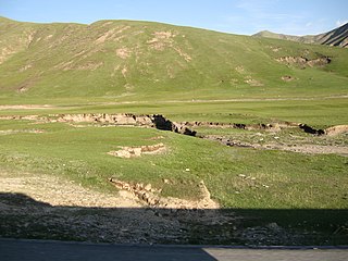
The Gobi Lakes Valley desert steppe ecoregion covers the narrow, flat valley in southwestern Mongolia that lies between the Khangai Mountains, and the Gobi-Altai Mountains. The region is known as the "Valley of the Lakes" because runoff from the mountains collect in lakes that have no outlet to the sea. Although the valley is a semi-arid desert steppe, it has areas of wetlands near the lakes that are important habit for water birds.

The Khangai Mountains conifer forests ecoregion covers the northern slopes of the Khangai Mountains in central Mongolia. The montane taiga supports a populations of elk, deer, wild boar, wolves, and brown bear. The diversity of plants and animals has benefited from the relative isolation and low human population of the area.

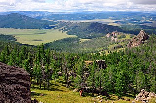
Khangai Nuruu National Park stretches in a west-to-east band across the middle of the Khangai Mountains, with the eastern half following the upper Orkhon River valley. There are a variety of habitat types in the park: steppe, riparian forests, larch taiga, and alpine meadows.
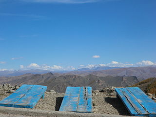
Khan-Khokhi Khyargas Mountain National Park covers a western extension of the Khangai Mountains in Uvs Province. The mountains separate the Uvs Depression to the north from the Khyargas Lake depression to the south. Khan Khuckii is one of the "10 Sacred Mountains of Mongolia". The site features ancient burial mounds.
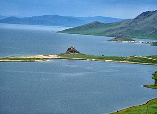
Khorgo-Terkhiin Tsagaan Nuur National Park covers the picturesque Terkhiin Tsagaan Lake and the nearby Khorgo Mountain in the north central Khangai Mountains of Mongolia. The marshes along the west end of the lake are an important breeding and staging area for birds. The park is located in Tariat District of Arkhangai Province.
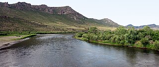
Onon-Balj National Park covers two sectors of the Onon River valley as it flows north from Mongolia into Russia. The region is in the transition zone between the Siberian conifer forests of the north and the Daurian steppe and forest steppe of Mongolia. The area is one of relatively high biodiversity, and is also historically and culturally important for its association with Genghis Khan. The park is located in the far northeast of Khentii Province, 280 km northeast of Ulaanbaatar.

The Baluchistan xeric woodlands ecoregion covers the middle elevations of a series of mountain ranges of western Pakistan and northeastern Afghanistan, reaching 1,200 kilometres (750 mi) from the Arabian Sea in the south to the Hindu Kush Mountains and the Himalayas in the north. The characteristic vegetation is xeric (dry) woodlands of shrubs and herbaceous cover. The region has rich biodiversity but relatively few endemic species.