
Nepal measures about 800 kilometers (497 mi) along its Himalayan axis by 150 to 250 kilometers across. Nepal has an area of 147,181 square kilometers (56,827 sq mi).

Janakpur is one of the fourteen zones of Nepal, reaching from the Indian border in the south to the Tibetan border in the north and Sagarmatha Zone in the east and Bagmati and Naryani Zones in the west.

Siddharthanagar municipality is the administrative headquarter of Rupandehi District on the Outer Terai plains of Nepal, 265 km (165 mi) west of Kathmandu Nepal's capital. It is also the "Gateway of Lumbini." Lumbini, the birthplace of Gautama Buddha is 25 km to the west. Butwal is the nearest city around 21 km from Bhairahawa making the two major cities of the Butwal - Bhairahawa corridor. It borders India, Sonauli in Maharajganj district of Uttar Pradesh. The city is among the major industrial power house in the country impacting major economic aspects of Nepal. It has the second largest rate of border trade with India after Birgunj border in the country. Bhairahawa is under the administration of Siddharthanagar Nagarpalika (municipality) so often known as Siddharthanagar.
Banbasa (बनबसा) is a census town in Champawat district in the state of Uttarakhand, India most famous for its border crossing into Nepal from India.

Birgunj is a metropolitan city and border town in Parsa District in the Narayani Zone of southern Nepal. It lies 135 km (84 mi) south of the capital Kathmandu, attached in the north to Raxaul in the border of the Indian state of Bihar. As an entry point to Nepal from Patna and Kolkata, it is known as the "Gateway to Nepal". The town has significant economic importance for Nepal as most of the trade with India is via Birgunj and the Indian town of Raxaul. Tribhuvan Highway links Birgunj to Nepal's capital, Kathmandu. It was declared a Metropolitan City on 22 May 2017 along with Biratnagar and Pokhara. Birgunj is currently the second largest city in the Terai region of Nepal, and the sixth most populated metropolis of the nation.

Raxaul is a sub-divisional town in the East Champaran district of the Indian state of Bihar. It is situated on the India-Nepal border opposite Birgunj (Nepal). Raxaul is a major railway terminus.

Lipulekh is a Himalayan pass on the border between Uttarakhand, India and Tibet, China. The southern side of the pass is controlled by India but claimed by Nepal. It is near their tripoint with Chinese trading town of Taklakot (Purang) in Tibet. It has been used since ancient times by traders, mendicants and pilgrims transiting between India and Tibet. It is also used by Manasarovar pilgrims.
Mahendra Highway, also called East-West Highway runs across the Terai geographical region of Nepal, from Mechinagar in the east to Bhim Datta in the west, cutting across the entire width of the country. It is the longest highway in Nepal and was constructed by CPWD/PWD Nepali and Indian engineers.

The Republic of India and the Federal Democratic Republic of Nepal initiated their relationship with the 1950 Indo-Nepal Treaty of Peace and Friendship and accompanying secret letters that defined security relations between the two countries, and an agreement governing both bilateral trade and trade transiting Indian territory. The 1950 treaty and letters exchanged between the Indian government and Rana rulers of Nepal, stated that "neither government shall tolerate any threat to the security of the other by a foreign aggressor" and obligated both sides "to inform each other of any serious friction or misunderstanding with any neighboring state likely to cause any breach in the friendly relations subsisting between the two governments." These accords cemented a "special relationship" between India and Nepal. The treaty also granted Nepalese, the same economic and educational opportunities as Indian citizens in India, while accounting for preferential treatment to Indian citizens and businesses compared to other nationalities in Nepal. The Indo-Nepal border is open; Nepalese and Indian nationals may move freely across the border without passports or visas and may live and work in either country. However, Indians aren't allowed to own land-properties or work in government institutions in Nepal, while Nepalese nationals in India are allowed to work in Indian government institutions. After years of dissatisfaction by the Nepalese government, India in 2014, agreed to revise and adjust the treaty to the reflect the current realities. However, the modality of adjustment hasn't been made clear by either side.
Krishnanagar is a municipality in Kapilvastu district of Lumbini Zone in the western terai part of Nepal. The municipality was established on 18 May 2014 by merging the existing Krishnanagar, Sirsihawa, Shivanagar village development committees (VDCs). on Nepal's southern border with India across from Barhani Bazar. Movement of Indian and Nepalese nationals across the border is unrestricted, however there is a customs checkpoint for goods. Goods bound for Dang and Arcghakhanchi cross here. Krishnanagar connects by road to the east-west Mahendra Highway.
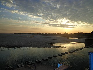
Mahakali is a village development committee in Baitadi District in the Mahakali Zone of western Nepal. It is located on the Mahakali River which is also the border with Uttarakhand state, India across from Jhulaghat. Amraad and Basku are main places in this village. Indian and Nepalese nationals cross without restrictions, however there is a customs checkpoint for goods.
The Mechi River is a trans-boundary river flowing through Nepal and India. It is a tributary of the Mahananda River.

Phulbari also known as Fulbari is a road border crossing for vehicles and people on the India-Bangladesh border and a proposed municipality in Rajganj community development block in Jalpaiguri district in the Indian state of West Bengal. The Bangladesh side of the border crossing is Banglabandha.
Galgalia is a village in Kishanganj District, Bihar state, India.

Chilahati is a border railway station in Bangladesh, situated in Nilphamari District, in Rangpur Division. It is a defunct railway transit point on the Bangladesh-India border.

The visa policy of Nepal is relatively liberal, allowing citizens of almost all nations to obtain a tourist visa on arrival.

Haldibari railway station serves Haldibari town in Cooch Behar district in the Indian state of West Bengal. It is a defunct railway transit point on the Bangladesh-India border.
The territorial disputes of India and Nepal include few areas: Kalapani: Nepal claims that the river to the west of Kalapani is the main Kali river, hence it belongs to Nepal. But India insists that the river to the east of Kalapani is the main Kali river. The river borders the Nepalese zone of Mahakali and the Indian state of Uttarakhand. The Sugauli Treaty signed by Nepal and British India on 4 March 1816 locates the Kali River as Nepal's western boundary with India. Subsequent maps drawn by British surveyors show the source of the boundary river at different places. This discrepancy in locating the source of the river led to boundary disputes between India and Nepal, with each country producing maps supporting their own claims. The Kali River runs through an area that includes a disputed area of about 400 km² around the source of the river although the exact size of the disputed area varies from source to source. Kalapani has been controlled by India's Indo-Tibetan border security forces since the Sino-Indian War with China in 1962.
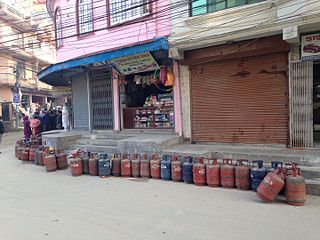
The 2015 Nepal blockade, which began on 23 September 2015, is an economic and humanitarian crisis which has severely affected Nepal and its economy.

Kora La or Korala is a mountain pass between Tibet and Upper Mustang. It is only 4,660 metres (15,290 ft) in elevation, it has been considered the lowest drivable path between Tibetan Plateau and Indian subcontinent. It is currently being planned as vehicle border crossing between China and Nepal.


