
Samuel de Champlain was a French explorer, navigator, cartographer, draftsman, soldier, geographer, ethnologist, diplomat, and chronicler. He made between 21 and 29 trips across the Atlantic Ocean, and founded Quebec, and New France, on 3 July 1608. An important figure in Canadian history, Champlain created the first accurate coastal map during his explorations and founded various colonial settlements.

The Ottawa River is a river in the Canadian provinces of Ontario and Quebec. It is named after the Algonquin word 'to trade', as it was the major trade route of Eastern Canada at the time. For most of its length, it defines the border between these two provinces. It is a major tributary of the St. Lawrence River and the longest river in Quebec.

The Wyandot people are Indigenous peoples of the Northeastern Woodlands of North America, and speakers of an Iroquoian language, Wyandot.

New France was the territory colonized by France in North America, beginning with the exploration of the Gulf of Saint Lawrence by Jacques Cartier in 1534 and ending with the cession of New France to Great Britain and Spain in 1763 under the Treaty of Paris.

The Algonquin people are an Indigenous people who now live in Eastern Canada. They speak the Algonquin language, which is part of the Algonquian language family. Culturally and linguistically, they are closely related to the Odawa, Potawatomi, Ojibwe, Mississaugas, and Nipissing, with whom they form the larger Anicinàpe (Anishinaabeg). Algonquins call themselves Omàmiwinini or the more generalised name of Anicinàpe.
Étienne Brûlé was the first European explorer to journey beyond the St. Lawrence River into what is now known as Canada. He spent much of his early adult life among the Hurons, and mastered their language and learned their culture. Brûlé became an interpreter and guide for Samuel de Champlain, who later sent Brûlé on a number of exploratory missions, among which he is thought to have preceded Champlain to the Great Lakes, reuniting with him upon Champlain's first arrival at Lake Huron. Among his many travels were explorations of Georgian Bay and Lake Huron, as well as the Humber and Ottawa Rivers. Champlain agreed to send Brûlé, at his own request, as an interpreter to live among the Onontchataron, an Algonquin people, in 1610. In 1629, during the Anglo-French War, he escaped after being captured by the Seneca tribe. Brûlé was killed by the Bear tribe of the Huron people, who believed he had betrayed them to the Seneca.

Georgian Bay is a large bay of Lake Huron, in the Laurentia bioregion. It is located entirely within the borders of Ontario, Canada. The main body of the bay lies east of the Bruce Peninsula and Manitoulin Island. To its northwest is the North Channel.

The Beaver Wars, also known as the Iroquois Wars or the French and Iroquois Wars were a series of conflicts fought intermittently during the 17th century in North America throughout the Saint Lawrence River valley in Canada and the Great Lakes region which pitted the Iroquois against the Hurons, northern Algonquians and their French allies. As a result of this conflict, the Iroquois destroyed several confederacies and tribes through warfare: the Hurons or Wendat, Erie, Neutral, Wenro, Petun, Susquehannock, Mohican and northern Algonquins whom they defeated and dispersed, some fleeing to neighbouring peoples and others assimilated, routed, or killed.
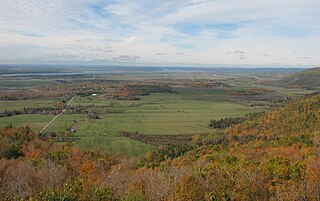
The Ottawa Valley is the valley of the Ottawa River, along the boundary between Eastern Ontario and the Outaouais, Quebec, Canada. The valley is the transition between the Saint Lawrence Lowlands and the Canadian Shield. Because of the surrounding shield, the valley is narrow at its western end and then becomes increasingly wide as it progresses eastward. The underlying geophysical structure is the Ottawa-Bonnechere Graben. Approximately 1.3 million people reside in the valley, around 80% of whom reside in Ottawa. The total area of the Ottawa Valley is 2.4 million ha. The National Capital Region area has just over 1.4 million inhabitants in both provinces.

Events from the 1600s in Canada.
The Odawa are an Indigenous American people who primarily inhabit land in the Eastern Woodlands region, now in jurisdictions of the northeastern United States and southeastern Canada. Their territory long preceded the creation of the current border between the two countries in the 18th and 19th centuries.

Jean Nicolet (Nicollet), Sieur de Belleborne was a French coureur des bois noted for exploring Lake Michigan, Mackinac Island, Green Bay, and being the first European to set foot in what is now the U.S. state of Wisconsin.

The Chaudière Falls, also known as the Kana:tso or Akikodjiwan Falls, are a set of cascades and waterfall in the centre of the Ottawa-Gatineau metropolitan area in Canada where the Ottawa River narrows between a rocky escarpment on both sides of the river. The location is just west of the Chaudière Bridge and Booth-Eddy streets corridor, northwest of the Canadian War Museum at LeBreton Flats and adjacent to the historic industrial E. B. Eddy complex. The islands surrounding the Chaudière Falls, counter-clockwise, are Chaudière Island, Albert Island, little Coffin Island was just south of Albert Island but is now submerged, Victoria Island and Amelia Island,, Philemon Island was originally called the Peninsular Village by the Wrights but became an island when the timber slide was built in 1829 it is now fused to south shore of City of Gatineau, and Russell Island, now submerged, was at the head of the Falls before the Ring dam was built. The falls are about 60 metres (200 ft) wide and drop 15 metres (49 ft). The area around the falls was once heavily industrialized, especially in the 19th century, driving growth of the surrounding cities.
Muskrat Lake is located in the Whitewater Region of Renfrew County, in Ontario, Canada. It is approximately 16 km (9.9 mi) in length, an average of 17.9 m (59 ft) deep but 64 m (210 ft) at its deepest point, and covers an area of 1,219 ha. It is rumored to be home to a legendary lake monster that locals fondly refer to as “Mussie”. The lake currently has over 300 lakefront properties and two privately owned campgrounds surrounding its shores. The town of Cobden is the largest settlement on the lake, with a population slightly over 1,000 people.

Tessouat was an Algonquin chief from the Kitchesipirini nation. His nation lived in an area extending from Lake of Two Mountains to modern-day Pembroke, Ontario.

The Petun, also known as the Tobacco people or Tionontati ,(Dionnontate, Etionontate, Etionnontateronnon, Tuinontatek, Dionondadie,or Khionotaterrhonon), were an indigenous Iroquoian people of the woodlands of eastern North America. Their last known traditional homeland was south of Lake Huron's Georgian Bay, in what is today's Canadian province of Ontario

L'Isle-aux-Allumettes is a municipality in the Outaouais region, part of the Pontiac Regional County Municipality, Quebec, Canada. The municipality consists primarily of Allumette Island, and also includes Morrison Island, Marcotte Island, and some minor islets, all in the Ottawa River north of Pembroke.
Nicolas de Vignau was a companion of Samuel de Champlain in New France. Champlain said of him in his writings "[He is] the most impudent liar that has been seen for a long time".

Fort Ville-Marie was a French fortress and settlement established in May 1642 by a company of French settlers, led by Paul de Chomedey de Maisonneuve, on the Island of Montreal in the Saint Lawrence River at the confluence of the Ottawa River, in what is today the province of Quebec, Canada. Its name is French for "City of Mary", a reference to the Blessed Virgin Mary.
The history of Ottawa, capital of Canada, was shaped by events such as the construction of the Rideau Canal, the lumber industry, the choice of Ottawa as the location of Canada's capital, as well as American and European influences and interactions. By 1914, Ottawa's population had surpassed 100,000 and today it is the capital of a G7 country whose metropolitan population exceeds one million.
