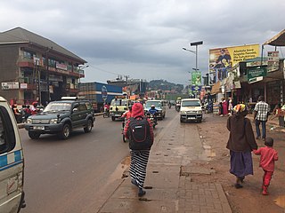
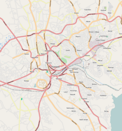
Makerere is a neighborhood in the city of Kampala, Uganda's capital city. The name also applies to the hill on which this neighborhood is perched; one of the original seven hills that constituted Kampala at the time of its founding, in the early 1900s.
Mulago is a hill in north-central Kampala, the capital city of Uganda. The hill rises 4,134 feet (1,260 m) above sea level. The name also applies to the neighborhoods that sit on this hill.
Makindye is a hill in Kampala, Uganda's largest city and capital. The name also refers to the neighborhood that sits on that hill. Makindye is also the seat of Makindye Division, one of the five administrative zones of the city of Kampala.
Nsambya is a hill in the center of Kampala, the capital and largest city in Uganda. The name also refers to the upscale and middle-class neighborhoods that have been developed on the hill and its slopes.
The Aya Group of Companies, commonly referred to as the Aya Group, is a business conglomerate based in Uganda.
Makindye Division is one of the five administrative divisions of Kampala, the capital of Uganda, and the largest city in that country. The city's five divisions are: (a) Kampala Central Division (b) Kawempe Division (c) Lubaga Division (d) Makindye Division and (e) Nakawa Division.
Kawempe is an area in the city of Kampala, Uganda's capital. It is also the location of the headquarters of Kawempe Division, one of the five administrative divisions of Kampala.
Kawempe Division (sub-county) is one of the five divisions that comprise the city of Kampala along with Makindye division, Lubaga division, Nakawa division and Central division, It has 19 parishes and 771 villages. The parishes include Bwaise I, Kanyanya, Kazo ward, Kyebando, Makerere iii, Mulago I, Bwaise ii, Kawempe I, Kikaya, Makerere I, Mpererwe, Mulago iii, Bwaise III, Kawempe ii, Komambogo, Makerere ii, Mulago i, Makerere University. The division's current mayor is His worship Dr. Emmanuel Serunjogi.
Naguru, also Naggulu, is a hill in Kampala, the capital and largest city in Uganda. The name also applies to the commercial and residential neighborhoods that sit on that hill.
Banda is a hill that lies in Nakawa Division, within Kampala, the capital of Uganda. Banda also refers to the neighborhoods on the slopes of the hill and between Banda Hill and Kireka, extending all the way to the Kampala-Jinja Highway. The southwestern slopes of the hill are occupied by the neighbourhood known as Kyambogo, and is the location of the campus of Kyambogo University, one of the nine public universities in the country.
Kisaasi is a location, within the city of Kampala, Uganda.
Bugolobi, sometimes spelled as Bugoloobi though incorrect, is a location in Kampala, Uganda's capital and largest city. It is a suburban neighborhood and some of the most valuable properties in Kampala are found here. It is among the most developed neighborhoods in Kampala and Uganda in general.
Wandegeya is a neighborhood within the city of Kampala, Uganda's capital and largest metropolitan area. The name is derived from the weaver birds,, which used to inhabit the area prior to the 1990s.
Naakulabye, also Nakulabye, is a neighborhood within the city of Kampala, the capital and largest city in Uganda.

Bwaise is a neighborhood within Kampala, Uganda's capital, and largest city. Due to lack of proper urban planning, it has grown into a commercial, industrial and residential township with poor infrastructure. The lack of developed infrastructure and poor service provision has exposed the town dwellings and residents to several challenges including flooding and water borne diseases.
Kyebando is a neighborhood within Kampala, the capital and largest city in Uganda.
Kaleerwe is a neighborhood within Kampala, Uganda's capital and largest city. Kaleerwe is a busy road-side marketplace, beyond which is a residential slum. Due to its relative low altitude, compared to the surrounding hills, and its proximity to a wetland, the area is prone to flooding. Kaleerwe merges with its immediate slum-neighborhood to the southwest, Bwaise. One may argue that Kaleerwe is part of Bwaise.
Kanyanya is a neighborhood within the city of Kampala, Uganda's capital.
Mpererwe is a neighborhood in the city of Kampala, Uganda's capital city. Sometimes it is spelled as Mpereerwe.
Kawempe General Hospital, also known as Kawempe Specialised National Referral Hospital, is a hospital in Uganda. It is an urban, specialised hospital built between 2014 and 2016 at an estimated cost of US$11.3 million. The hospital was constructed by the government of Uganda, with funding from the African Development Bank and the Nigeria Trust Fund.


